
|
|
Brush Management Most of the catchment area for the Edwards Aquifer recharge zone lies on the Edwards Plateau, high in the Hill Country of south central Texas. The interest in brush management as a means to increase water supply is rooted in the belief the Hill Country was originally open grasslands and the idea that brush such as cedar (Ashe juniper) and mesquite cause more rainfall interception, less runoff, and less infiltration than grasses. So the theory is that streamflows and Aquifer recharge might be increased by controlling and limiting growth of brush and trees in areas where grasslands would have naturally dominated. There are at least two ways this might happen: 1) removal of brush would mean less interception of rainfall, so there would be more runoff to streams and consequently more recharge; and/or 2) brush clearing would result in more infiltration of rainfall into the ground, thereby causing higher flow in small springs and seeps that feed the recharge streams. The bottom line is no scientist claims to be able to say for certain that brush clearing would result in more water in the Edwards Aquifer. Brush management is one of the options that made the initial draft report of the South Central Texas Regional Water Planning Group, but the document noted that quantity of water in terms of firm yield cannot be determined. When the document was updated in 2011, they estimated firm yield anyway by employing a modeling approach to conclude that if 156,000 acres were managed properly, 12,180 acre-feet of water per year could be gained at a cost of $823 per acre-foot. However, the section on brush management in the 2011 document begins by repeating some of the cedar myths that we are going to examine below, which brings the credibility of the entire section into serious dought, because one must then question the bias and motives of the author. Personally, I can make a computer model tell you whatever you'd like to hear.
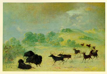
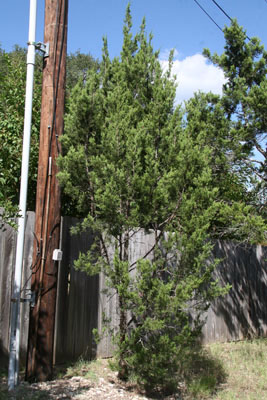
A Historical Perspective When people discuss brush management they almost always end up talking about the Hill Country in its natural, prehistoric state, so we may as well begin there. Some of the most hardened and persistent modern myths to be found anywhere deal with what this area was like in the beginning of the historical period. It's not uncommon to hear claims the area was originally a treeless grassland where cedar was not even native. Yet, dozens of first-hand eyewitness accounts by early explorers and settlers tell of abundant cedar on the Edwards plateau. My great-grandfather, one of the original 120 settlers of Fredericksburg in 1846, built a fachwerk cabin from cedar logs and mud. In The Explorer's Texas, Del Weniger collected a number of compelling first-hand accounts of the condition of the Texas Hill Country before about 1860, by which time it had all been greatly modified by Europeans. The explorers tell us it was a prairie, cedar-rich and thickety, where tall thin grasses and trees coexisted, where groves and woods mixed with open spaces. There was hardly any of the boot-high, short grasses that occur today where brush and cedar have been cleared. One of the most reliable eyewitnesses, expert naturalist and landscape designer Frederick Law Olmsted, reported the proportion of grass decreased and trees increased from west to east across the prairies (Olmsted, 1857). His report describes what should be expected, because the Hill Country is the zone of transition between the eastern forests and the western grasslands. Contributing to the diversity of the prairies was a third great ecoregion to the south, the Gulf Coastal Plain. Because south central Texas is the only place where all three ecoregions converge, the various prairies that existed had characteristics of all three. A description of the great diversity the explorers found was provided by C. Hugo Claus about 1875:
The area that Claus described became "vastly different" because settlers drastically changed the prairie by clearing trees and setting fires. Ranchers discovered that when prairies were burned and trees were cleared, the soil structure supported varieties of shorter, more nourishing grasses that grew in their place. By 1860, many of the trees had been cut and most of the tall grasses had disappeared. The trend continued throughout the last half of the 19th century, an era of great cutting and burning. There was a well-documented decline of trees under the assault of field-clearers, fence and cabin builders, cedar choppers, charcoal burners, and shingle makers. The Hill Country soil structure, part of the geologic legacy that developed over millions of years, was quickly ruined by overgrazing. In the 1890s, a long drought turned the Hill Country into a desert grassland, with mostly only live oaks remaining. When rains returned, ruined soils quickly became grossly eroded and far more shallow. These soils could not retain moisture for long, and grasses could no longer compete. The pendulum swung toward an increased dominance by brush and trees, a common result of heavy grazing on rangelands. Acting as "nature's band-aid", cedar began to predominate and spread back into areas that were originally mixed-forest prairies. The modern myth of an open, practically treeless Hill Country where cedars are unnatural invaders developed as this process of re-growth proceeded, in the first half of the 20th century, when cedars began reclaiming what had always been theirs. By the middle of the 1900s many were claiming the cedar was not even native, a myth that is common even today. Proof positive that cedars are native and were abundant can be found in ice age pollen. In the September 1995 issue of Quaternary Research, Stephen Hall and Salvatore Valastro presented a report on the southern great plains vegetation during the last ice age. The Friesenhahn Cave, located in northwest Bexar county, is included in the report as a site that produced juniper pollens dating back to the late ice age. The 2011 Region L planning document mentioned above repeats the myth of a treeless range in its opening paragraphs, stating the area was originally open grasslands, and that early settlers described it as such. One need only read the settler's own accounts to be convinced otherwise. This is not to say there isn't more cedar now than before. The Hill Country today is very different from what the explorers and settlers encountered, and the myths about cedar derive partly from the fact that it's range in south central Texas has indeed increased. Most rangeland ecologists believe it is more plentiful today than in the pre-historic period. Even so, most of the cedar that covers hillsides today in the Edwards region is regrowth, not an invasion of ancient grasslands. We should also mention the new emerging view among archaeologists regarding the "natural" condition of Texas and the Americas. You were probably taught in school that America was originally a vast wilderness, untouched by human hands, lighty populated by a handful of native Indians. Archaeologists now tell us that view is probably wrong. They now believe the Americas were far more populated than previously believed, and that almost all of North and South America were a managed landscape, where Indians used tools like fire and plantings to maintain forests, riparian corridors, and animal herds. Over thousands of years and through collective tribal wisdom, they developed sustainable natural resource management schemes that served their purposes very well. After European contact in 1492, more than 90% of the managers were eliminated by waves of European disease. So when the first permanent settlers arrived in Texas more than 200 years later, they did encounter a wild-looking and lightly populated landscape, but that's not what was here in 1492. In a very real sense, there is no "natural" landscape we can hope to restore. Perhaps the best we can do is find ways to manage it in a sustainable way for our own benefit, just as the Indians before us (Mann, 2012).
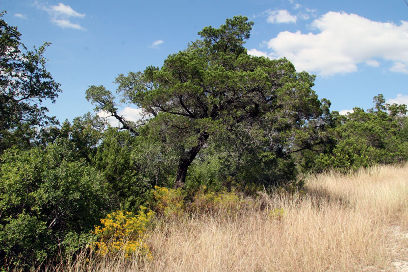
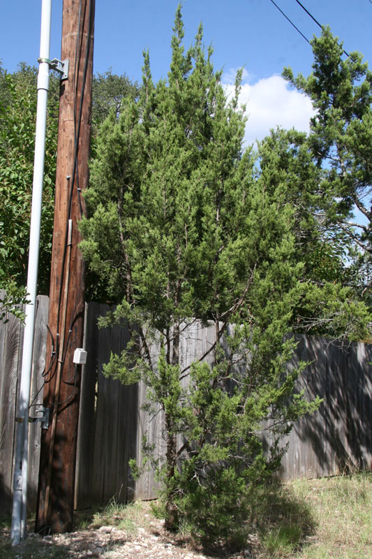
Brush Management and the Edwards Aquifer First of all, an important distinction should be made between very rare old-growth cedars and the very common type that are bushy re-growth. Old-growth trees are rare today because vast areas of the Hill Country were completely stripped. Old-growth trees no longer have the squat, bushy appearance that characterizes most cedar trees in the Hill Country today. They develop shaggy, twisting trunks and branches, intercept much less rainfall than young bushy trees, use less water, and channel water down their trunks into the ground during large rainfall events. An endangered species, the Golden-cheeked warbler, uses strips of shaggy bark from old-growth trees for nest building. Habitats for endangered species are protected by federal law, and some cities that value rare natural resources have adopted tree ordinances that protect old-growth trees from destruction. Hardly anyone proposes to remove old-growth cedars as part of a water management scheme, and many are realizing they are a rare and precious component of Texas' natural heritage. Rainfall Interception and Water Use by Cedars As mentioned at the outset, it is thought that one of the mechanisms by which clearing brush could result in more runoff to streams is by reduced interception of rainfall. The scale-like morphology of juniper needles is very efficient in capturing rainfall and holding moisture in the needles. In controlled studies at Camp Bullis and Honey Creek State Natural Area, 20% of the rainfall in simulated events was captured and stored by the juniper canopy (Munster, 2007). A basic assumption regarding the interception of rainfall has been that this water is lost via evaporation and does not contribute to the local water budget. However, research into how rainfall is partitioned in juniper communities suggests this retained moisture may result in decreased transpiration losses compared to trees which do not retain rainfall. The decreased transpiration may represent a water savings to the plant, so previous estimates of water use by cedar trees may have been an exaggeration (Owens, 2003). Previous estimates of water use by cedars, provided by the same researcher, were as high as 33 gallons per day. Indeed, a commonly heard criticism of Ashe juniper is they are "water-hogs", robbing our Aquifer by using lots of water themselves and keeping water from reaching the ground. It's true that in general, any mature woody plant in the Hill Country will use more water than grass. However, it is becoming clear the notion that cedars are high-water using is simply another myth. Cedars are extremely drought-tolerant, they only use water after significant rainfalls, and they have the ability to almost completely shut down when no water is available (Seiler, 2008). In July of 2008, Dr. Jim Heilman of Texas A&M University released research conclusions that show brushy species use only slightly more water than grassland, and that live oaks use more water than cedar. Further, removing cedar may be unwise because they are an important carbon sink, making them a potential ally in efforts to counter global warming. Heilman said “We’ve seen up to a six-fold increase [in carbon sequestration] with the encroachment of juniper. So, if we remove brush, we might have a marginal savings of water, but we’re losing a heck of a lot of carbon. Overall, Heilman said, the idea of brush removal to save water is a case of where “policy gets ahead of science" (Heilman, 2008). Other research released in 2008 suggested that brushy areas do not hog water. In the Concho River basin, researchers studied three watersheds that supply tributaries of the Concho to evaluate the extent to which streamflow changed after dramatic shifts in vegetation cover. In the last 100 years or so, the watersheds have transitioned from pristine prairie to degraded pastureland to woodland/savanna, as have many watersheds across Texas. They found that in all three watersheds, stream baseflows have remained the same or increased slightly since 1960, despite large increases in woody plants. In one stream, annual streamflow has decreased by 70%, but the researchers found no indication it was related to diminished groundwater flows caused by extraction of subsurface water by woody plants. They suggested the lower flow resulted from higher infiltrabilty due to generally improving range conditions (Wilcox, Huang, and Walker, 2008). See the complete study. Effects on Infiltration and Runoff The other mechanisms by which brush clearing has been proposed to increase water supply are increased infiltration and runoff. In the 1980s, rangeland ecologists I talked to about these mechanisms were deeply divided. These are very basic issues, so they became the subject of several studies. One study that began in 1991 in the Seco Creek watershed near Hondo involved looking at the effects of removing Ashe juniper. Eighty percent of the cedar canopy was removed from an eight acre tract, and flows from a nearby spring increased 20%. In a soil water balance study, all regrowth cedar was removed from rangeland in a 40 acre watershed. Three years of data showed an average increase in water yield of around 35,000 gallons per acre per year. The increase in water yield was significant, but it declined over time as grasses and other plants became established where the cedar had been. This suggested that cutting cedar could indeed help increase infiltration of water and increase local springflows where springs already exist, but long-term maintenance would certainly also be required. It is unknown whether increased infiltration produced by cutting cedar on the Edwards Plateau would actually result in more water in the Edwards Aquifer. The Seco Creek project demonstrated that cutting cedar can result in more water infiltrating down into the ground instead of running off the surface into nearby streams. However, these are streams that carry water to the Edwards recharge zone, so reducing water in them could actually result in less recharge after a rain event. On the other hand, in the long run, recharge might increase or remain about the same. This is because when water infiltrates into the ground on the Edwards Plateau, that which is not used by plants can later emerge from nearby springs, or it can travel long distances through the limestone and emerge from water table springs on the Balcones Escarpment (see the cross-sectional view on the Intro page). Both the local springs and the water table springs feed the recharge streams for the Aquifer, and they do it much more slowly than water that ran over the surface instead of moving through the ground, so increasing their baseflow might provide a more reliable and stable flow of water toward the Aquifer's recharge area. Another possibility is that any increased recharge resulting from increased infiltration would result mainly in increased water availability for users of the Trinity aquifer, not the Edwards. Following the Seco Creek study, several other studies looked at hydrologic changes resulting from brush control. One involved establishing baseline data and then removing cedar from tracts in Camp Bullis and Honey Creek State Natural Area. In a 2007 progress report, researchers reported their current estimate was that for every 8 acres of juniper cleared an additional acre-foot of recharge may occur (Wilcox, 2007). This would not necessarily be recharge to the Edwards. In 2011 the USGS released a study that appeared consistent with previous studies that did not find a difference in the streamflow to rainfall relation as a result of brush removal at a small plot or small watershed scale. In other words, brush clearing did not affect runoff to streams. By comparing cleared and uncleared sites in Honey Creek State Natural Area, the researchers concluded the relation between unit runoff and rainfall is influenced by more than rainfall amount, so the same rainfall on a cleared versus an uncleared area cannot be said to cause more runoff on one than the other. Rainfall intensity and duration of intensity also play a role. Further, the antecedent site conditions will directly affect the amount of water that may reach the stream channel. These include the soil moisture content immediately prior to the rainfall event and the type and amount of vegetation cover that can intercept rainfall, which in turn is partially dependent on the seasonal growing cycle. For example, when plants are budding interception will be different than when leaves are full (Banta and Slattery, 2011). Also like previous studies, the 2011 report suggested that clearing brush can result in more infiltration. Before clearing, potential groundwater recharge was 17% of the total water budget and afterwards it was 24%. In terms of rainfall inches, the potential recharge was 5.91" of the rain that fell, and afterwards it was 7.09", for a difference of 1.18". So in terms of actual water, the extra 1.18" would amount to 32,042 gallons per acre. As there are 325,851 gallons in an acre-foot, this means that roughly 10 acres would need to be cleared to gain an additional acre-foot of water as infiltration. That is roughly the same as found in previous studies.
2014 Water Supply Enhancement Plan In May of 2014, the Texas State Soil and Water Conservation Board offered a draft Water Supply Enhancement Plan that focuses on management of brushy species such as cedar. It was immediately criticized as perhaps the most inaccurate document ever prepared by a Texas state agency. It repeats many of the same old cedar myths, cites research that even the researchers say was wrong, and labels cedar as "detrimental to water conservation". The document is so hapless it even refers to cedar as a phreatophyte, which it surely is not. (By definition, a phreatophyte gets most of its water from the phreatic or saturated zone of an aquifer or riparian zone. That is not cedar.) The Board's Executive Director Rex Isom said large-scale brush-clearing "is a cornerstone solution for water supply issues in Texas." But the Austin American-Statesman reported the proposed program drew quick opposition from environmentalists, property owners and academics who say it is misguided and could lead to large scale soil erosion and no extra water. Texas A&M University range management scientist Brad Wilcox wrote to the Board saying "We fundamentally disagree with the plan's underlying tenet that brush management is a viable strategy for increasing water supplied from Texas rangelands." His letter was co-signed by seven additional A&M researchers. "The scientific evidence is overwhelming that shrub control will not increase water supply in Texas," Wilcox wrote. "We believe the plan as currently designed is a poor use of taxpayer money and we recommend that it not go forward." Wilcox and 11 other scientists also co-authored comments on the state's draft plan which outlined its many problems and dubious conclusions. Read their comments here. The Board adopted the plan on July 28.
Besides the supposed potential for increased recharge, there are several other reasons some people are in favor of cutting cedar. Some point to cedar chopping as a tool that will help restore the hillsides to something more closely resembling their native condition (the myth of a cedar-less Hill Country is still pervasive and widely believed). Some point out that eliminating thick stands produces more grazing for livestock. And some people just flat don't like cedar because it produces copious amounts of berries and pollen. On the other hand, there are also people who really love cedar, so the pro and con arguments regarding cutting it get tossed around quite a bit. Some worry that since long strips of bark from old-growth trees are required for nest building by Golden-cheeked warblers, cutting cedar won't ensure enough habitat exists to support healthy populations. Others point out that cedar is a great cover for wildlife and produces an important food during critical periods. And some worry that between the time cedar is cut and other plants start to grow, there could be an increased potential for flash flooding, erosion, and stream siltation. Both sides also have counterarguments: numbers of warblers can be increased by carefully planned programs of prescribed burning and improvements in cattle grazing systems; reducing cedar would increase diversity of plants and animals and improve habitat instead of reducing it; recharge might also be increased by encouraging more cedar and collecting and channelizing the increased runoff toward the recharge area.
Implementation Issues One thing that's clear is cutting very large areas of second growth cedar to increase infiltration would involve environmental trade-offs. This is always the case when humans take actions that affect the environment. Another thing that's clear is all the issues and ecosystem impacts of cutting cedar have not been fully studied, perhaps not even completely listed. There are plenty of implementation issues that would have to be worked out. The cheapest methods of clearing cedar such as chaining and cabling also remove wildlife habitat and expose surfaces to erosion by wind and water. Low impact, hand techniques are much more expensive. Chemical methods could be employed, but there's a risk they could runoff into streams and affect air quality if they are sprayed. Also, it has not been shown that a large-scale brush control program would be practical because it would require the cooperation of many different landowners having different interests in their property. To have a significant impact on increasing recharge to the Edwards, brush control would have to be practiced over a very large area. Property owners who are not dependent on grazing income might have little interest in brush control. On hunting ranches, owners might actually prefer keeping thick stands of vegetation. And as with all recharge-enhancement schemes, clearing cedar could have little effect in a long term drought, because there is no water to recharge. Perhaps the bottom line on all this was summarized by noted range management specialist Steve Nelle. In an editorial in February of 2015 that discussed Texas' new Water Supply Enhancement Program, he pointed out that landowners are generally good stewards of their land and that "Government incentive programs that promote genuine land and water stewardship on private land are a worthy investment of public funds, but only if they deliver the benefits they promise. If public funding of brush control continues, it must be justified for reasons other than an increase in water." See his opinion piece here. For a great online source of info regarding the Ashe juniper, see Elizabeth McGreevy's Mountain Cedar page. Ms. McGreevy is a landscape designer and restoration consultant and the foremost expert on Hill Country cedar.
|
||||||||||||||||
