|
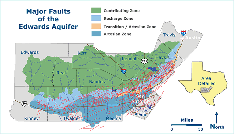
The graphic above gives you an idea of the
great number and complexity of the faults of the Edwards Aquifer.
There's so many faults it makes you dizzy to look at them at this
scale! There are places on this graphic where many small faults
just kind of form a red blob.
Large faults act as barriers or partial
barriers to groundwater flow; while smaller faults and associated
joints form local and regional ground-water conduits. The graphic
does not show the direction of dip, but for most of these faults
it is toward the southeast. Note how most of the faults tend to
run from southwest to northeast.
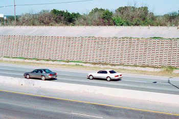 |
Many of the normal faults of the Balcones
Fault Zone are surrounded by zones of highly fractured strata. When Loop 1604 was widened near I-10 in northwest Bexar county in
the mid-80's, a road-cut was made under the railroad tracks and
the ground was found to be so highly fractured and unstable that
retaining walls had to be built to keep unconsolidated material
from sliding onto the road. |
|
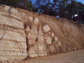 |
An abrupt change in the
composition of limestone marks one of the many normal faults of the
Balcones Fault Zone. This one came to
light during excavation for construction of the Target near the corner
of 1604 and Bandera Road. |
|
 |
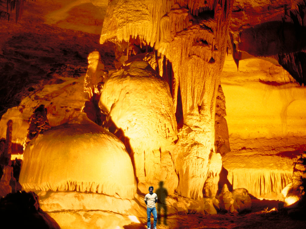
A large solution
chamber in Glen Rose limestone at the Cave Without A Name. This room is about 100
feet wide, 60 feet high, and 400 feet long. Almost every
kid who grew up in the Texas Hill Country has stories
about exploring caves, as they are very common. This
particular cave has an underground river flowing through
it that has been explored and mapped for over three
miles. |
|
 |
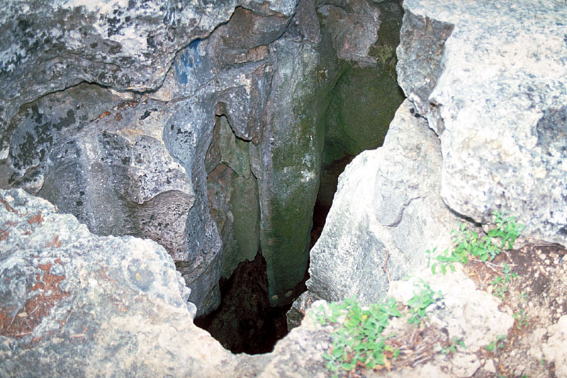
This pit cave in
northwest Bexar county is about 60 feet deep. There are
thousands of such recharge features in the area, many of
which have not been documented. Many of these features
that are sinkholes today were springs 13,000 years ago
when the climate was wetter and cooler. Now that the
climate is much drier, the direction of flow is reversed
and water only goes in. Note the weathered remnants of a
large stalactite that formed when this spot was still
overlain by thousands of feet of limestone. |
|
 |
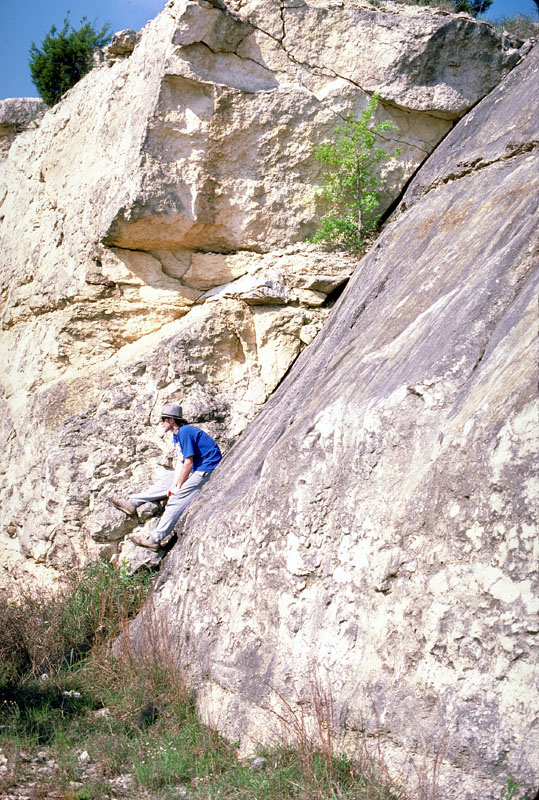
A limestone fault
on the Edwards Plateau exposed by a roadcut on U.S. 281
north of San Antonio. One can observe slickensides here. The Balcones Fault Zone contains a
complicated series of such faults and fracture. |
|
 |
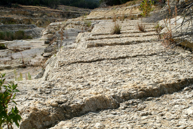
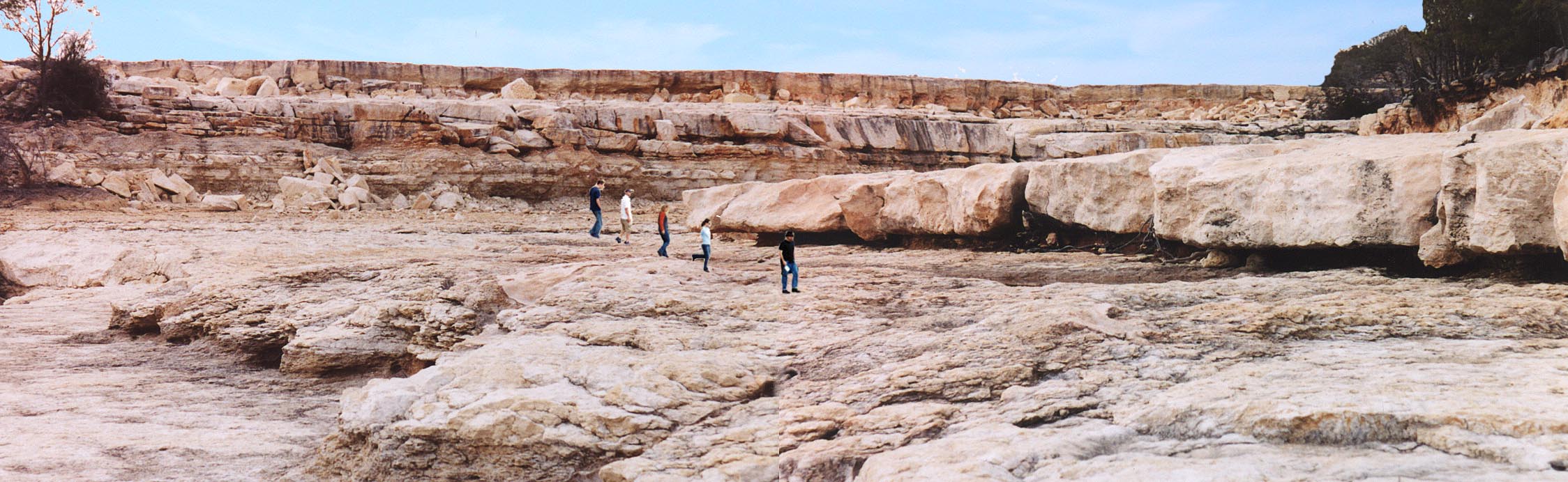
A series of small parallel faults, each with a displacement of only inches, was revealed when Canyon Gorge was created by floodwaters in 2002 (see the Canyon Lake page for more on the Gorge). |
|
 |
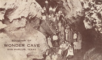
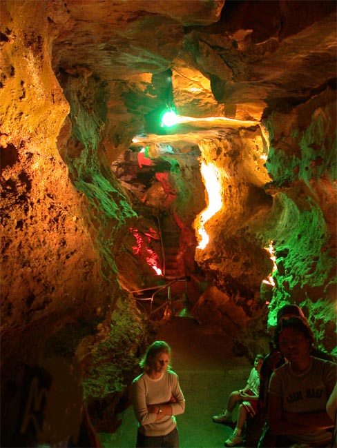
Wonder
Cave in San Marcos is the oldest commercially operated cave in
Texas. It is a dry, A-frame cave formed along one of the many
faults within the Balcones Fault Zone. Although there are not many
formations typical of wet caves, it is an interesting look at the
shifting and faulting that occurred during the uplifting of the Edwards
Plateau. San Marcos Springs are just
a few thousand feet north of Wonder Cave. The cave was discovered in 1893 by Mark A. Bevers, who was drilling for water in what is now the parking lot, and was originally known as Bevers Cave. It was purchased in 1903 by W. S. Davis, who opened it to the public. |
|
 |
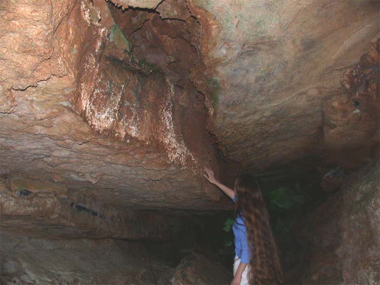
A fault line is visible on
the ceiling of Wonder Cave. Geologists are not sure whether these
faults formed all at once, such as in a large earthquake, or over a long
period of time. |
|
 |
A 12 page brochure published by Arthur B. Rogers, who purchased the cave in 1916 for $50, a gray horse, and a saddle. He installed electric lights, paths, handrails, and ladders, and then went on to develop Aquarena Springs. It is undated, but contains an advertisement for Rogers' Spring Lake Park Hotel at San Marcos Springs, which opened in 1929, so it must have been produced sometime between then and 1958, when Rogers sold the cave to T. J. Mostyn. |
|
 |
A color-enhanced view of the cave on a postcard mail in July of 1956. The cave is not actually those intense shades of green and purple. The caption on the back of the card says:
Subterranean fantasies are explored by visitors traversing natural sub-surface pathways. |
|
 |
A
man-made wishing well in Wonder Cave is the lowest point in the cave,
about 158 feet below the surface. The well connects with the
nearby Ezell's Cave, home to the endangered Texas
Blind Salamander. Ezell's Cave is owned by the Nature
Conservancy of Texas and is closed to the public. The pulley in
the photo was used by turn-of-the-century cave explorers to get water
from the lake below. Before stairs made the walk easy, it could
take 5-6 hours to spelunk down to this spot. |
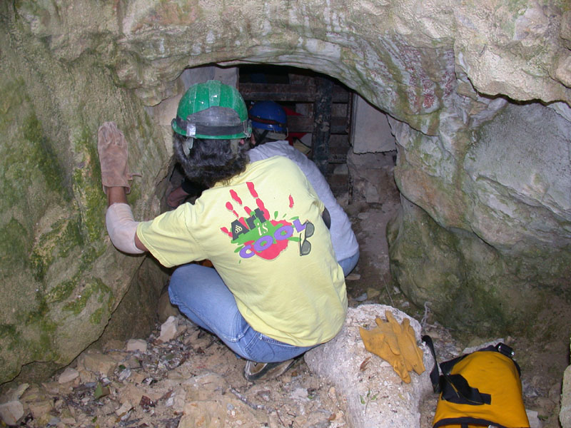
Robber Baron Cave is one of the most significant caves in Bexar county. It is a vast network of passageways underneath the area south of Loop 410 near Nacogdoches Road. It is the only known home of two endangered species, Texella cokendolpheri (a harvestman) and Cicurina baronia (a spider).
The Cave was a tourist attraction from 1926 to 1933, with a cable car ride to the entrance. During Prohibition one of the larger caverns was used as a speakeasy, and the metal door is still inside the cave. Historic graffiti covers portions of some walls.
Many young boys who grew up in the area in the 40s and 50s have tales of exploring the Cave instead of attending class. Eventually the Cave entrance was filled with trash and debris and access was difficult except for the most determined.
In 2002, the Texas Cave Management Association began a restoration project and dedicated volunteers spent five years excavating the entrance, making the cave safe and accessible, and landscaping the area. In 2008 the Cave was officially reopened, and visits can be made by appointment. For more information on the history of the cave or to schedule a visit, visit the TCMA website.
|
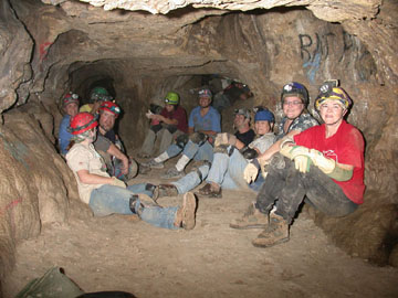 |
A group of intrepid explorers in Robber Baron Cave in 2007. |
|
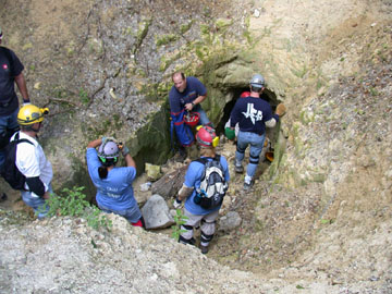 |
The entrance to Robber Baron Cave, excavated by volunteers after being covered by trash and debris for decades. |
|
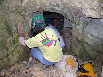 |
To get in the Cave, you have to be able to squeeze through a narrow 18" opening in a protective grate. |
|
 |
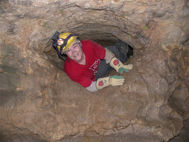
Be prepared for a lot of crawling through very narrow passageways. |
|
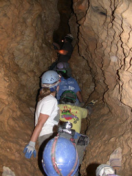 |
The cave is sort of an underground jungle gym, with many passageways where you have to shuffle along spider-like with all four limbs on the side walls and nothing below you. |
|
 |
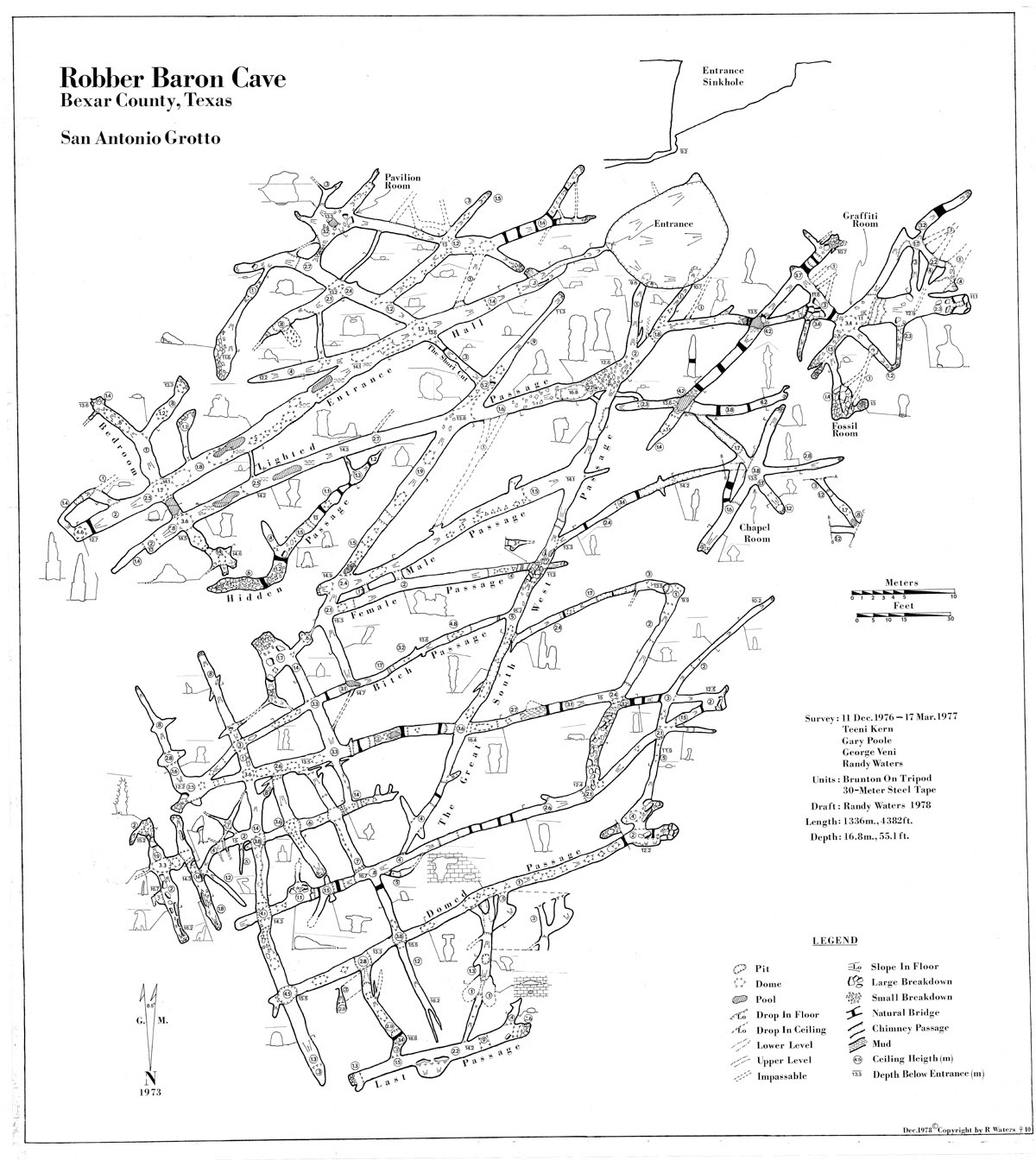
A map of the cave shows how extensive the known network of passageways is. Volunteers believe there are many more that are as yet undiscovered. |
|
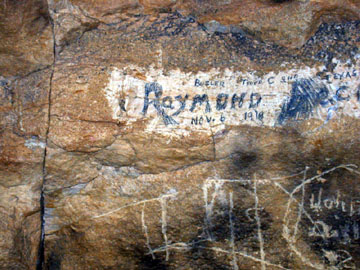 |
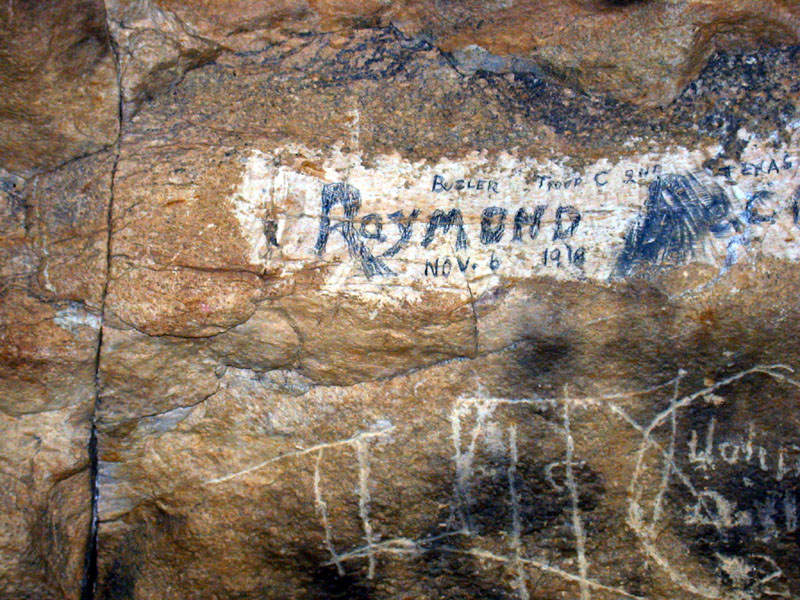
There is a lot of graffiti in the Cave dating back to the 1800s. |
|


