 |
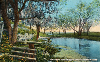
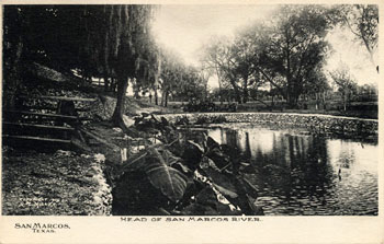
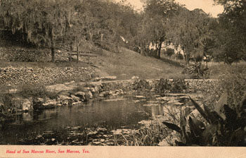
One of the greatest outflows from the Edwards Aquifer is the San Marcos Springs. More than 200 springs burst forth from three large fissures and many smaller openings. Early travelers and settlers described the large ones as fountains, gushing water several feet above the surface of the stream they created. Today, the Springs lie at the bottom of Spring Lake and are viewed through the floor of glass-bottomed boats. The Springs and the short 3.8 mile San Marcos River below them have been designated as critical habitat for five endangered species, including the Fountain Darter, the Texas Blind Salamander, the San Marcos Salamander, the San Marcos gambusia, and Texas Wild Rice. |
Many archaeologists believe the area around the Springs is one of the oldest continually inhabited site in North America (Shiner, 1983). Sediment cores indicate that humans lived here 11,500 years ago, and there is evidence the area has been occupied during every known period of human habitation in Central Texas (Bousman and Nickels, 2003). In historical times, the Cantona Indians called the Springs Canocanayesatetlo, meaning "warm water" (Hatcher, 1932). Another Indian term for the area was Canaquedista, meaning "headwaters" (Foster, 1995). A graphic picture of their original condition was written in 1846 by William A. McClintock:
Two miles north of St. Marks
we crossed the Blanco, a mountain torent of purest water,
narrow and deep, there is the finest spring of springs (for
they are not less than 50 in a distance of 200 yds.) I ever
beheld. These springs gush from the foot of a high cliff and
boil up as from a well in the middle of the channel. One of
these, the first you see in going up the stream, is near the
center, the channel is here 40 yds. wide, the water 15 or 20
feet deep, yet so strong is the ebulition of the spring, that
the water is thrown two or three feet above the surface of
the stream. I am told that by approaching it in canoe, you
may see down in the chasm from whence the water issues. Large
stones are thrown up, as you've seen grains of sand in small
springs, it is unaffected by the dryest season. I am
persuaded that the quantity of water which is carried off by
this stream in the course of a year is greater than that by
the South Licking, it is about 60 feet wide and 3 feet deep
on an average, with a curant of not less than ten or fifteen
miles per hour. Great numbers of the finest fish; and
occasionally an alligator may be seen sporting in its chrystal
waters... In the eddies of the stream, water cresses and
palmettoes grow to a gigantic size.
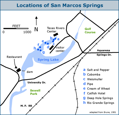 |
The graphic shows the locations of the various groups of Springs. The
three larger ones are Weismuller (c), Installation or Pipe (d), and Deep
Hole Springs (g). |
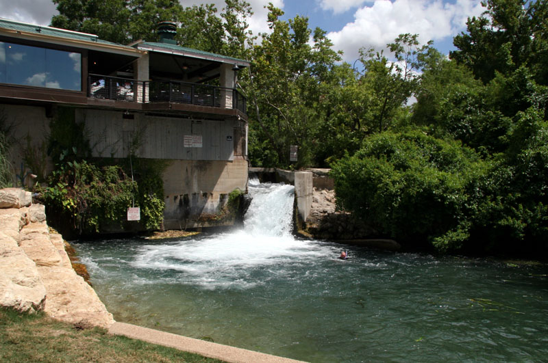
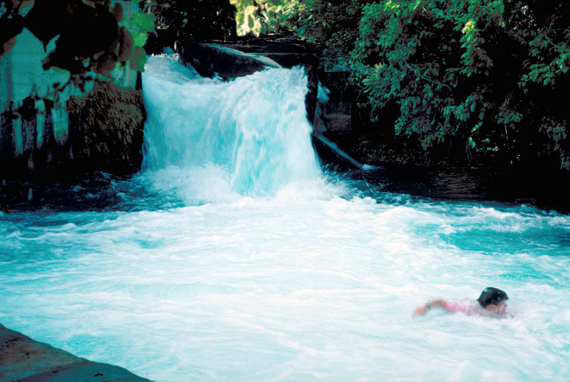
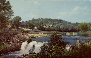
The best place to see the tremendous discharge of the
Springs is at the two spillways at the southwest end of Spring Lake. There is also a
popular swimming hole there. The main spillway is adjacent to a restaurant where one can dine atop the dam. Just to the east is a second spillway.
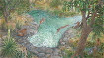
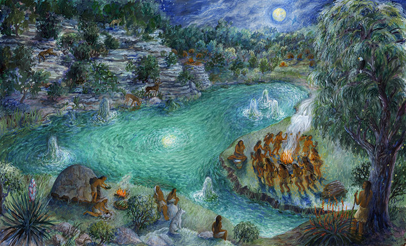
Of all the springs and sites that would be visited on this pilgrimage, the San Marcos Springs are key. This is the creation site of the Coahuiltecan Indian tribes. Natives explain that when they were in their pre-human spirit form, they do not really know what they looked like. After following a deer through the underworld, they took on their human form when they emerged as people from the fountain springs of San Marcos.
The native tribes still maintain their covenant with the sacred sites through the Indigenous Cultures Institute. Visit their site to learn more about their programs and sign up for a guided tour.
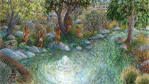
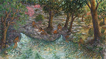
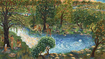
In 2014, artist Susan Dunis created a series of paintings for these pages that depict a family of Lower Pecos natives on this sacred pilgrimage to the Edwards springs sites. Each painting illustrates a different aspect of cultural importance of the Edwards springs.
In this painting, the second in the series, the theme is ceremony. In addition to the deer, there are four other sacred animals depicted, and if you look closely you will find the tribal symbol in the smoke from the fire.
You'll have to visit the Indigenous Cultures Institute to learn the significance of the other animals and many other elements in the painting - I'm not telling you!
The first Europeans to visit the San Marcos Springs were members of the Domingo Terán de los Rios expedition in June of 1691. In his diary of the expedition, Fray Damián Massanet noted the same tribes would customarily remain near the headwaters to hunt each year until winter, when they would move west. On approaching the Springs, the visitors encountered a very large gathering of 2,000 to 3,000 Indians, and Terán identified the nations as the Jumano, Cibolo, Cantona, and Casquesa, all well known-known to the Europeans. These members of distant tribes were on an annual hunting and trading expedition to the Springs which the historian Elizabeth Johns refers to as a trade fair. Terán prepared an impressive barbecue for them and they responded by conducting a parade that was one of the most dramatic and dazzling displays of Indian pomp and ceremony witnessed on any Spanish expedition. Several thousand Indians marched and rode in columns, two by two (Foster, 1995).
Several subsequent expeditions visited the Springs, and a short-lived Spanish settlement occurred in 1755. In that year, several missions on the San Gabriel River were abandoned and re-established temporarily on the San Marcos River. By 1757 the presidio soldiers had been re-assigned to other missions in Menard and San Antonio, and the exact location of the settlement is not known (Bolton, 1915). Another Spanish settlement was established along the San Marcos River in 1808 by Don Filipe Roque de la Portilla, but by 1812 it was abandoned due to Tonkawa and Comanche Indian harassment and severe flooding, and it is unknown whether these settlers utilized the springs or headwaters (Horrell, 1999).
In 1831, Juan Martín de Veramendi, who was a governor of Texas under Mexican rule and an important figure in early San Antonio, received a land grant of two leagues that contained the Springs. He died of cholera two years later, and in 1840 his heirs sold some of his land to Nathaniel Lewis. That same year, the Texas Republic established Post San Marcos at the headwaters to safeguard travel between San Antonio and Austin and to facilitate the building of a more direct road between the two towns. The exact location of the fort has never been determined (Pierce, 1969).
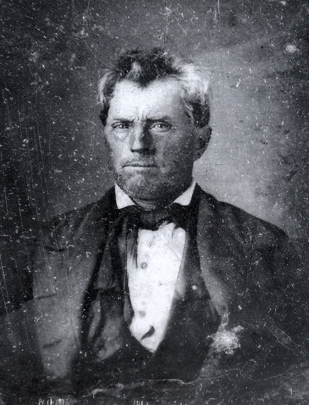
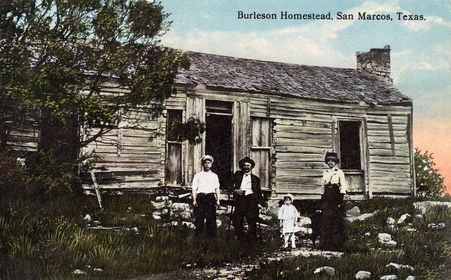
In 1845, General Edward Burleson acquired the headwaters and Springs from Lewis. Burleson was a well-known war hero who had fought with Ben Milam in San Antonio and commanded the First Regiment at San Jacinto, where Texas' independence was won. He acquired additional fame during battles with Comanches and Cherokees, and also served as Vice-President of the Republic of Texas under Sam Houston and as a senator for the Fifteenth District. In 1848 Burleson and his sons built a two room cabin on the hill overlooking the Springs and began using the adjacent lands for cropland and grazing (Bousman and Nickels, 2003).
In 1849 Burleson built a dam across the San Marcos River to operate a gristmill, inundating the Springs and forming Spring Lake. When Spring Lake was created it also sealed archaeological artifacts underneath, where they lay protected from collectors and diggers for over 100 years. This was a real boon for archaeologists in the 20th century, who uncovered more than 50,000 artifacts from only 5% of the lake bed between 1979 and 1982 (Garza, 1982). Many are presently on display at the site.
In the last half of the 19th century, Burleson's land was split up and various owners used water from the Springs to power a variety of grist and sawmills, an ice factory, and an electric light works. The site was also an important stop on the Chisholm cattle trail from 1867 to 1895.
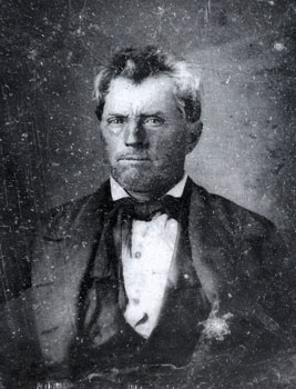 |
The only known original portrait of General Edward Burleson, from the Texas State Library & Archives Commission. |
|
 |
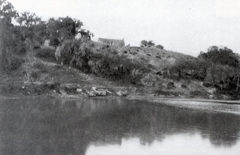
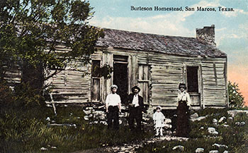
Photo taken in 1907 showing the San Marcos River and Burleson's cabin. From the San Marcos-Hay County Collection at the San Marcos Public Library.
|
|
 |
An old postcard showing the cabin's east side and an enclosed dogtrot between the two rooms. |
|
 |
The steel grid that archaeologists set up when excavating a portion of the lake bed is still in place and visible from the glass-bottomed boats. |
|
 |
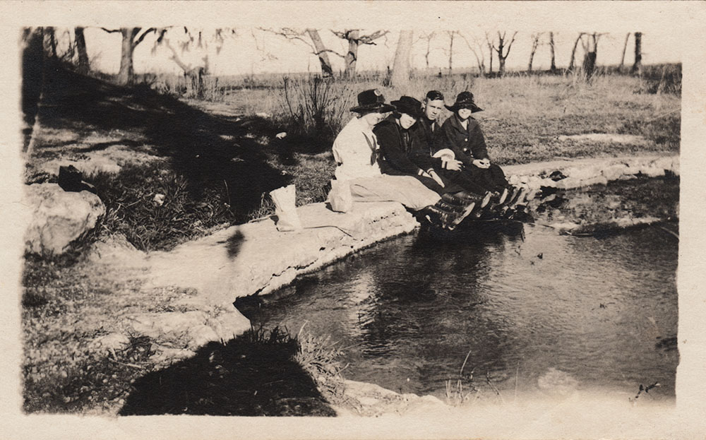
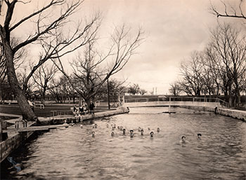
Some unidentified picnickers at the headwaters circa 1920s. |
|
 |
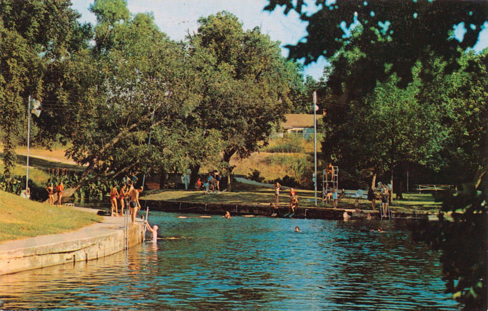
Just below the San Marcos Springs is Sewell Park.
One of the swimmers seen here in the foreground is mathematics Professor S. M. "Froggy" Sewell, who in 1916 thought the college needed a park. In 1917, the college leased four acres from the U. S. Bureau of Fisheries and created Riverside Park. In 1946 it was renamed in honor of Professor Sewell.
The back caption says the photo was taken on January 15, 1940, and that in the many years that Professor Sewell had been associated with the college, he had only missed two years of having a swim in the river during the Christmas holidays. |
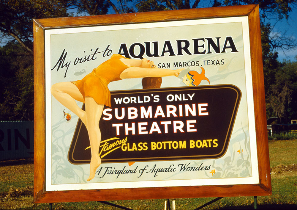
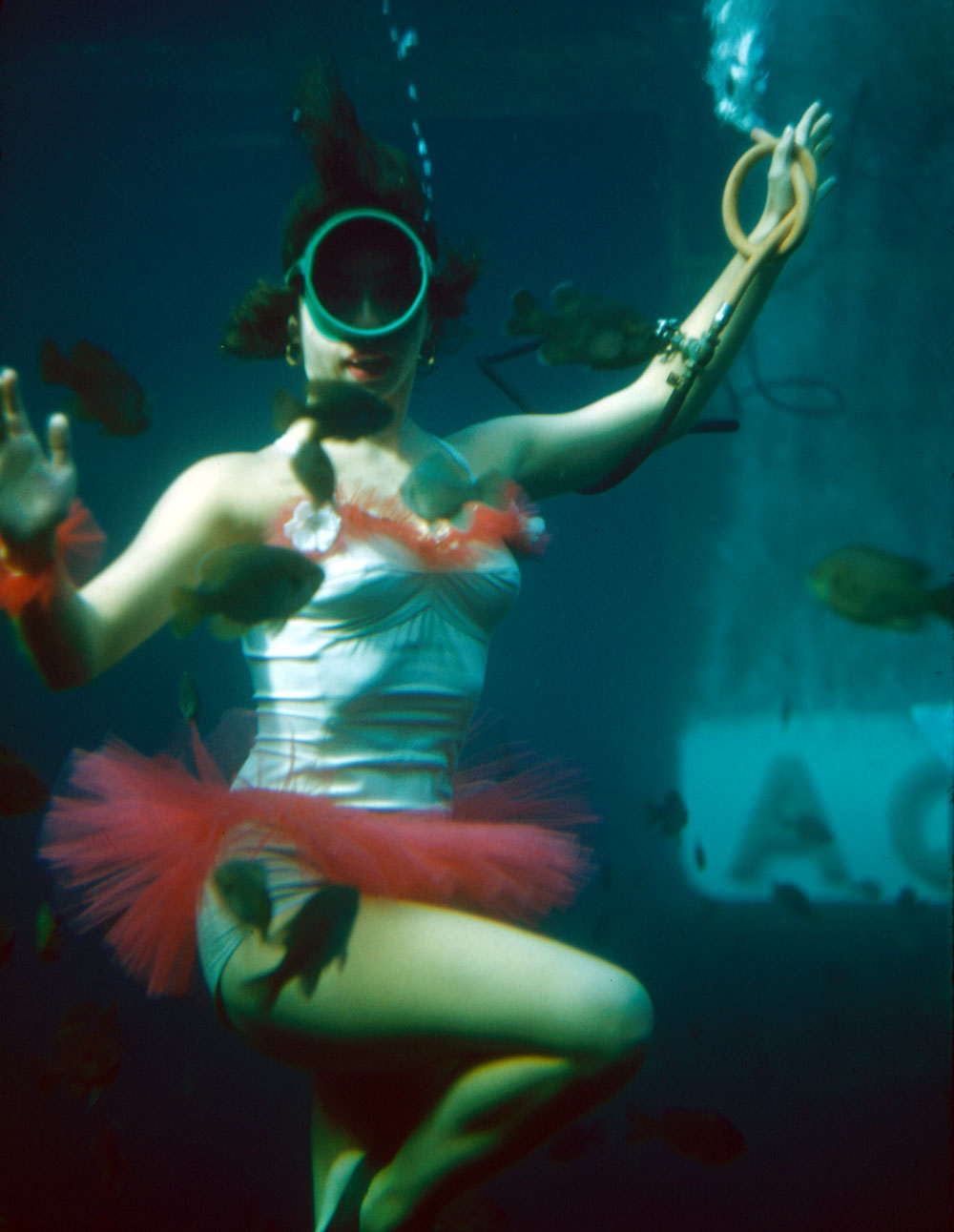
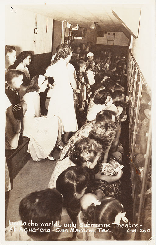
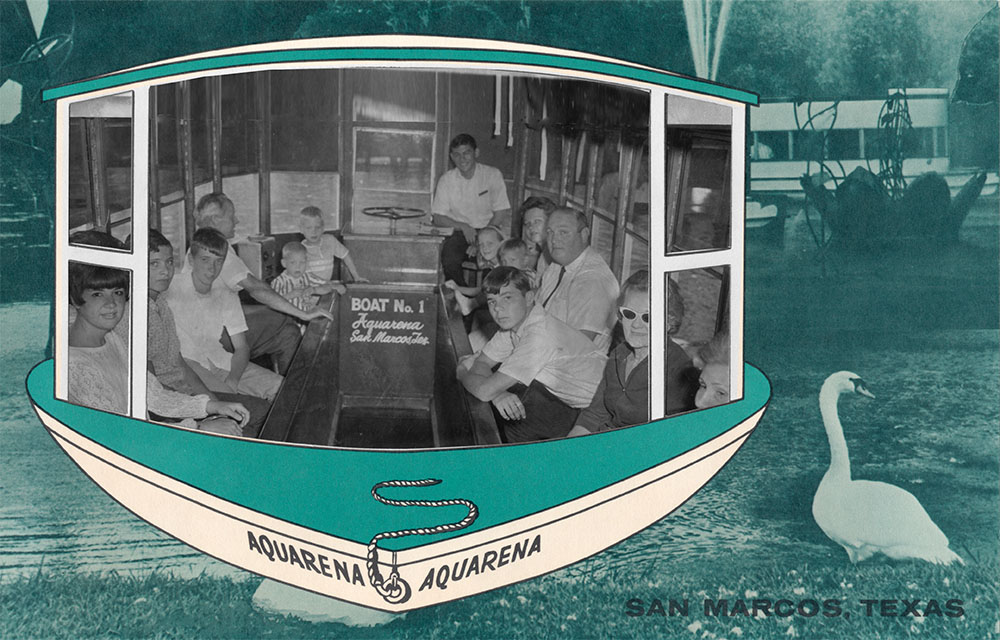
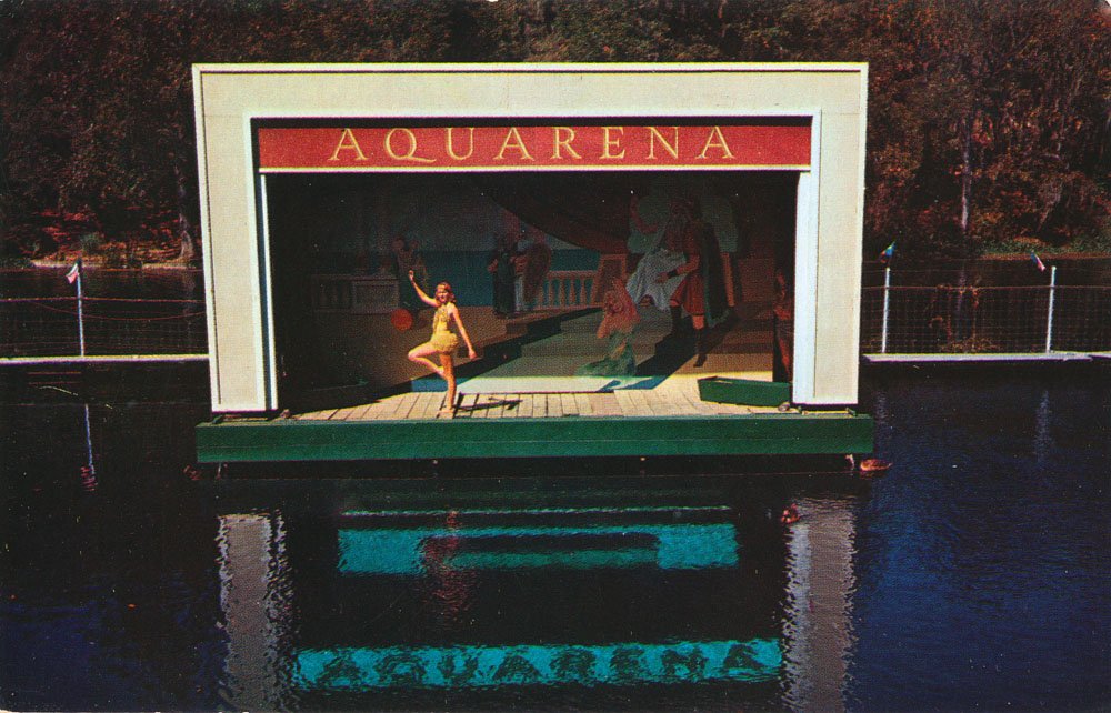
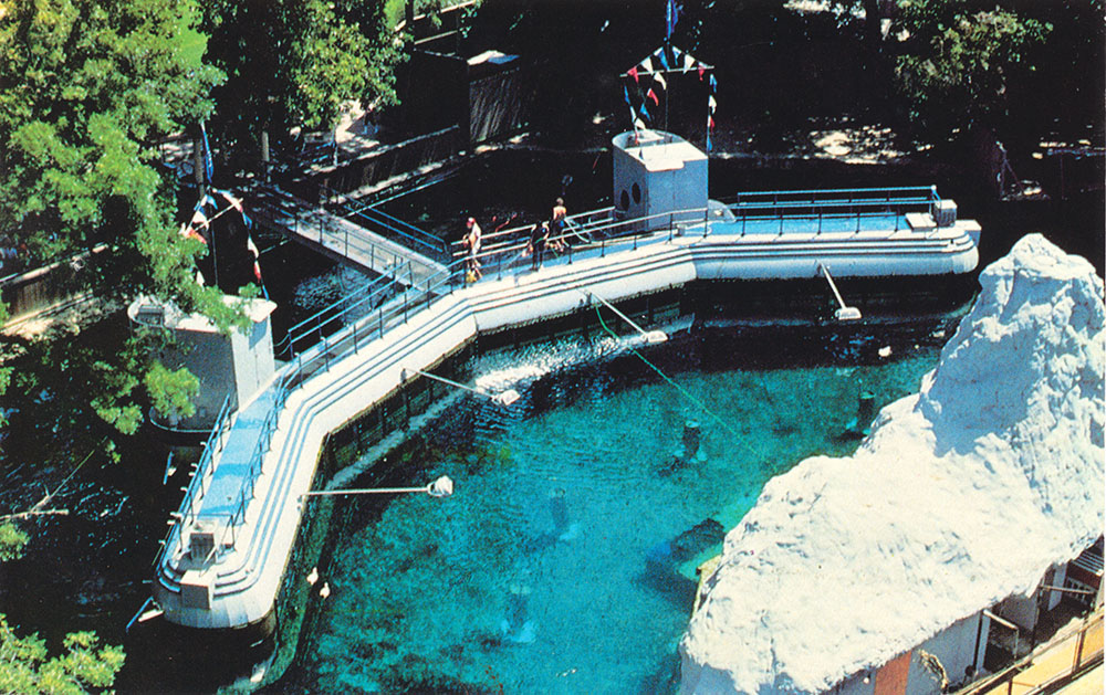
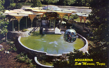
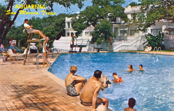
In 1926 A. B. Rogers purchased Burleson's homestead tract, including the two-room cabin, for $21,466 (Hays County Deed Records 91:458) and by 1929 he had built a 200' long hotel that was first named the Spring Lake Park Hotel and was later known as the Landmark Inn. In 1949 Paul Rogers bought the land from his parents and founded Aquarena Springs, which became a popular tourist attraction and resort. The name derived from a concatenation of 'Aqua', referring of course to water, and 'arena', referring to a submersible underwater theatre that was considered an engineering marvel in the 1952 edition of Popular Mechanics. Ralph the Swimming Pig and frolicking underwater mermaid dancers became trademarks. Glass-bottomed boat tours offered a look at the flooded Springs - smaller ones appear as bubbling sands and are easily visible on the lake bottom.
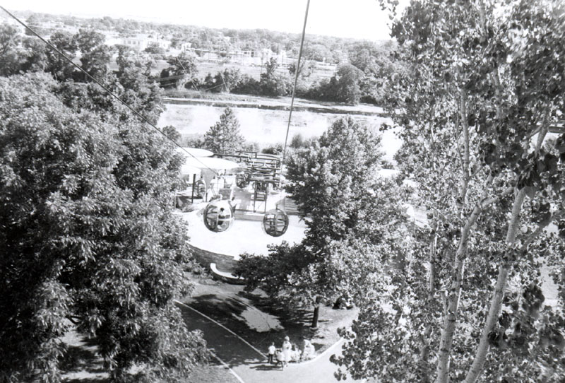
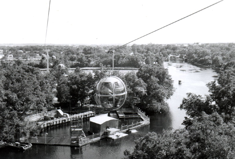
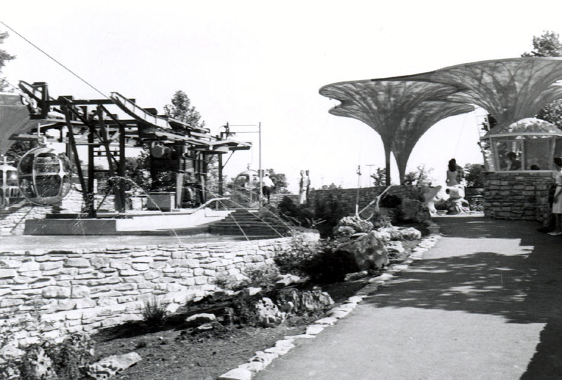
In 1955 the collapsing remains of Burleson's cabin were dismantled to keep students and kids from being injured, and a sky-ride gondola was built on the spot around 1959. The sky-ride became a major attraction, and the cabin was faithfully reconstructed nearby in 1966 to add additional ambience. Another main attraction of Aquarena Springs was a ride in a round car up a needle-like tower for a panoramic view of the area. For several generations of Texans, a visit to Aquarena Springs was a childhood rite of passage and there are many avid collectors of the various knick-knacks and postcards sold there over the years.
People held widely disparate views of what all this meant for the Springs. Many regarded the site as a wonderful family vacation spot, tourist attraction, and revenue generator for the city. Others viewed San Marcos Springs as one of the saddest places in Texas. For thousands of years awesome fountain springs were regarded as sacred and living by indigenous people, but now they could only be viewed in an underwater theater and through glass bottomed boats. Adding swimming pigs and mermaids ballets to the mix caused noted Texas naturalist Del Weniger (1984) to write:
Seated in this theater at the
mouth of the spring, how can one help but wonder if there is
any most unlikely corner of the biosphere humans will not
invade and desecrate to their own whims.
|
 |
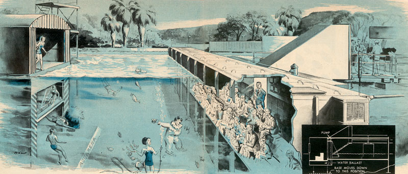
The June 1952 edition of Popular Mechanics proclaimed:
At San Marcos, Texas now boasts a venture unique to both the entertainment and educational worlds - a theater which allows an amazed audience to witness an hourlong program beneath the surface of a crystal-clear lake.It is a submarine theater which, when a special ballast tank is flooded, takes its cargo of people below the surface.
The article described the theatre as holding three million gallons of water and being 30 feet deep. Between shows, a pump would take 10,000 gallons per minute from a spring opening and discharge it into the arena for a constant supply of clear water. The theatre would submerge 42 inches in 11 minutes, using 15,500 gallons of water. The submarine's entrance, which was above water even when the theatre was submerged, remained open at all times. |
|
 |
From a roll of Kodachrome slides that I acquired on eBay. They are in pressboard mounts of a style that were used from 1952 to 1955. |
|
 |
From the same roll of Kodachrome as the sign above. It was apparently a very quiet day, the other slides show there were only four people in the theater for this show, and only two people on a boat ride. |
|
 |
Visitors peer through the viewing window of the underwater theater in this photo card mailed in July of 1952. On the back Helen and Jim wrote:
See you soon. You would enjoy this unusual place. |
|
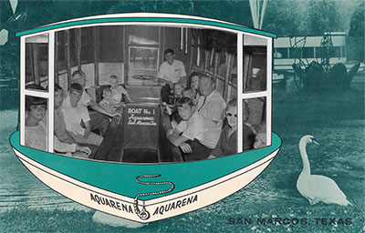 |
Photographic souvenirs were available to commemorate your ride on the glass-bottomed boat. |
|
 |
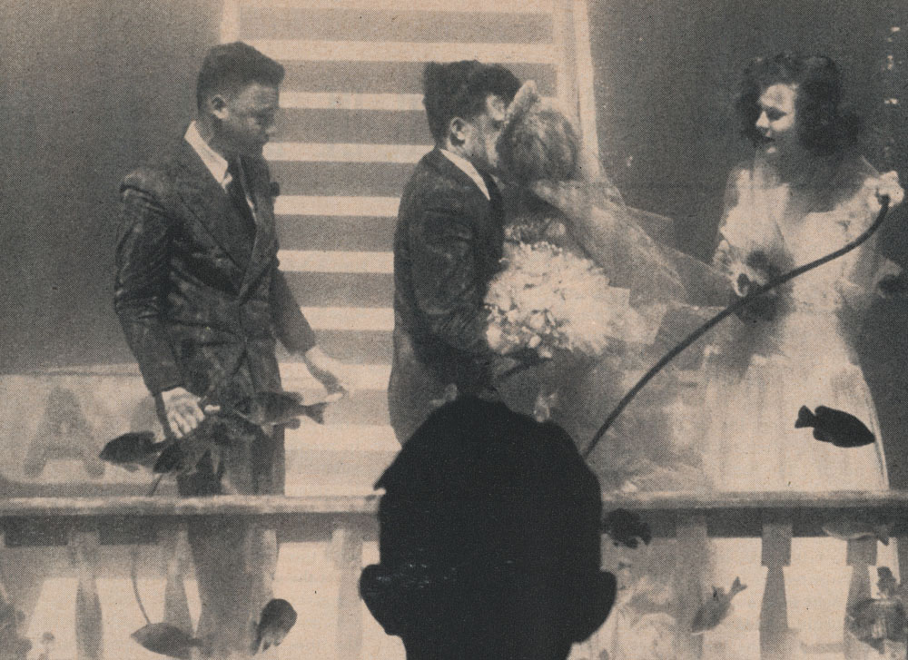
The March 8, 1954 edition of Life magazine had a story on the underwater theater wedding of Aquarena clown Bob Smith and Aquamaid Mary Beth Sanger. The bride's skirt was lined with lead hoops so it would not billow during the ceremony, and the groom wore shoes with 12 pounds of lead in the soles to steady him. |
|
 |
King Triton was featured on a backdrop for the Aquarena stage in 1959, with some lovely maids and perhaps members of his court. |
|
 |
By 1966 King Triton was gone and replaced by underwater performers and Blurpo the Clown. |
|
 |
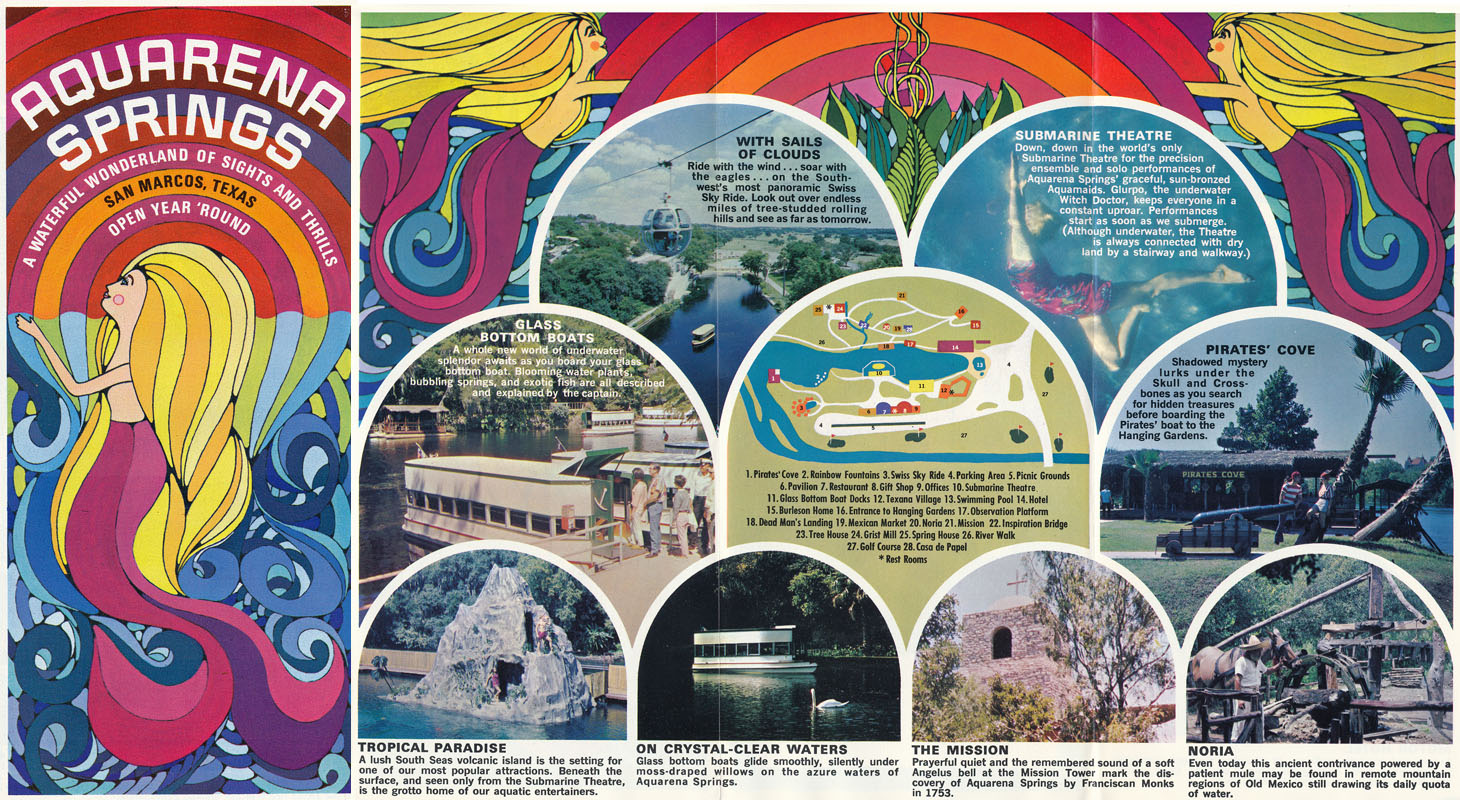
A groovy souvenir from 1968, when bold psychadelics were all the rage. The brochure unfolds to reveal photos of attractions like the Pirates Cove and the Submarine Theatre (click on the image to see the inside). |
In May of 1970, more than 16 inches of rain in less than 24 hours put Aquarena Springs under five feet of water and 21 alligators escaped from a pond into Spring Lake. The flood caused considerable damage at the administration building, gift shop, restaurant, and Texana Village.
But within a week, Aquarena recovered and ran newspaper ads advising the public they were open and flourishing and "Anyway, we're used to working underwater."
All of the alligators were recovered, although one had to be shot. Alligator hunter Tom Allen was called in from Ocala, Florida - he prowled the area in a canoe and, upon locating one of the free-ranging reptiles, would jump in the water with a noose, tie it around the nose, and haul it out.
A long-running and legendary Texas event, the Chilympiad, got its start at Aquarena Springs in 1970. In addition to the chili competition, the three-day event featured parades, car shows, starving artist shows, glider and parachute demonstrations, fiddler contests, and musical stage shows. There were always celebrities in attendance, along with local gadflies like Sam Kindrick and Hondo Crouch.
During an initial 1970 planning session at John T. Floore Country Store in Helotes, the organizers decided there would be only two rules:
- all chili had to be made from scratch at the site of the contest
- women were not allowed to compete
These rules were adopted because the organizers, who regarded themselves quite highly as Doctors of Chilosophy, were appalled by a rumor the San Antonio Conservation Society was going to enter, and they didn't want a bunch of tennis-shoed blue-haired ladies hanging around. So the next year the ladies staged their own women-only contest in Luckenbach, calling it "Hell Hath No Fury Like A Women's Chili Society."
In 1975, from a barstool in Sisterdale, Hondo Crouch told me the exclusion of women wasn't really about sexism - it was simply because the men knew their chili was bad and they could not beat the cooks from the Conservation Society.
|
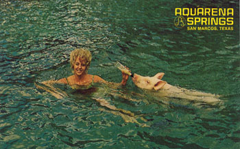 |
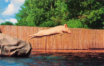
Ralphie the swimming pig, a Texas institution. Actually, hundreds of pigs were used over the decades, since they quickly became too big to swim.
Lovely Aqua-Maid and her
trained swimming pig, Ralphie, two of the many attractions seen from the
world's only Submarine Theater. |
|
 |
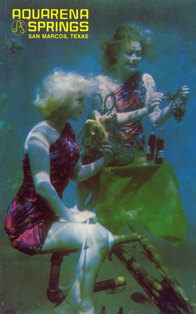
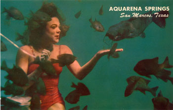
The frolicking underwater maids at Aquarena Springs. The back of the card says:
Two lovely Aqua-Maids keep audiences spellbound during their very wet but clean underwater fishnic. Friendly fish are invited. |
|
 |
The Sky Ride Launching Pad was housed inside a unique fibreglass structure designed and constructed by Texas artist Buck Winn. |
|
 |
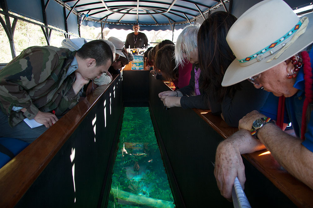
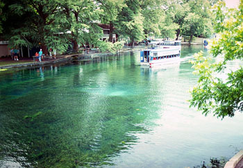
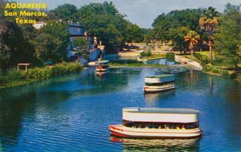
Since Paul Rogers started lake tours in 1949, the Springs have been viewed by thousands through the floor glass bottomed boats. At right is Dr. Mario Garza of the Indigenous Cultures Institute, who is viewing this scene differently from the rest. For him, this is the place of birth of his people. |
|
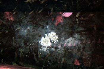 |
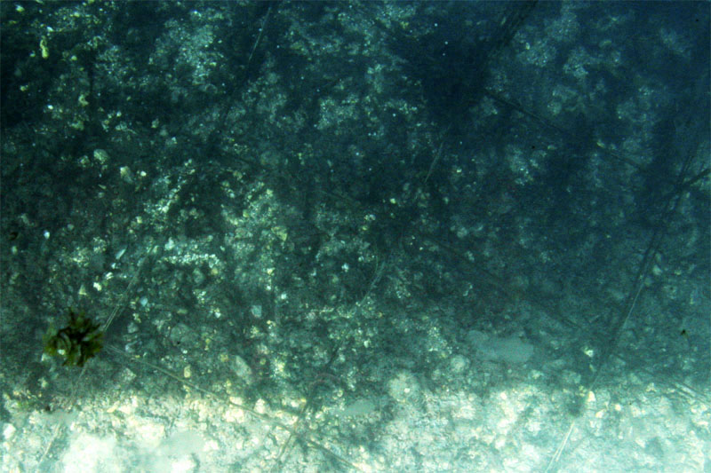
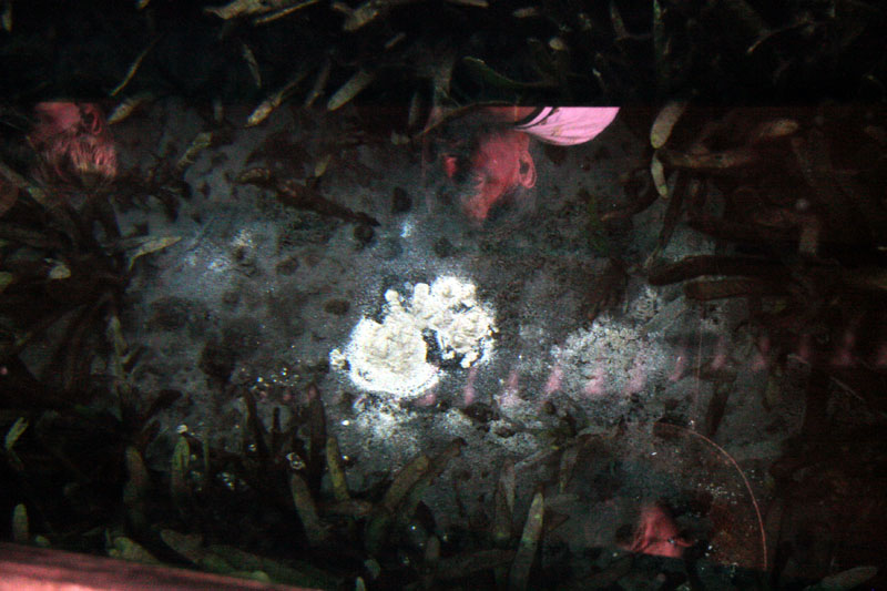
Visitor's faces are reflected in the glass and a bubbling spring is visible just a few feet below the bottom of the boat. |
The Springs and resort were purchased by Southwest Texas State University in 1991 and continued to be operated as a theme park and resort. In February of 1996 the Board of Regents took what environmentalists hailed as a giant initial step toward restoring the dignity and natural beauty of this site. The Board voted to convert the facility from a theme park to "educational and general uses", ending the swimming swine's 30 year run. The dancing mermaid shows and theme-park like rides were eliminated. The University solicited community input on questions like whether the rides should be removed to improve views of Spring Lake and present a less cluttered appearance. Exhibits were completed on endangered species and on the many archaeological artifacts that have been recovered from the site. The underwater theater offered educational workshops instead of the mermaid show. The site is now known as Aquarena Center.
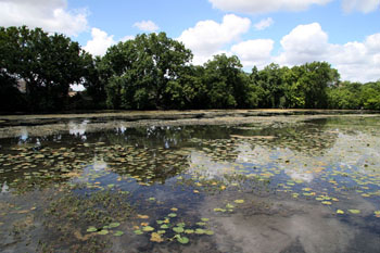
However, the decision to end the amusements created ill will between the University and the community. The city lost a major tourist attraction, summer jobs, and $120,000 per year in tax revenues. To build a bridge back to the community, the University conceived a $5 million wetlands project with several miles of nature trails that would connect to the city's trail system, forming a 10-mile route along the San Marcos and Blanco rivers. The first step in the project involved removing water hyacinth, a non-native fast-growing plant. Many additional plant and animal species present are not native, and the school began efforts to replace the introduced ones with native ones. Geese and swans have been removed, and efforts are ongoing to get rid of nutria, imported snails, hydrilla, elephant ears, and tilapia. Today, the Wetlands Boardwalk, made of recycled plastic lumber, floats on a shallow and marshy area of Spring Lake and allows visitors to view the flora and fauna of a wetland ecosystem. The former Landmark Inn became the home of the Texas Rivers Center and houses several interpretive and interactive displays.
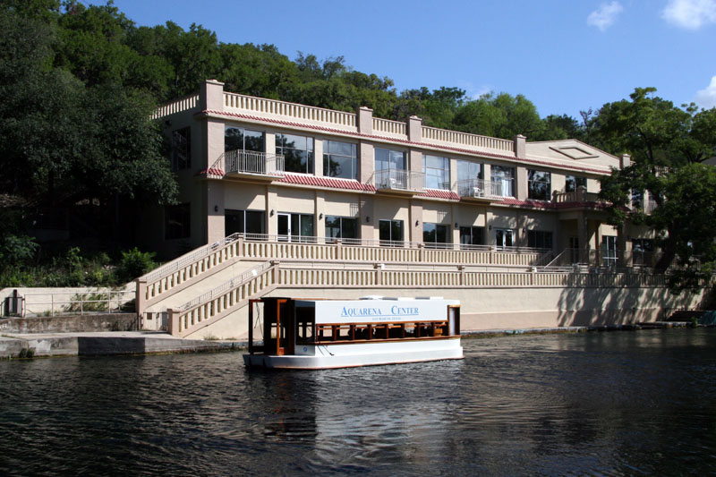
The Texas Rivers Center was a partnership with the River Systems Institute and branches of the Texas Parks and Wildlife Department and the National Park Service. In August of 2012, following a large gift from the Meadows Foundation, it became The Meadows Center for Water and the Environment. The Meadows Center is continuing the mission to develop and promote programs and techniques for ensuring sustainable water resources for human needs, ecosystem health and economic development. It aims to promote a holistic approach to the management of natural systems where key principles of sustainability and equitable use guide sound water policy.
Still, controversy surrounds the University's ownership and stewardship of the San Marcos Springs and Spring Lake. Some naturalists would like to see the Lake drained and the Springs restored to something more closely resembling their natural state. The dam suffered major damage during floods in October of 1998 and some argued it should have been removed instead of repaired. They argue the dam may actually be a threat to the endangered species present, and they point out that perhaps the most educational thing that could be done would be to let the area revert to it's natural state. The Univerisity and federal officials have a different opinion. The U.S. Fish and Wildlife Service argues the endangered species have adapted to Spring Lake and would be worse off without it.
By 2014, almost every single trace of the old Aquarena theme park had been removed. The Sky Ride and Sky Spiral infrastructure were dismantled, the Submarine Theater was pulled from the Lake, and the old gift shop, restaurant, and outbuildings were demolished. The site was planted with native prairie vegetation and grasses. Today, it is difficult to tell that anything else ever existed.
|
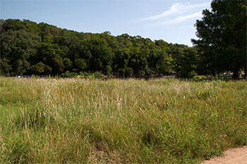 |
Site of the old Aquarena gift shop and restaurant. Almost every trace of the Aquarena theme park is now gone and restored with native grasses. |
|
 |
Part of the Wetlands Walk is over open water and it's easy to spot many fish, turtles, and other aquatic creatures. |
|
 |
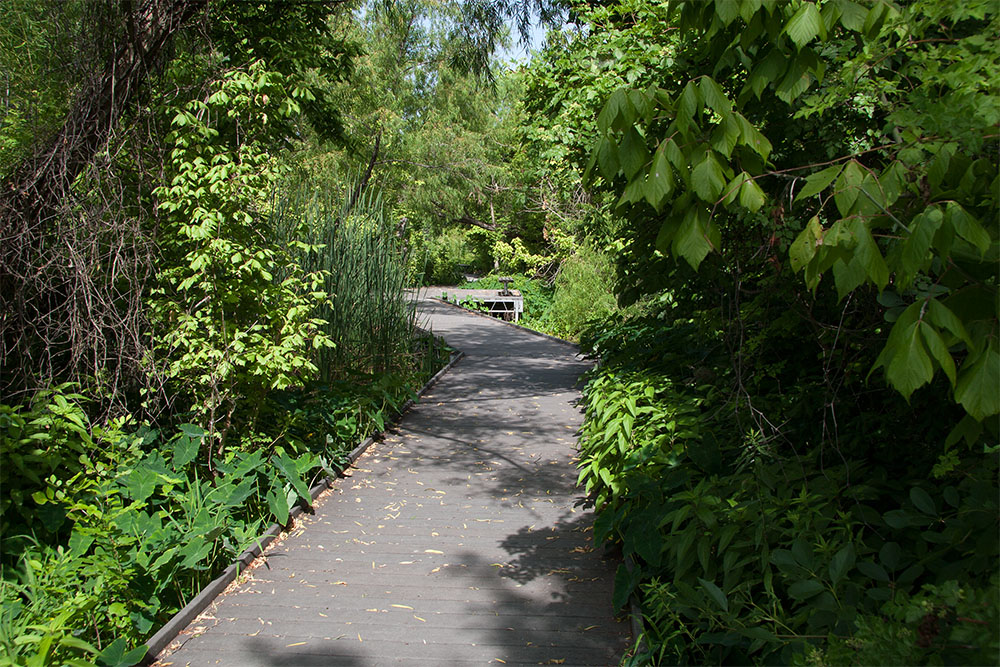
Another part of the Wetlands Walk traverses a shallow, marshy area of Spring Lake, allowing visitors an up-close view of the flora and fauna. |
|
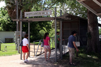 |
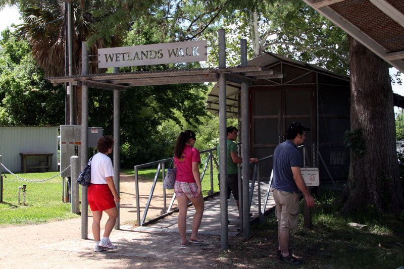
Entrance to the Wetlands Walk. |
|
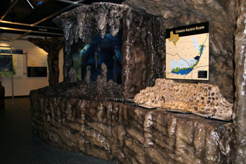 |
The Texas Rivers Center was a partnership with the River Systems Institute and branches of the Texas Parks and Wildlife Department and the National Park Service. It is now the Meadows Center for Water and the Environment. The new Center continues to be housed in the old Spring Lake Park Hotel, which has been converted into an educational and research facility. Visitors can explore interesting interactive and interpretive exhibits. |
|
 |
The conflict between recreation and the Texas Wild Rice is evident in this photo taken in the city park just below San Marcos Springs. The Wild Rice is the swath of greenery on the left. While I was standing on the bridge taking this picture, some kids in an innertube floated by who were casually reaching out to rip out plants. |
Data from hydrochemistry studies and dye-tracer studies suggests that two nearly
independent flow regimes contribute water to the various spring orifices.
In one study, dye was injected in nearby Ezell's Cave, which is located along
the San Marcos Springs fault (see the page on
Faults & Caves). Eleven days later, dye was detected at Deep Hole,
and 30 days after that dye was seen at Catfish Hotel. No dye appeared in
any of the spring orifices farther north such as Weismuller and Cabomba.
In 1979 a fault was mapped that separates the southern springs from the northern
ones, which could have sufficient displacement to act as a groundwater
barrier. Also, the fact that it took 30 days for water to move only 230
feet between Deep Hole and Catfish Hotel suggests minimal hydraulic connection
and/or a zone of extremely slow ground-water movement possibly caused by a
meeting of two separate pressure systems (Ogden,
Quick, and Rothermel, 1986). In a second study by the same scientists,
dye was injected in Rattlesnake Cave, located about 4,000 feet northeast of
Spring Lake. After 40 days the dye emerged at all the monitored orifices
in Spring Lake. The researchers concluded that groundwater from the San
Antonio region moves northward, confined within a narrow fault block, and
emerges primarily from just the southern orifices. This groundwater
appears to be separated from the Blanco River and Sink Creek areas by a
fault-controlled pressure boundary. This pressure boundary moves slightly
in response to changes in hydrostatic head between the two ground-water flow
systems and may allow flow to go in either direction under different
conditions. This would explain why the dye emerged 40 days later at all
the spring orifices.
It has long been accepted that a groundwater divide separates the San Antonio segment of the Edwards containing San Marcos Springs from the Barton Springs segment of the Aquifer in Austin. But in April 2010 a study commissioned by the Guadalupe-Blanco River Authority found that groundwater level data indicates the groundwater divide dissipates
and no longer hydrologically separates the two segments during major droughts and current levels of pumping. As a result, there is potential for some groundwater to bypass San Marcos Springs and flow toward Barton Springs during major droughts. The groundwater divide appears to be influenced by recharge along Onion Creek and the Blanco River and is vulnerable to extended periods of little or no recharge and extensive pumping. See the complete study.
Several previous studies hypothesized that discharge at San Marcos Springs might include notable contributions of recharge from nearby streams, including the Guadalupe River, Cibolo Creek, Dry Comal Creek, Sink Creek, Purgatory Creek, York Creek, Alligator Creek, and, in particular, the Blanco River (Guyton and Associates, 1979; Ogden and others, 1986; Johnson and Schindel, 2008). However, in 2012 the USGS conducted a new study that indicated recharge from these local streams is not a major source of San Marcos Springs discharge. Rather, discharge at San Marcos Springs is dominated by regional recharge sources and flow paths, even during wet hydrologic conditions when Aquifer recharge is likely occurring from local streams.
In the 2012 study, geochemical modeling results suggested that the proportion of local stream recharge contributing to San Marcos Springs discharge increased from a dry period to a wet period, but even under wet conditions the proportion was less than 30 percent, and for most hydrologic conditions it was less than 10 percent. The results also indicated that, in addition to a dominant component of regional groundwater flow, a small contribution of saline water is needed to account for the composition of San Marcos Springs. Both the Edwards Aquifer saline zone and the underlying Trinity Aquifer were considered as hydrologically plausible saline-water sources. Although the Trinity Aquifer cannot be eliminated as a potential source, modeling results indicated that mixing with a small component (less than 1 percent) of saline-zone groundwater more likely accounts for the composition of San Marcos Springs discharge. See the complete study.
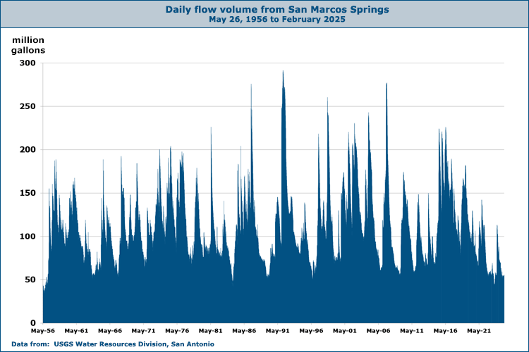
History does not record a time
when the San Marcos Springs have ceased to flow. The lowest
recorded flow rate was 46 cubic feet per second (29.7 million gallons per day) in August of
1956. At that time, the Comal Springs were dry. There is a
relationship between the level of the J-17 index well and
the flow at San Marcos Springs, but because of local recharge
around the Springs the correlation is not as precise as with
Comal Springs (see Flowpath Map). San Marcos Springs would cease to flow with a water elevation of
about 574 feet at the springs. The "bad water" line is
remarkably close to the springs. It runs through the facility's
parking lot only about a thousand feet from the Spring outlets. There is a fault at this location which causes the Edwards
limestone carrying fresh water to the Springs to be juxtaposed
with denser, less permaeble limestone containing saline water.
Official flow records for San Marcos Springs begin in 1915, but they were sporadic and were discontinued in 1921. No additional measurements were made until May of 1956, and for a long time the official flow record began at the beginning of the 1995 Water Year (October 1994). To extend the data record back to 1956, hydrologists applied a calculation that attempts to separate flow that can be attributed to local stormwater runoff at USGS gage 08170500 on the San Marcos River. Once runoff is removed, the rest is attributed to springflow, and that volume is recorded at USGS gage 08170000.
The chart below shows it is typical for springflow rates to increase dramatically after prolonged or intense rain events, and then there is a gradual decline lasting for months of even several years. Flows often exceed 100 million gallons per day, but rarely do they exceed 200. For the latest San Marcos springflows see
the USGS
Real-Time data page.
Although today’s Spring Lake is a manmade feature, there is some evidence that a natural lake may have existed at various times in the past.
In 2013, Jacob Hooge extracted and analyzed an array of core samples from sites along the banks of the Springs to increase our understanding of the geoarchaeological record.
His analysis suggested that over the last 12,000 years, long periods of drought would lead to deposition of sediments that would form a levee across the stream channel, turning the springs into a lake. When wetter times returned, the levee would be eroded and the lake would turn back into a stream channel. Download Hooge's thesis here.
|
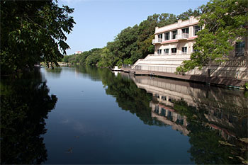 |
A view of Spring Lake and the Meadows Center in July of 2014. |
|
 |
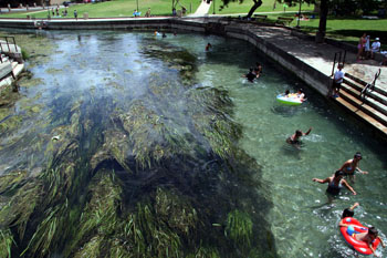
A view of the main spillway. There is a restaurant here where one can dine atop the dam, and a popular swimming hole just below. The dam
suffered major damage during the October '98 floods - a hole the size of a
Volkswagen developed underneath. The swimming hole had to be closed in
May '99 because a State inspection found the dam could collapse at any
time. In September 2000 authorities warned swimmers to stay out of the San
Marcos River below the Springs because high levels of fecal coliform bacteria were detected. The River is normally heavily used by swimmers,
snorkelers, and tubers. |
|
 |
The hotel built by A. B. Rogers is now the Meadows Center for Water and the Environment. It was previously the Texas Rivers Center. During renovation for the Rivers Center, they went with a poached salmon color scheme instead of the original white and red. |
|
 |
Another view of Spring Lake taken in 1991 from what is now the Meadows Center.
Notice the exceptional clarity of the water and the aquatic vegetation
visible below the surface. |
|
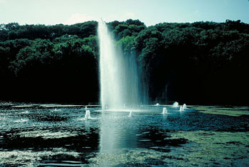 |
Fountains in Spring Lake once evoked the feeling of the
awesome fountain springs that once gushed skyward from the riverbed. The fountains are gone now. |
|
 |
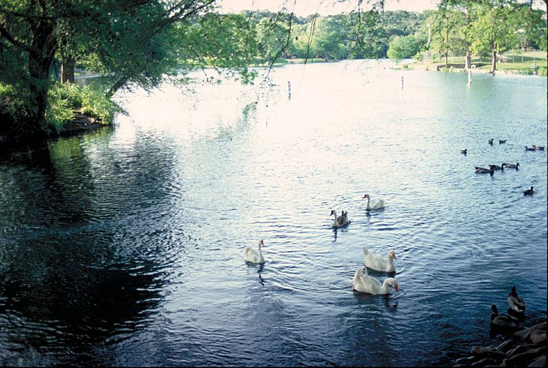
Photo taken about 1991. Non-native species like these ducks have been removed. |
|
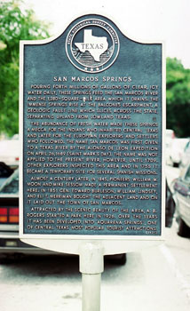 |
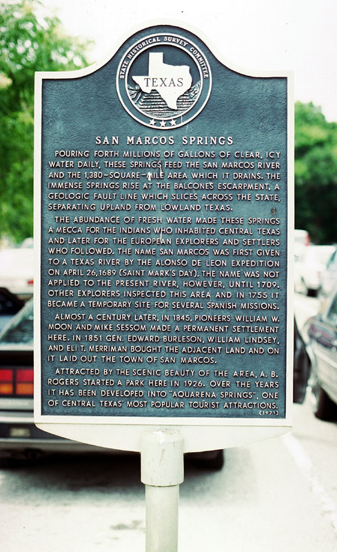
Pouring forth millions of
gallons of clear, icy water daily, these Springs feed the San Marcos River
and the 1,380 square mile area which it drains. The immense Springs rise
at the Balcones Escarpment, a geologic fault line which slices through the
State, separating upland from lowland Texas.
The abundance of fresh water
made these Springs a mecca for Indians who inhabited Central Texas and
later for the European explorers and settlers who followed. The name San
Marcos was first given to a Central Texas river by the Alonso de Leon
expedition on April 26, 1689 (St. Mark's Day). The name was not applied to
the present river, however, until 1709. Other explorers inspected this
area and in 1755 it became a temporary site for several Spanish missions.
Almost a century later, in
1845, William W. Moon and Mike Sessom made a permanent settlement here. In
1851 Gen. Edward Burleson, William Lindsey, and Eli T. Merriman bought the
adjacent land and on it laid out the town of San Marcos.
Attracted by the scenic
beauty of the area, A. B. Rogers started a park here in 1926. Over the
years it has been developed into "Aquarena Springs", one of Central Texas'
most popular tourist attractions. |
|
 |
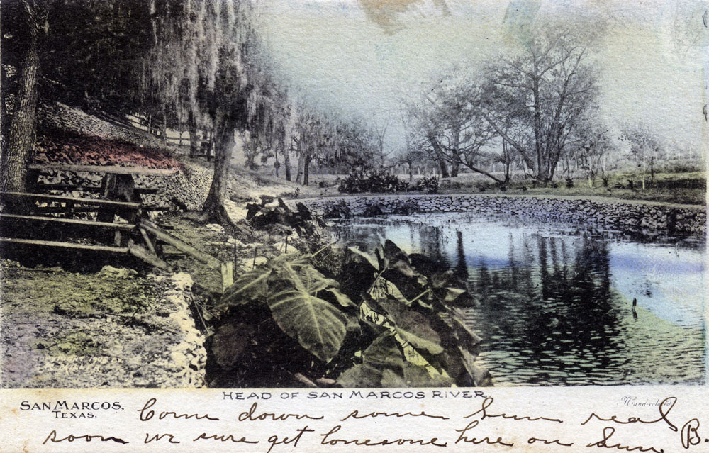
A very early view of Spring Lake before the low stone wall in the image below was built. |
|
 |
This hand-tinted photograph on a postcard from 1901 was taken from the
north side of the lake, showing the upper end of Spring Lake where the hotel was constructed. |
|
 |
An uncolored version of the same card as above. |
|
 |
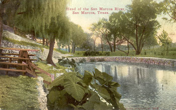
An early view of Spring Lake produced by Tom Jones of Cincinnatti for M. J. Funk of San Marcos. In those days postmarks did not include the year, but I have another copy of this card in which the writer noted the date was June 19, 1907, which helps to date the card to around that year. |
|
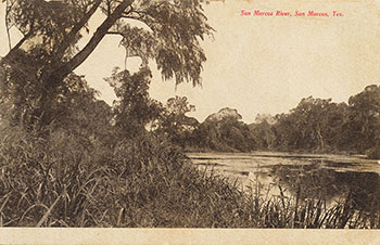 |
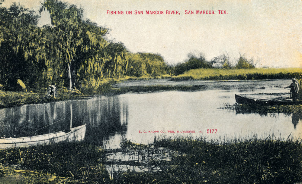
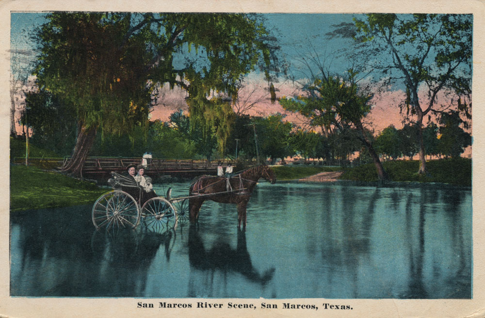
A very early postcard view of the San Marcos River, produced by Tom Jones in Cincinnati for M. J. Funk of San Marcos. |
|
 |
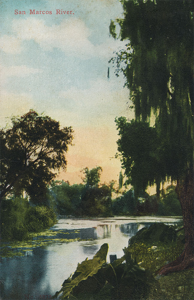
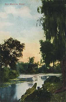
A view of the San Marcos River mailed in March of 1909. |
|
 |
This must have been a very popular view because another postcard mailed over a
decade later uses the exact same photograph, this time colored with a
lithographic technique. |
|
 |
Not mailed or dated, but I'm dating this card to approximately 1910 because of its similarities to other dated cards. |
|
 |
A view of the San Marcos River postmarked January 6, 1912. |
|
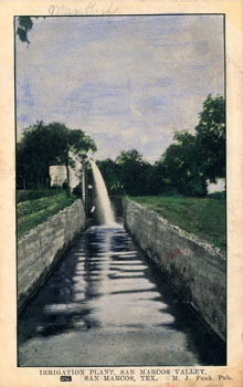 |
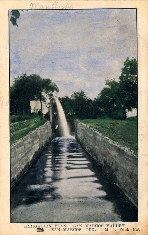
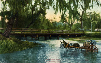
Spring water diverted to an irrigation channel. Not mailed or dated, but as with the card above, the style suggests it was produced before 1915. |
|
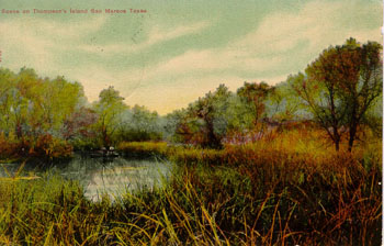 |
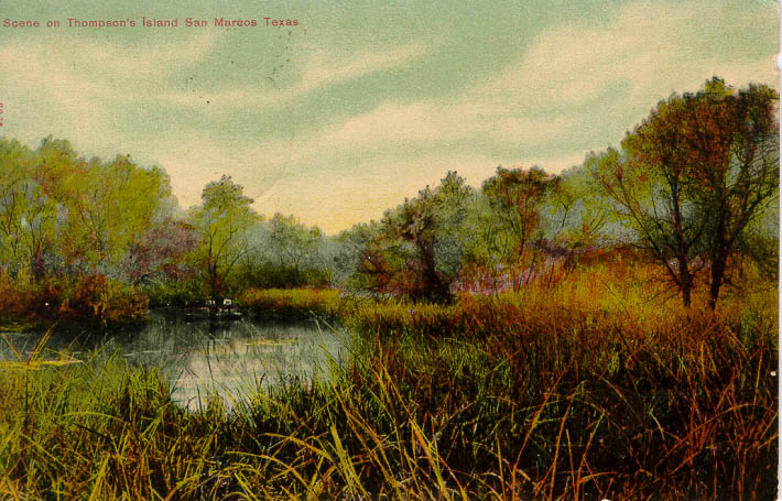
A scene from Thompson's Island around the turn of
the century. |
|
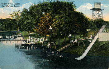 |
Before he bought the headwaters in 1926, A. B. Rogers operated a resort on the San Marcos River where Rio Vista Park is located today, just upstream of Cheatham Street. |
|
 |
Judging from the postcard style and the dress of the swimmers, this card was produced slightly later than the one above. |
|
 |
Before municipal water supply systems were built, most people got their water by delivery from mule drawn wagons. Here, a water vendor fills his barrel before setting out on his rounds. |
|
 |
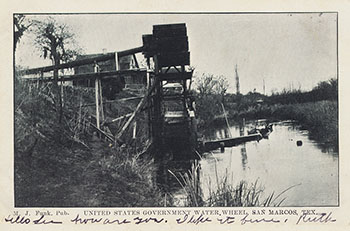
Mailed on July 12, 1915, the back of the card says:
Broke down here - broke gear shifting lever. Had to order one from Austin holding us up 4 hours, everything fine. Hope business is good. - FDR |
|
 |
A divided back card by the M.J. Funk Publishing Company. |
|
 |
A hand-colored Real Photo postcard that was mailed in 1918. |
|
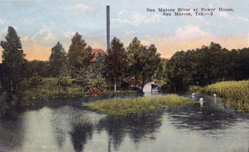 |
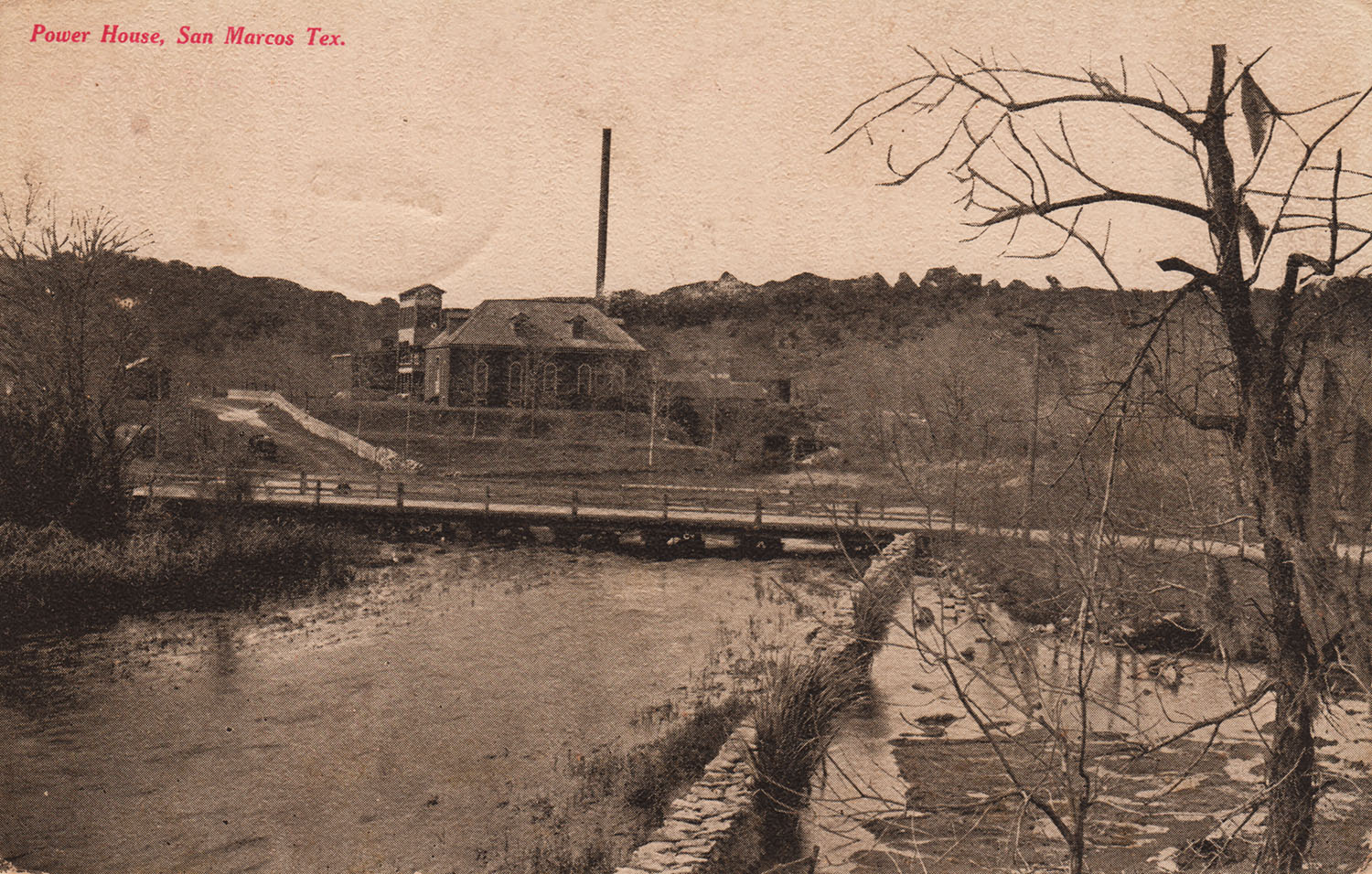
Another view of the San Marcos river at the Power House in 1921. The power plant was located at Burleson's dam, where the Saltgrass Steakhouse is today. The back
of the card says:
Dear Ida:
I hate to disappoint you but we have inquired about the roads and all
declared it unpassable with a large car. Will come with my airoplane
later.
With love, Dora |
|
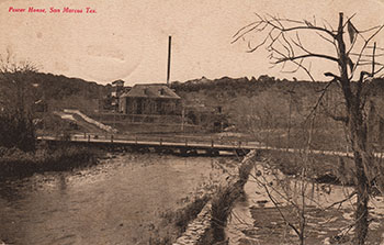 |
Another postcard view of the Power House, undated. |
|
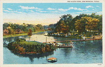 |
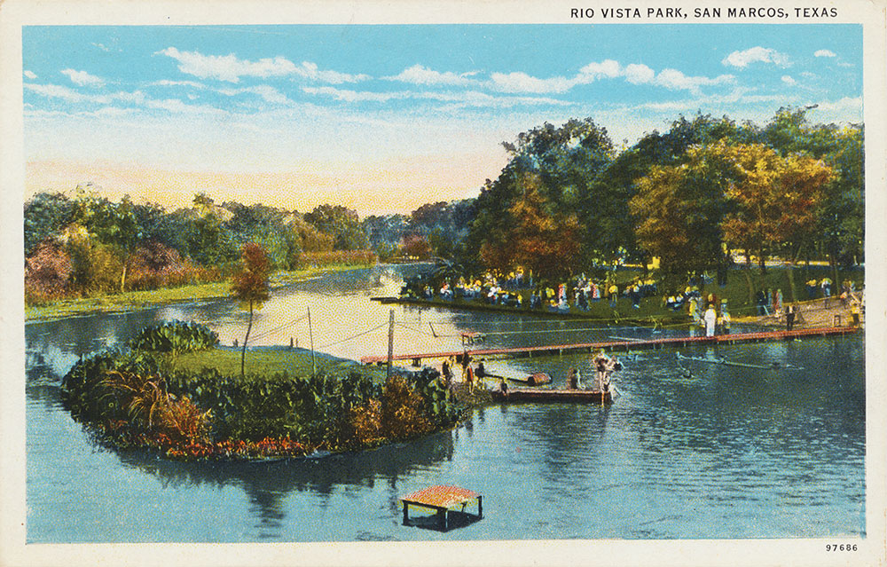
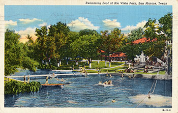
Rio Vista Park still exists at the corner of Cheatham Street and CM Allen Parkway. On its 14 acres it offers a city swimming pool, tennis and basketball courts, picnic facilities, and a pavilion.
This card has a Curt Teich production number that dates it to approximately 1924. |
|
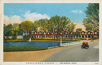 |
Vogelsang's Lodges were located on the San Marcos River on Highway 81 (now I-35) and catered to travelers. An article in the Hays County Citizen from October 10, 1974 reported that Mr. Vogelsang built the lodges around 1939 and they were operated by the family until 1952, when they were sold to J. E. Younger. Mr. Younger sold them in 1957 to Ben Festervan and the name was changed to Festervan Lodges. Later John Stokes bought the property and tore the lodges down to build an apartment complex.
The Citizen article estimated the construction date a little late - this card has a Curt Teich production number that indicates it was produced in early 1931. On the back, Margie wrote to Harold Johnson in Rockford, Illinois:
How's the itchy feel? Better come this way next time. It's marvelous, even in the heat. |
|
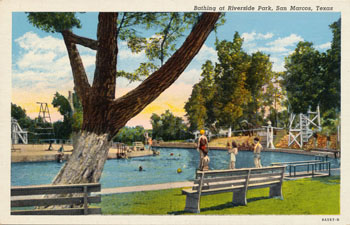 |
A view of Riverside Park. Not mailed or dated, but the Curt Teich production number indicates it was produced in 1939. |
|
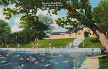 |
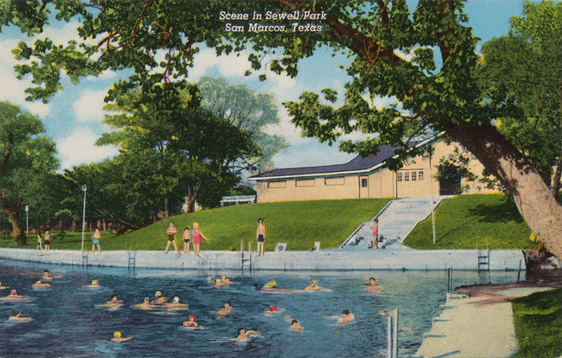
A view of Sewell Park produced in early 1939, as indicated by the Curt Teich production number on the reverse. The back caption says:
Crystal clear, spring fed San Marcos River traverses Southwest Texas State College Campus. Salubrious climate at 600 ft. elevation provides ideal outdoor recreation throughout the year. |
|
 |
Mailed in August of 1942. The Curt Teich production number indicates it was produced in 1941. The suffix N on the production number indicates it was a reprint, so apparently there was still demand for it when the first production run was sold out. |
|
 |
A color chrome card from the 1960s. |
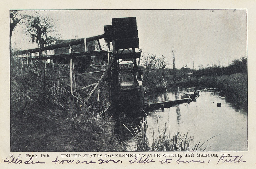
In 1965, the US
Fish and Wildlife Service donated the aging hatchery to Southwest
Texas State University which, in turn, donated 116 acres south of the
city of San Marcos to the Service for the development of a new San
Marcos National Fish Hatchery and a Technology Center. The Center was
dedicated in 1974.
The primary mission of the Center is to provide refugia for Texas
wildrice, Texas blind salamanders, San Marcos salamanders, fountain
darters, and, if found, San Marcos gambusia. Culture-related
activities for these species are inherent to this mission.
Major consideration is placed on assessment of biological issues related
to the Edwards Aquifer and San Marcos and Comal springs.
|
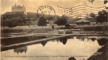 |
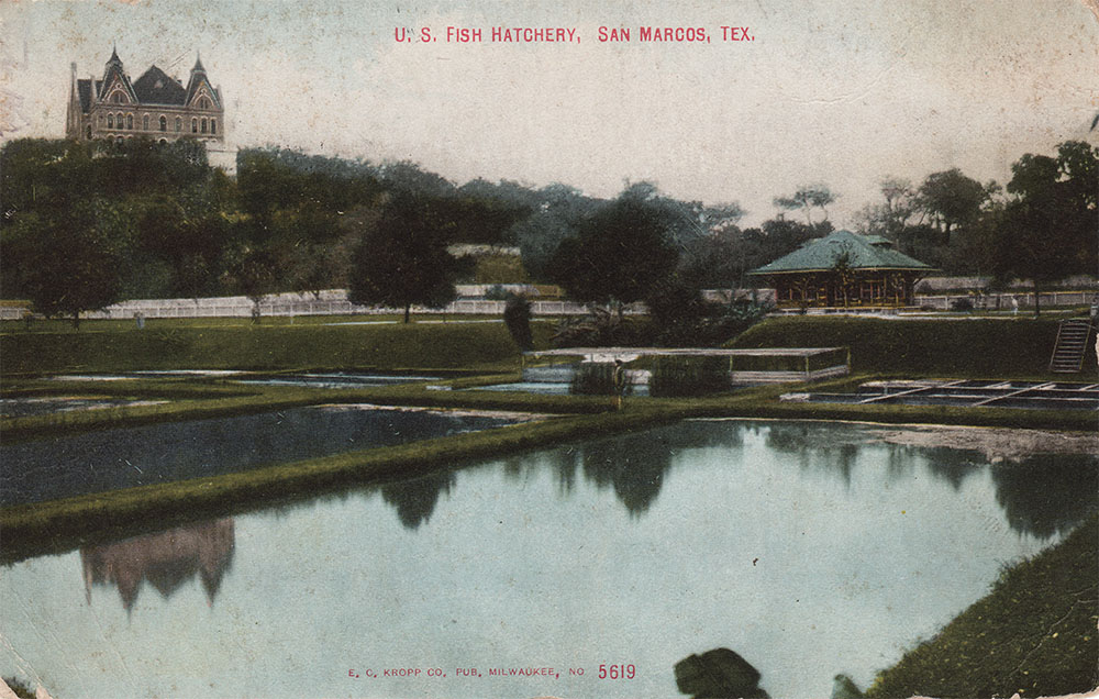
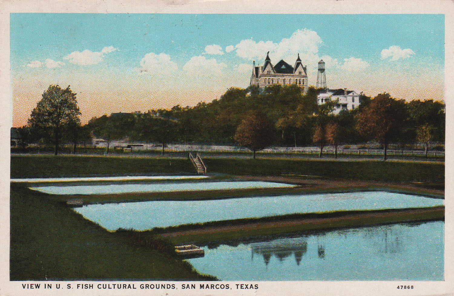
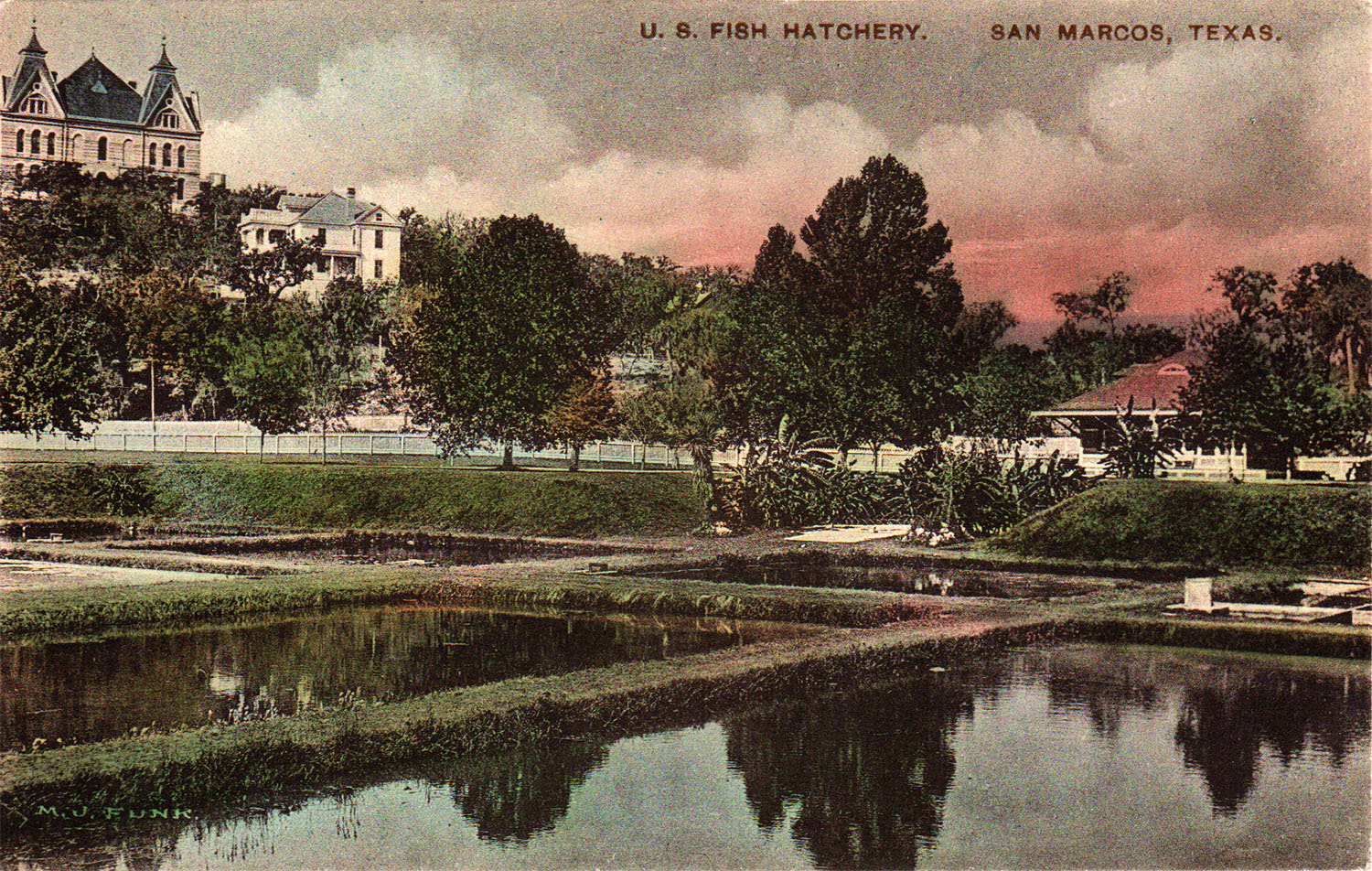
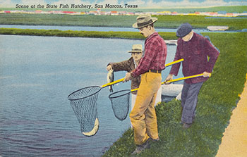
The original San
Marcos National Fish Hatchery, the first warmwater hatchery west
of the Mississippi River, was established in 1897 and was located near
the headwaters of the San Marcos River. For over 60 years, the
hatchery was involved with production and development of efficient
cultural techniques of warmwater sportfishes. |
|
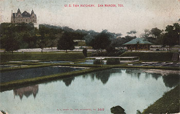 |
A colorized version of the card above mailed in 1909. |
|
 |
The Curt Teich production number on this card indicates it was produced between 1900 and 1908. The writer on the back said:
Main building of the college. Some is exaggerated, but still it is very pretty. |
|
 |
A very rare fold-out card printed in Germany and published by the St. Louis New Co. |
|
 |
An undated Albertype card showing the Fish Hatchery. |
|
 |
A Curt Teich card with a production date of 1954.
|
|
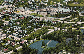 |
An undated postcard showing an aerial view of the Teachers College and Fish Hatchery. Published by Smith News Agency of San Marcos. |
|
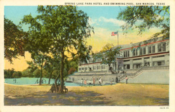 |
A nice view of the 26 room Spring Lake Park Hotel built by A. B. Rogers. The site was operated as a popular resort for two decades before Aquarena Spring was founded in 1949 by Roger's son Paul. |
|
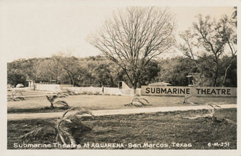 |
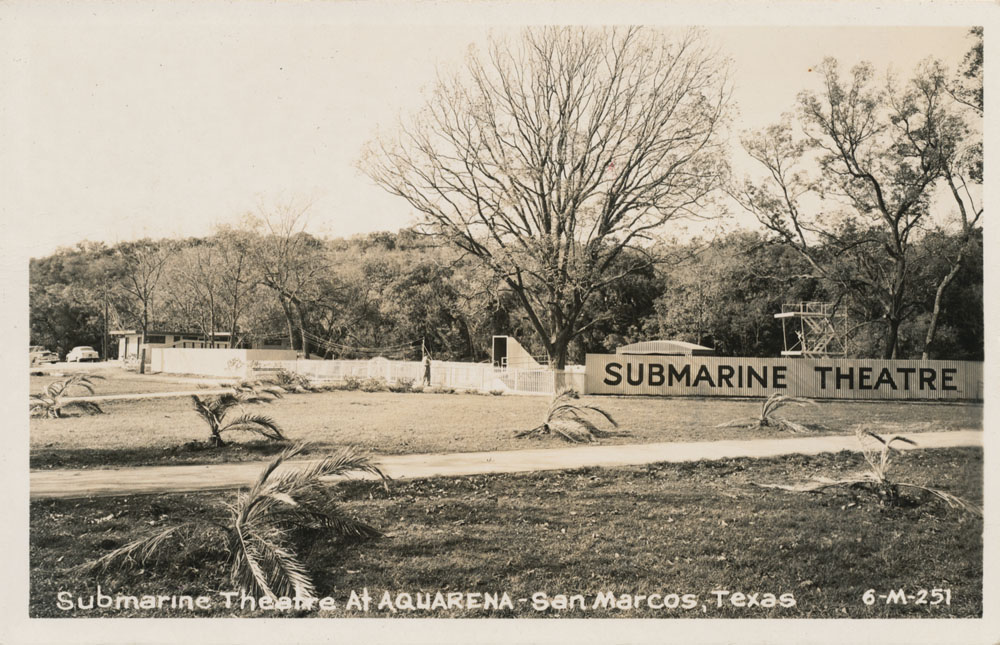
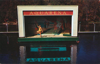
A Real Photo view of the Submarine Theatre entrance in the 1950s. |
|
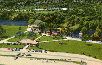 |
A very nice aerial view of Aquarena produced by Curt Teich. Happily, Teich cards all include a serial number that makes them completely dateable. This one was produced in 1954. The back caption say:
Aquarena is located on the banks of Spring Lake, the famous headwaters of the San Marcos River. Nature has blessed this area with an abundance of Flora and Fauna in a background setting of rugged hill country. |
|
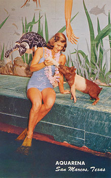 |
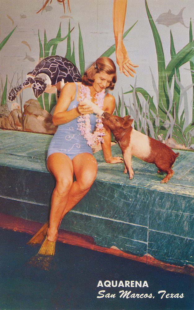
This is Margaret Russell, wife of Aquarena general manager Don Russell. She had been an instructor and performer at Weeki Wachi Springs in Florida and was the underwater body double for actress Ann Blyth in the 1948 film Mr. Peabody and the Mermaid. Her talents were invaluable to Aquarena. She created the underwater theatre show and trained performers in all aspects of underwater ballet. In this Mike Roberts card, she trains Missy the Pig for her role in the submarine theatre show. |
|
 |
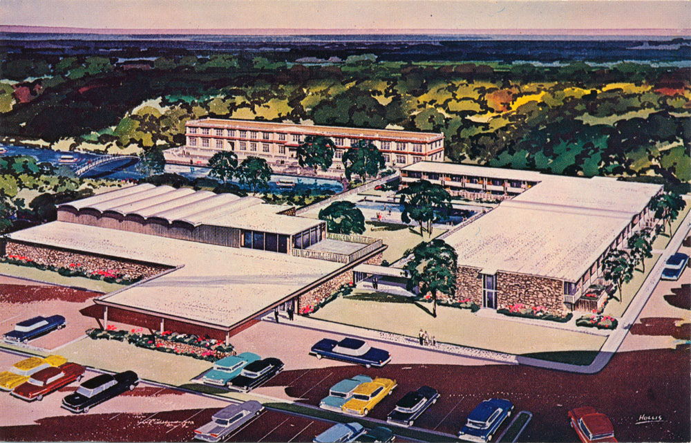
At the time of his death in 1965, Paul Rogers had plans to build a $1 million motor hotel around the headwaters. A postcard was produced using an artist's rendering, but the hotel was never built. |
|
 |
In the background is the Pirate's Ferryboat, Spanish Mission in Hanging Gardens, and the upper section of the Swiss Sky Ride.
|
|
 |
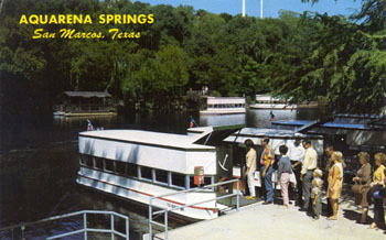
The caption on the back says:
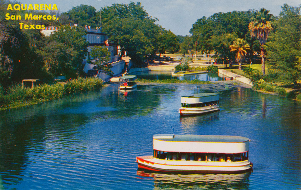
A bird's eye view of two of Aquarena's Famous Glass Bottom Boats. The crystal blue waters of the San Marcos River permit perfect vision. Spectators see dozens of springs, hundreds of fish, turtles, eels, etc., and beautiful aquatic plants. Boats operate continuously year-round. |
|
 |
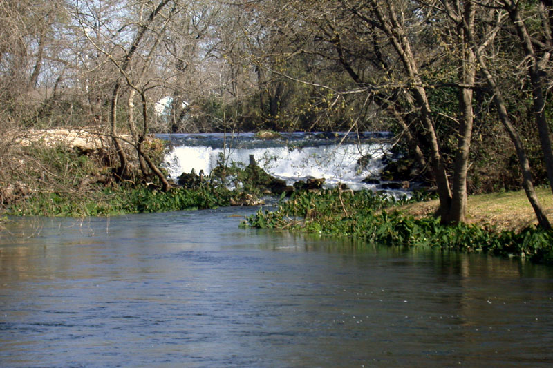
An Anscochrome image by Dan R. Bartels from August of 1961 of the eastern spillway. It is now mostly obscured by trees and brush. |
|
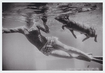 |
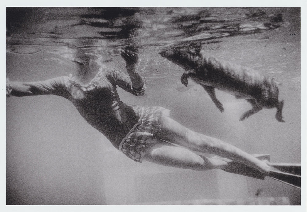
An underwater photograph from 1964 by Garry Windgrand. |
|
 |
The pool was demolished and filled in the 1990s and today you can't tell it ever existed. |
|
 |
Mailed on May 23, 1972.
Two lovely Aqua-Maids add beauty to this picturesque scene of the headwaters of the San Marcos River. The springs which form this river have become known as the most beautiful springs in the U.S.A. and are viewed daily from Aquarena's fleet of Glass Bottom Boats. |
|
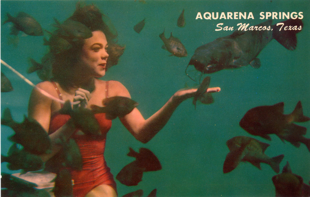
 |
A pretty Aqau-Miss on a Mike Roberts card from the 1970s. Mike Roberts produced postcards for Aquarena springs for over 20 years. The back caption says:
Pretty Aqua-Miss entertains spellbound audience during her under-water fishnic act. Presented by World's only Submarine Theatre. Friendly fish are also fascinated. |
|
 |
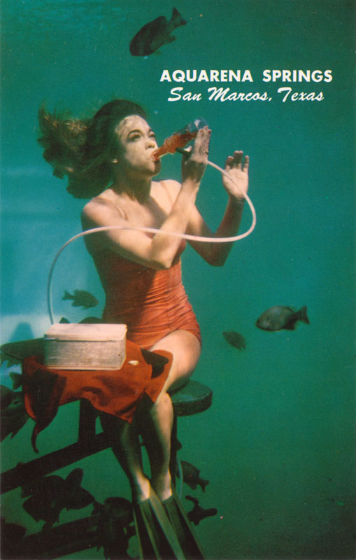
The same pretty Aqua-Miss as in the card above, this time demonstrating the art of underwater drinking:
Ever get thirsty underwater? Aqauatic star demonstrates how to enjoy a soda pop along with the fish during Submarine Theatre show. |
|
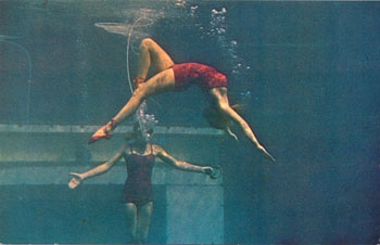 |
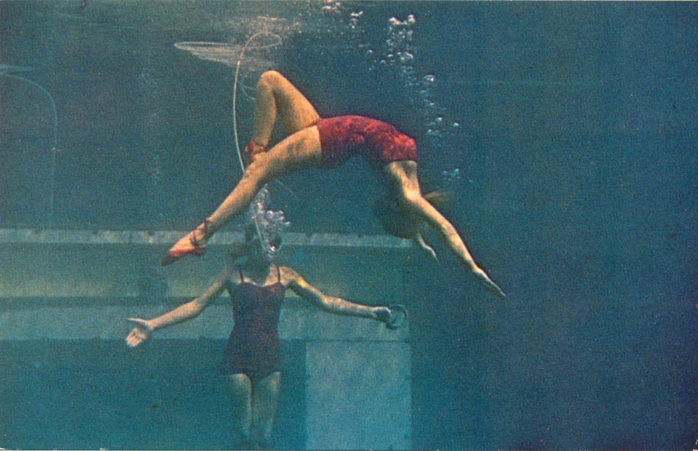
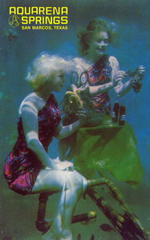
Part of the show included an underwater ballet. The back caption says:
Lovely Aqua-Maids perform ballet routines at World's Only Submarine Theatre. Aqua-Maid in background holds air tube for partner. |
|
 |
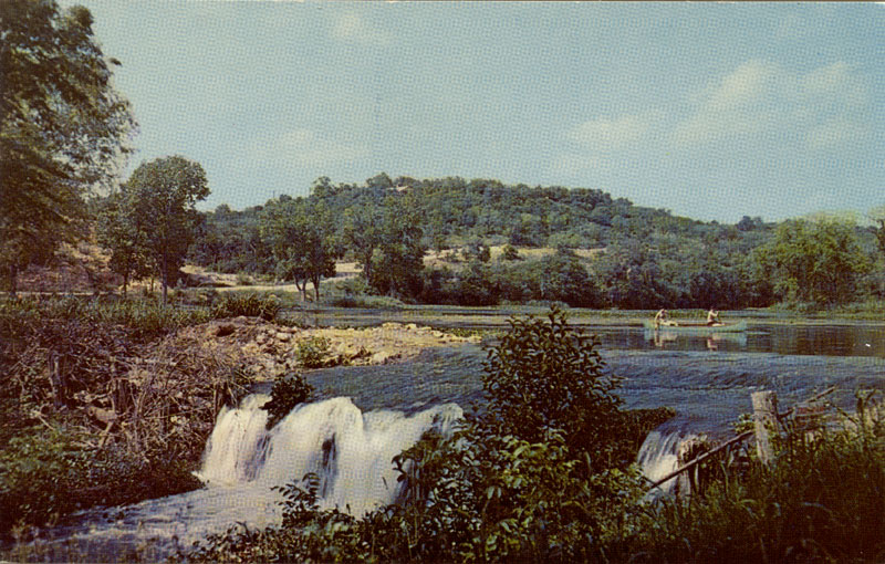
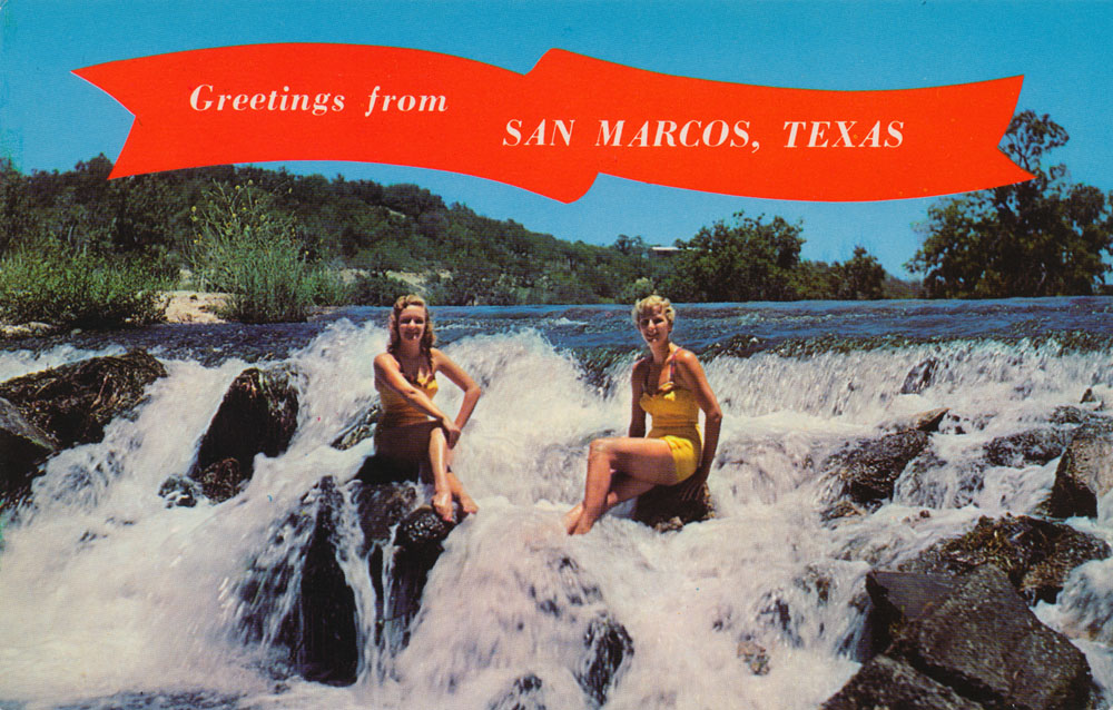
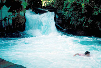
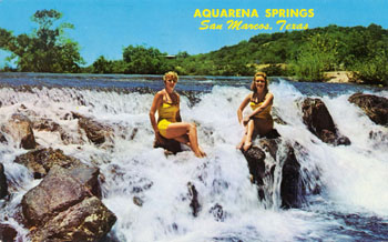
The back caption says:
A couple of Texas beauties enjoying the cooling of a Central Texas waterfall. Picnicking, swimming and fishing are favorite pastimes under Texas skies. |
|
 |
The back caption says:
Laughter can be heard as the Submarine Theatre's most hammy performer takes the stage and then into the water; it's Aquarena Spring's famous swimming pig doing his spectacular swine dive.
|
|
 |
In the early 80s the show was switched from a Polynesian mermaid theme to a performance based on the mythical greek island of Atlantis. |
|
 |
A cute pirate at the entrance to what was described as:
A unique aquatic shop where sea lore from all ports of call surround guests with a Barbary Coast atmosphere. |
|
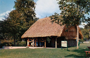 |
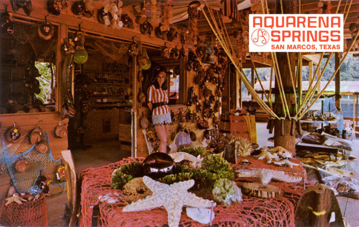
The Texana Shop at Aquarena in a color photo by Gene Aiken. The caption on the back says:
One of the most unusual shops found anywhere. Aquarena's Texana Shop features Nature's gifts to Texas and the Southwest. The structure, styled after typical Mexican dwellings, is made of native reeds and cedar poles and houses cacti, shrub plantings, driftwood, mineral rocks, etc. |
|
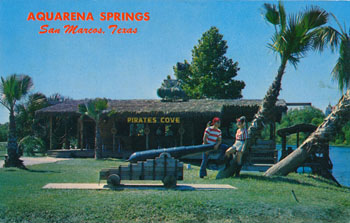 |
The Pirates Cove in a color photo by Bill Kobert. The back says:
One of the new additions at Aquarena Springs is Pirate's Cove which delights children and adults alike. The cove houses a unique aquatic shop, observation deck and is the departing point for the Pirate's Ferryboat which transports guests to Hanging Gardens. |
|
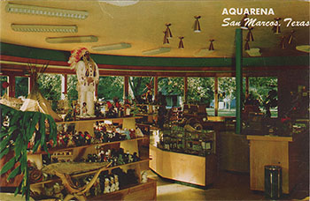 |
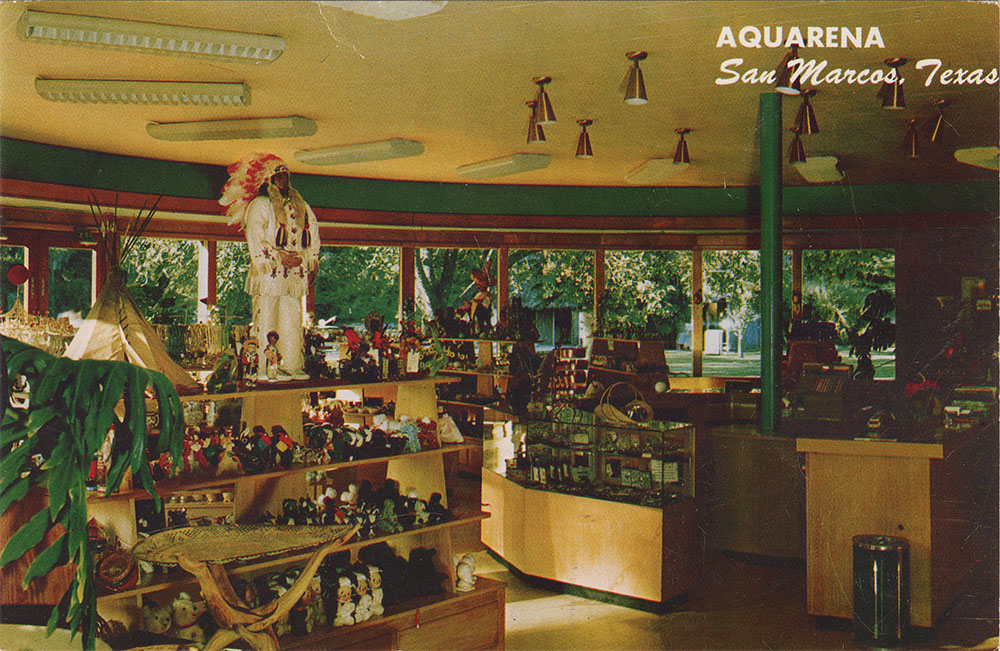
Another color photo card by Bill Kobert. The back says:
Interior view of Souvenir Gift Shop - one of the finest in the country. Features thousands of very unusual items. |
|
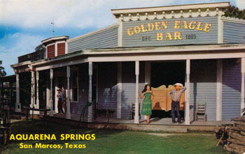 |
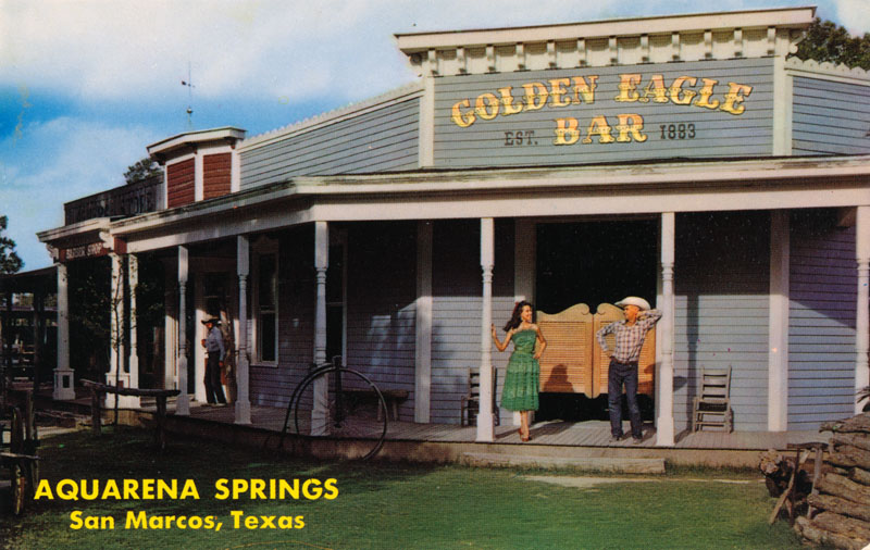
A cowgirl chats with a cowboy in front of the Golden Eagle Bar, part of the Texana Village that also featured Kit Grifffin's Barber Shop, a General Store, and a Blacksmith Shop. On the back, someone wrote: Sunday, June 24, 1973. |
|
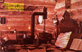 |
The home of Dr. Eli T. Merriman, one of the oldest in San Marcos, was re-located to Aquarena Springs' Texana Village with its complete interior intact.
|
|
 |
A Mike Roberts card from 1984, showing the underwater venue that was known as the Atlantis Theatre at this time. This is the second version of the theatre, built in the early 1970s. In May of 2012 it was removed as part of Spring Lake restoration efforts. |
|
 |
Another Mike Roberts card produced in 1992. As such, it is one of the last cards made for Aquarena Springs as a theme park. By this time, the property was already owned by the University. In 1996 the University's Board of Regents voted to convert the site from a theme park to educational uses. The back captions says:
World-famous Ralph, the swimming pig, performs a perfect swine dive in the World's only Submarine Theatre. |
|
 |
A final Mike Roberts card from 1992. The 220 foot Sky Spiral had a round car that traveled up the tower and then rotated 360 degrees.
|
|