|
|
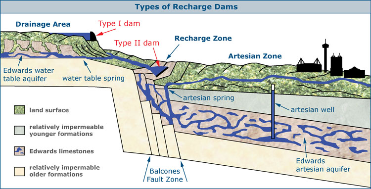
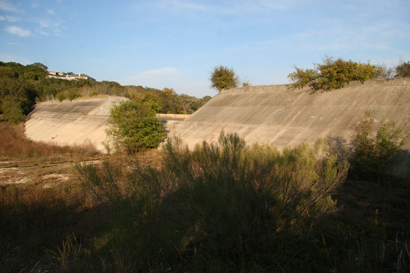
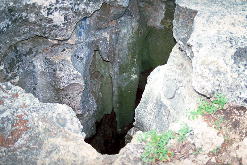
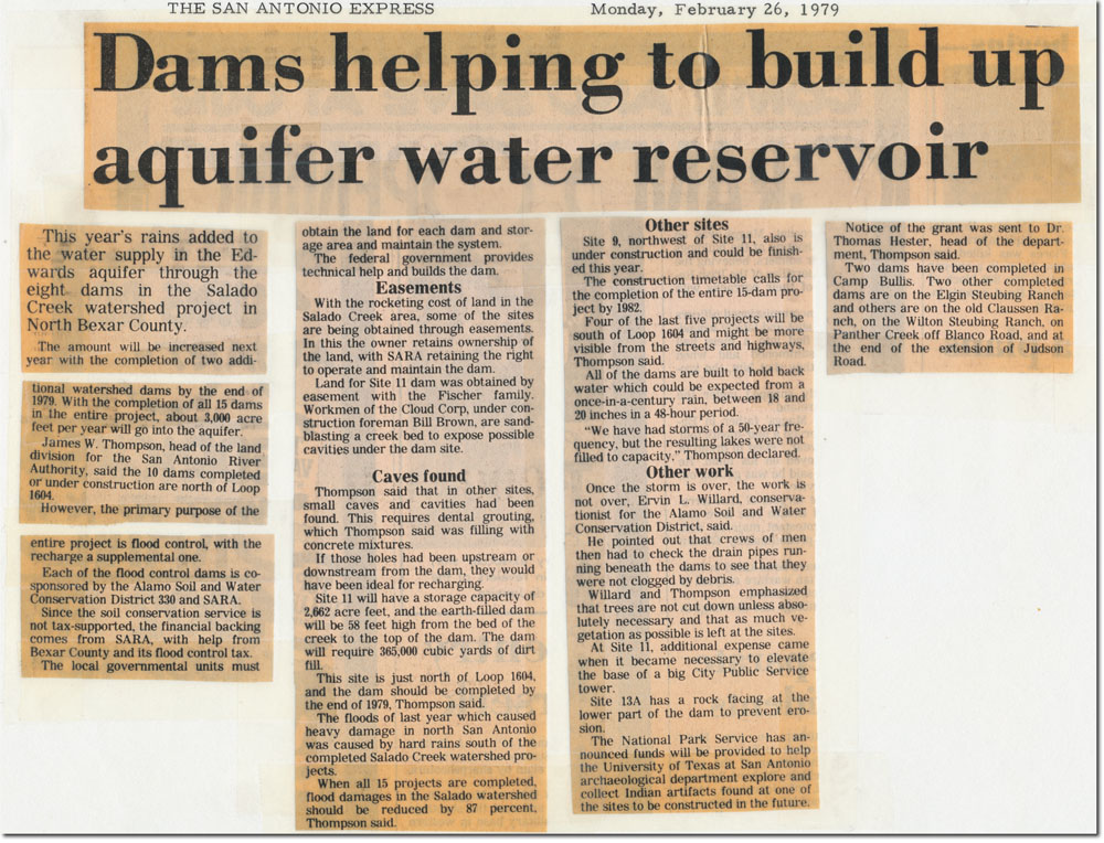
Recharge Dams Water enters the Aquifer easily in the Recharge Zone, but the subsurface drainage is generally inadequate to hold all the water that falls in large rain events. Recharge conduits and sinkholes quickly become filled and the remaining water has to flow over the surface and on past the Recharge Zone. So the idea behind recharge dams is that by stopping water and retaining it behind structures, more can be forced to go into the Aquifer. Some of it could be made available for production from wells while the remainder would help sustain flows at Comal and San Marcos Springs above levels that are critical for maintaining endangered species habitats. In the 1960s and 70s, there was a rash of dam building for flood control purposes, and many of them had the side effect of also increasing recharge (see article below). Between 1990 and 1998, six studies were completed that analyzed the potential for enhanced recharge using dams (HDR, 1991-1998). There are two types of recharge dams that have been proposed and considered, known as Type I and Type II dams. Type I dams would be constructed on the creeks and rivers of the Edwards Plateau, the catchment area for the Aquifer, where they would catch storm runoff and release it slowly toward the Recharge Zone. Several studies have determined that Type I dams would have to be very large and expensive and would inundate large areas during rainy times and leave large mud-crusted areas during dry times, so authorities consider them generally not feasible. For example, there is a site with good potential to recharge large amounts of water, but it would have the unfortunate side effect of periodically inundating Garner State Park. Type II dams would be constructed on the Recharge Zone itself and would stop water as it runs off the plateau, allowing more time for it to go into the ground. Some of the best sites for Type II dams already have dams on them, such as the Medina Lake and Diversion Lake system, which are estimated to contribute about 37,000 acre-feet per year to recharge (Slattery and Miller, 2004).
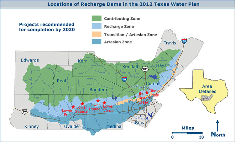
There are many issues that complicate the notion of building additional recharge dams. Landowners may not be willing to give up their property for such projects, and the Recharge Zone is one of the most environmentally sensitive areas in Texas. There is a long list of endangered and threatened species that would be impacted by periodic inundation, and numerous archaeological sites would be impacted as well. Also, excess water that flows over the Recharge Zone without going in is not really “wasted” – there are at least three ways it benefits people and ecosystems downstream. First, there are people who hold surface water rights, so recharge projects would have to ensure that provisions are made for protection or mitigation of impacts on people who rely on surface water. Secondly, waters that bypass the Edwards Recharge Zone can recharge the Carrizo-Wilcox Aquifer, which is a water source for many users on the coastal plain. Finally, waters from the Edwards Plateau support instream flows and the bay and estuary system on the Texas coast. There is increasing concern about maintaining flows for instream and coastal environmental needs and coastal commercial fisheries. In August 2012, the TCEQ adopted rules that outline instream flow standards for major streams in the San Antonio and Guadalupe basins and freshwater inflow needs to the bays and estuaries, and these would have to be considered in any plans to impound and recharge water. Further, it is not exactly clear who would pay and who would benefit from recharge dams. For example, if people in Bexar county paid to build a dam, most of the water that goes into the Aquifer as a result would emerge as increased flows at Comal Springs, which mainly benefits people other than those who paid. Now it’s true that maintaining springflows in Comal county also benefits Bexar county, because we are all one regional economy and the periods of time that pumping restrictions would have to be imposed would be shorter, but even so, the people in Bexar county who paid for the structure would likely prefer to see some cost sharing by those in Comal county who benefit as well. Other considerations would be securing the necessary state and federal permits, conducting the myriad of studies required for such permits, acquiring land and/or easements either through negotiations or condemnation, and relocating roads, railroads, and other utilities. To make recharge dams a success and part of an overall solution, many complicated issues like these would have to be addressed and worked out. Though many questions and issues exist, the scientists and stakeholders who produced the latest version of the section of the 2012 Texas Water Plan that applies to south central Texas believe there is indeed some potential to build additional Type II recharge dams. They would not be a magic-bullet type of solution and could only supply a small percentage of overall projected water needs. The latest version of the regional water plan produced by the South Central Texas Regional Water Planning Group in 2011, which was incorporated in the 2012 Texas Water Plan, recommended completion of six projects by 2020 and possibly nine more by 2060. The six projects in the first phase would add an estimated recharge of 54,471 acre-feet per year in average conditions and 10,034 acre-feet per year in drought conditions. Each year they would provide 13,451 acre-feet for pumping and 24,401 acre-feet for springflows. The cost would be $159,950,000 (in 2008 dollars).
To make recharge enhancement initiatives an equitable and effective Aquifer management tool, the structures would probably have to be developed as regional projects, with the cooperation and involvement of many agencies such as the Edward Aquifer Authority, San Antonio, and numerous other area cities, counties, and purveyors. In it’s latest 2012 Water Management Plan, the San Antonio Water System said the present regulatory environment is not favorable for recharge enhancement initiatives for municipal supply purposes. SAWS said it views the enhancement of recharge as a public good and continues to support implementation as a regional benefit, but it would not be pursuing the matter from the municipal water supply perspective.
|
||||||||||||