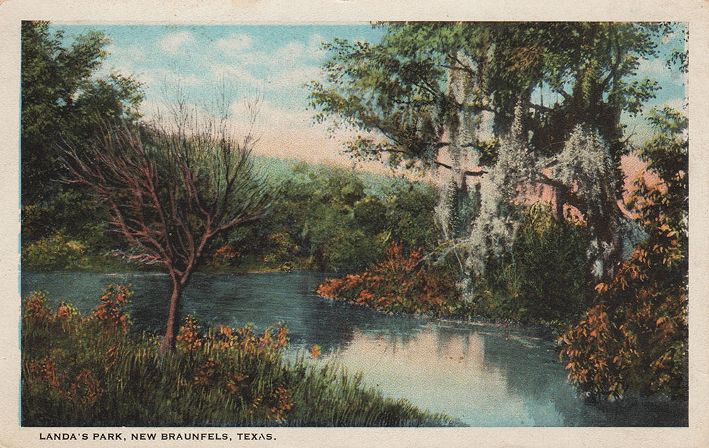
and Landa Park
|
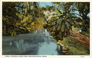
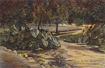
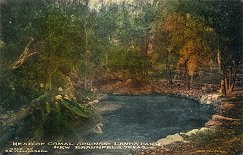
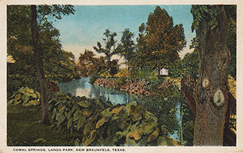
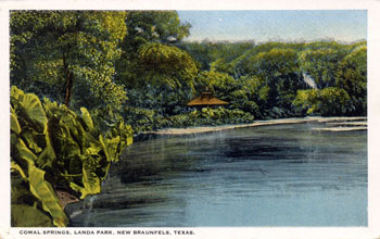
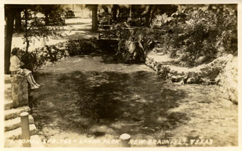
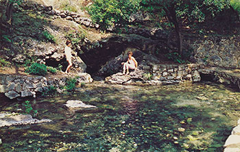
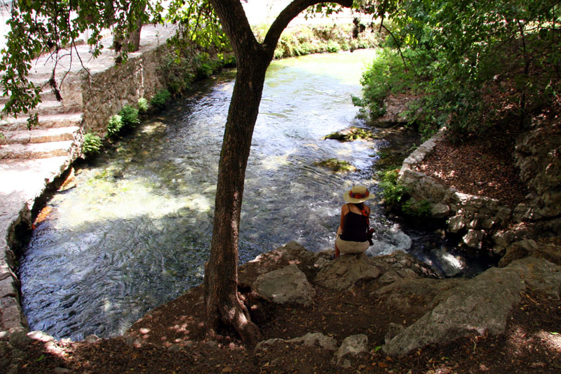
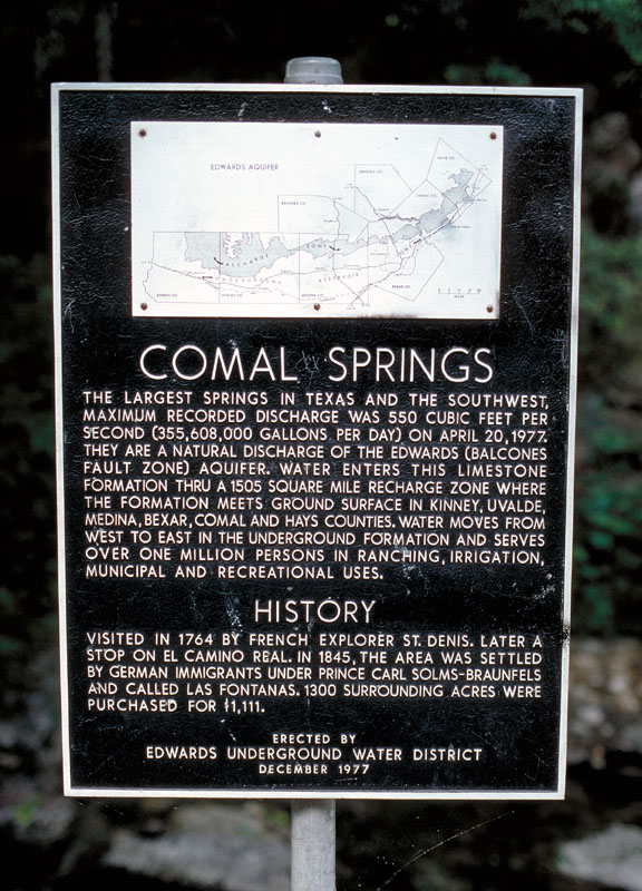
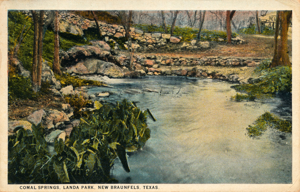
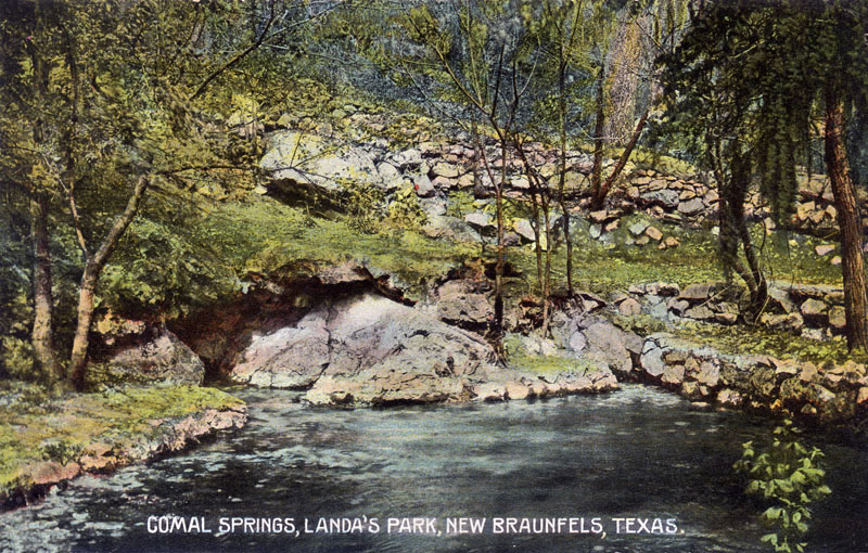
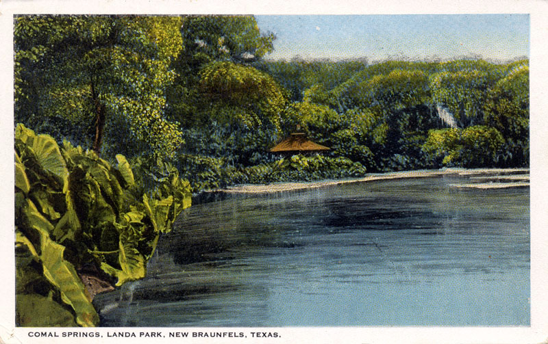
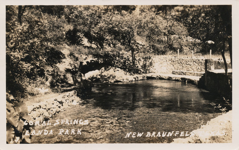
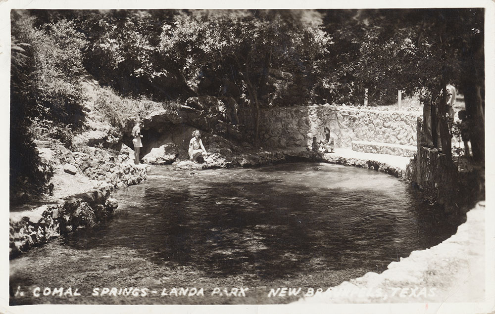
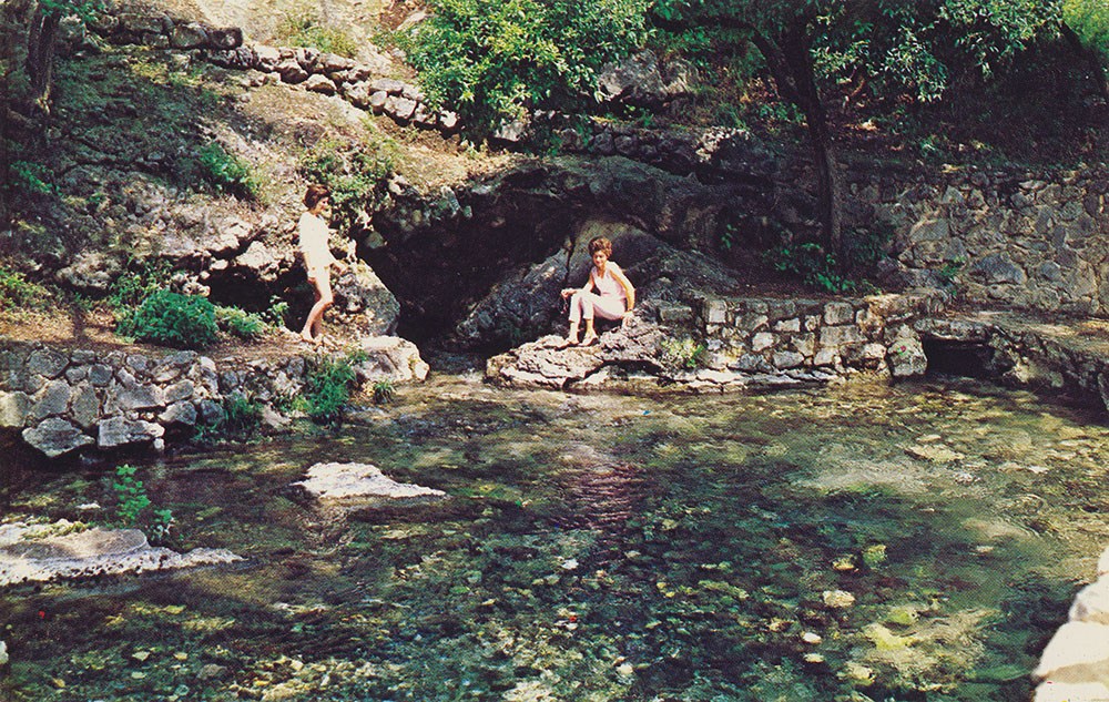
The Comal Springs are the largest in Texas and the American southwest. Seven major springs and dozens of smaller ones occur over a distance of about 4,300 feet at the base of a steep limestone bluff in New Braunfels' Landa Park. The Springs and the Comal River below are home for a federally endangered species, the Fountain Darter. In Spanish, comal is a flat griddle used for cooking tortillas, so the name probably refers to the flat area below the bluff where the springs issue forth. The largest and most easily visited is the one shown at left, just west of Landa Park drive.
|
These springs were a favorite camping place for native Indian tribes for thousands of years, and many artifacts and burial mounds have been found. In the language of the Indians the Comal Springs were called Conaqueyadesta, which means "where the river has its source" (Ximenes, 1963). The Comal River arises entirely, except after major rains, from springs in this vicinity and flows for just over two miles through Landa Park and New Braunfels before confluencing with the Guadalupe River. It is said to be the shortest river in the United States.
When Spanish missionaries arrived in 1691, they found a huge concentration of Indians at Comal Springs, some from as far away as New Mexico (Brune, 1981). In 1716, Juan Espinoza encountered the beauty of the springs and more than a few ticks:
Soon we reached the passage of
the Guadalupe which is made of gravel and is very wide.
Groves of inexpressible beauty are found in this vicinity. We
stopped at the other bank of the river in a little clearing
surrounded by trees, and contiguous to said river. The waters
of the Guadalupe are clear, crystal and so abundant that it
seemed almost incredible to us that its source arose so near.
Composing this river are three principal springs of water
which, together with other smaller ones, unite as soon as
they begin to flow. There the growth of the walnut trees
competes with the poplars. All are crowned by the wild
grapevines, which climb up their trunks. Willow trees
beautified the region of this river with their luxuriant
foliage and there was a great variety of plants. It makes a
delightful grove for recreation, and the enjoyment of the
melodious songs of different birds. Ticks molested us,
attaching themselves to our skin (Tous, 1930).
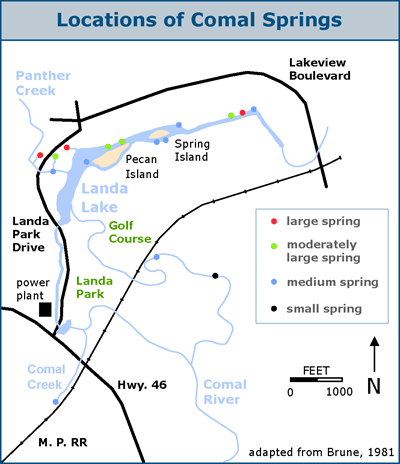
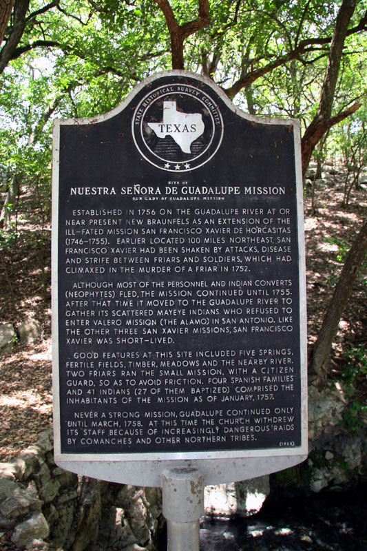
The "three principal springs" described by Espinoza were probably the two large and one moderately large spring on the west end of Landa Lake. The Spanish never established a permanent presence here, although it was the location of an early Spanish mission, Nuestra Señora de Guadalupe, from 1756 to 1758. In 1827 the league containing the headwaters and Springs was granted to Juan Martín de Veramendi, Mexican Governor of Coahuila and Texas.
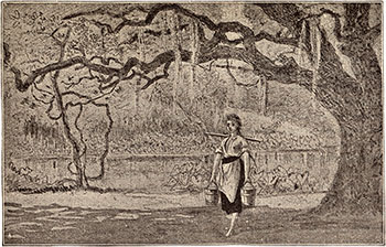
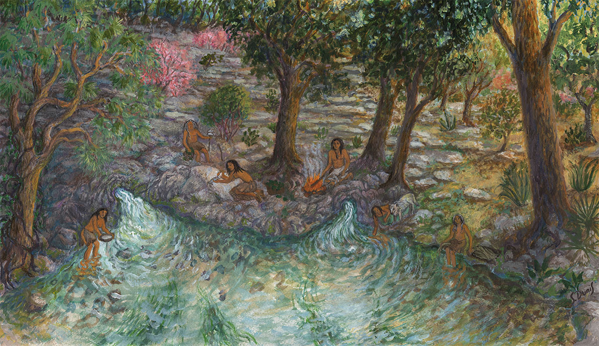
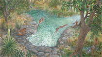
In 2014, artist Susan Dunis created a series of paintings for these pages that depict a family of Lower Pecos natives on a sacred pilgrimage to the Edwards springs sites about 4,000 years ago. Each painting illustrates a different aspect of cultural importance of the Edwards springs.
In this painting, the third in the series, the theme is the use of the springs for everyday activity - cooking dinner. The site is still largely recognizable today, and the rock being used for cleaning a fish is still there, with traces of animal residue from thousands of cooking events still visible.

In 1844, German settlers arriving in Texas under the auspices of an emigration society, the Adelsverein, discovered they had been grievously deceived regarding the suitability and ownership of a tract in the Hill Country intended for their settlement. In San Antonio, society organizer Prince Carl Solms was told by John Rahm, an old Texan, about "Las Fontanas" - a place where huge natural springs formed the headwaters of a perpetually flowing river. With his first immigrants living in deadly conditions at the coast, and with waves of thousands more expected, Solms was desperate to establish an inland way station. Dan Murchison, a scout belonging to Captain Jack Hays famous company of Texas Rangers, piloted him to Las Fontanas. In March of 1845 he purchased the site from Veramendi's heirs for $1,111 (Harby, 1888). In 1847 William H. Merriweather bought the Comal Springs tract. Merriweather built a saw and grist mill and a cotton gin on the property. His slaves dug a millrace to divert water for power. The Springs were dynamited to increase their discharge and eventually harnessed for many commercial purposes.
|
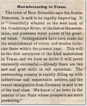 |
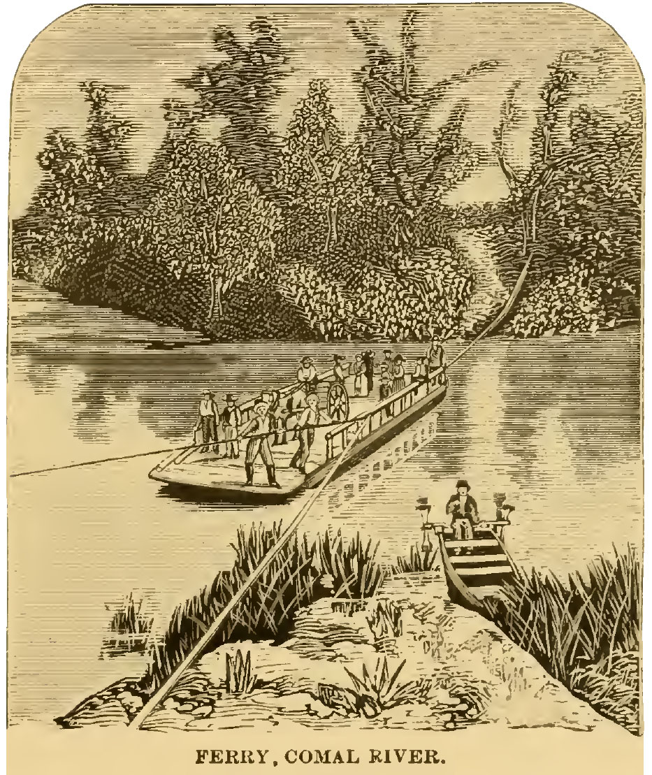
It didn't take the industrious German settlers long to begin harnessing the power of the Springs. This article from the March 31, 1849 edition of Scientific American extolled the new little town's promising prospects. |
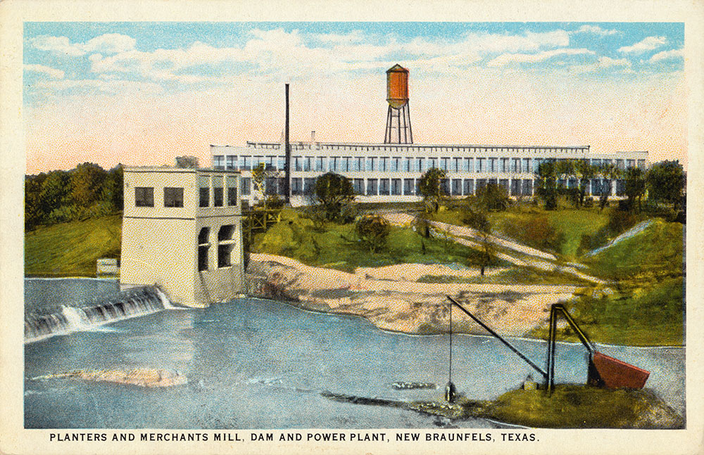
By 1860, seven grist, flour, and sawmills were using the Spring waters for power. There were also cotton and woolen factories, a paper mill, an ice plant, and a brewery. Hydroelectric power was generated using springflows from 1890 until about 1950 (Brune, 1981). New Braunfels merchant Joseph Landa purchased the site in 1860, and by the 1890s it had become known as Landa's Pasture and was a popular picnic and recreation spot.
|
 |
This engraving appeared in Homer S. Thrall's 1879 travelogue called A Pictorial History of Texas, From the Earliest Visits of European Adventurers, to A. D. 1879. |
|
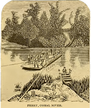 |
Another engraving from Thrall's 1879 travelogue. |
|
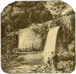 |
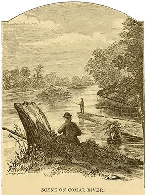
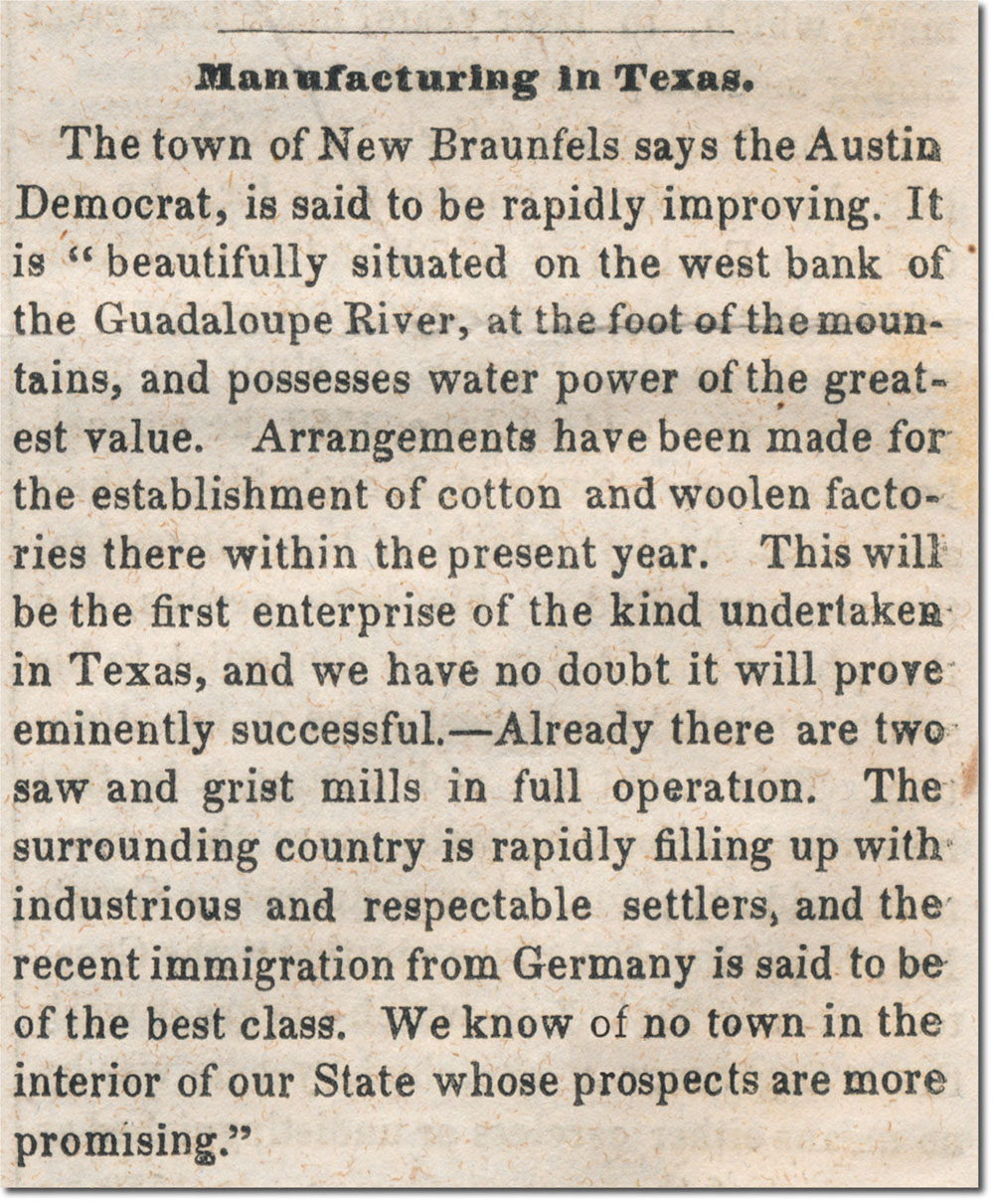
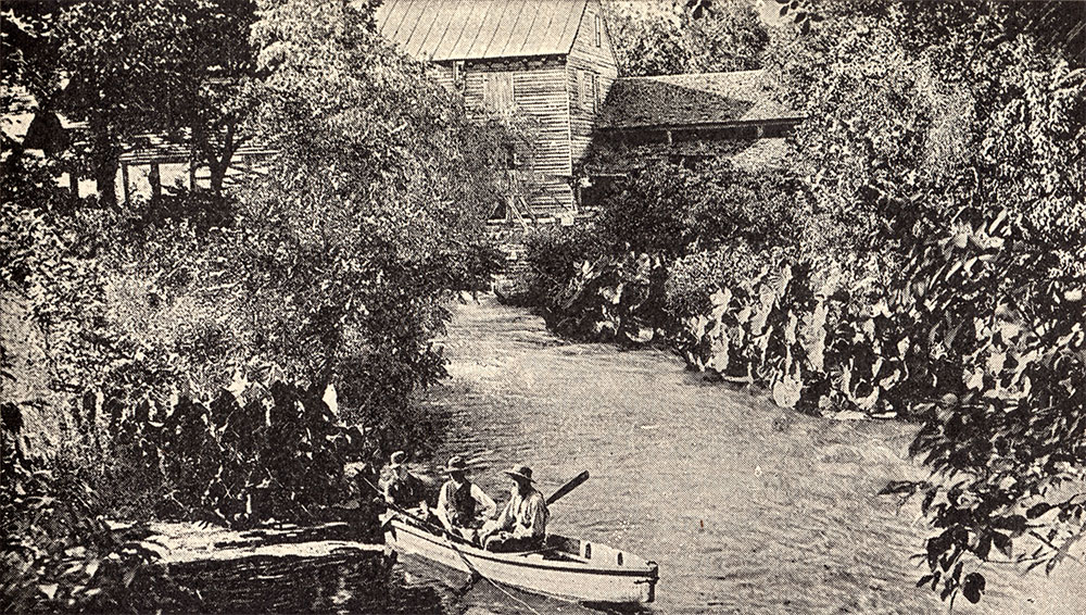
A third engraving from Thrall's 1879 travelogue of a scene on the Comal River near New Braunfels. |
|
 |
This image appeared in the Magazine of American History Illustrated, November 1888. |
|
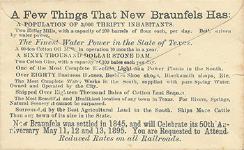 |
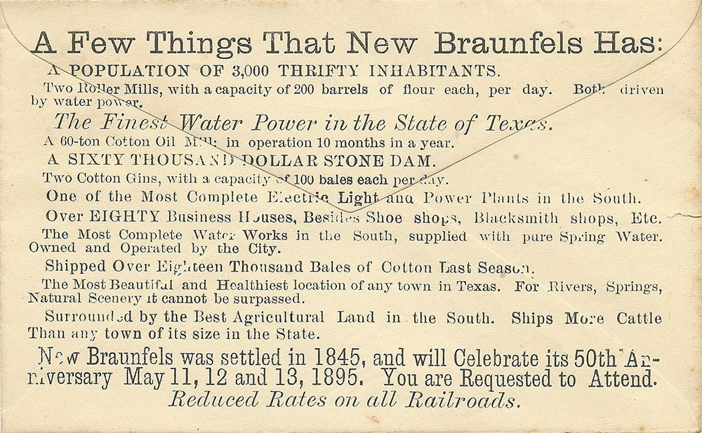
An RSVP envelope for New Braunfels' 50th anniversary in 1895 highlighted the little city's abundant water, declaring it had "The Finest Water Power in the State of Texas" and "The Most Complete Water Works in the South, supplied with pure Spring Water." |
|
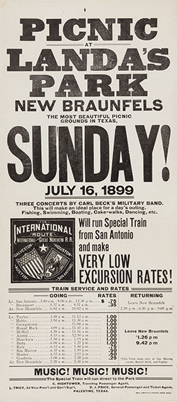 |
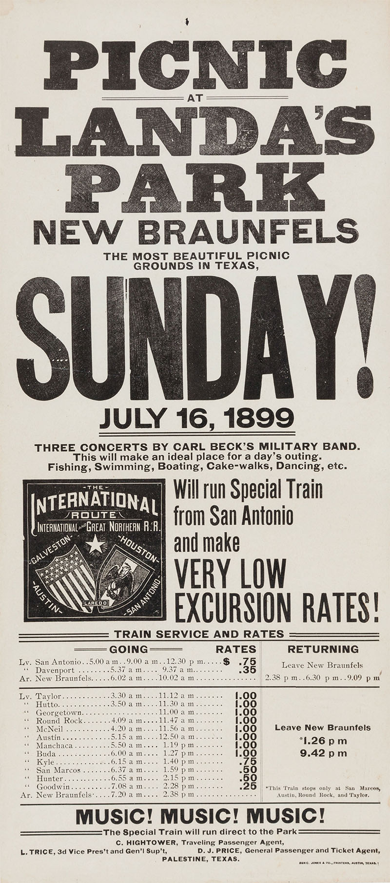
In 1897, Helen Gould, daughter of railroad financier Jay Gould, visited Landa's Pasture and was impressed by its beauty. She suggested that the International and Great Northern build a spur into the property. The Missouri, Kansas and Texas railroad also built a track into the park. By 1899, the railroads were offering 'very low excursion rates' to attract tourists from San Antonio and Austin, and they sponsored special music events, such as concerts by Carl Beck's Military Band. The Pasture became known as Landa's Park and grew into one of the most popular resorts in the Southwest.
|
|
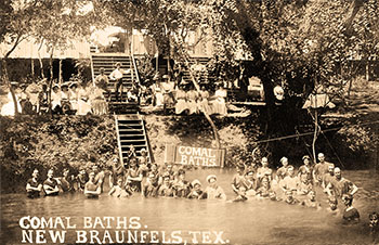 |
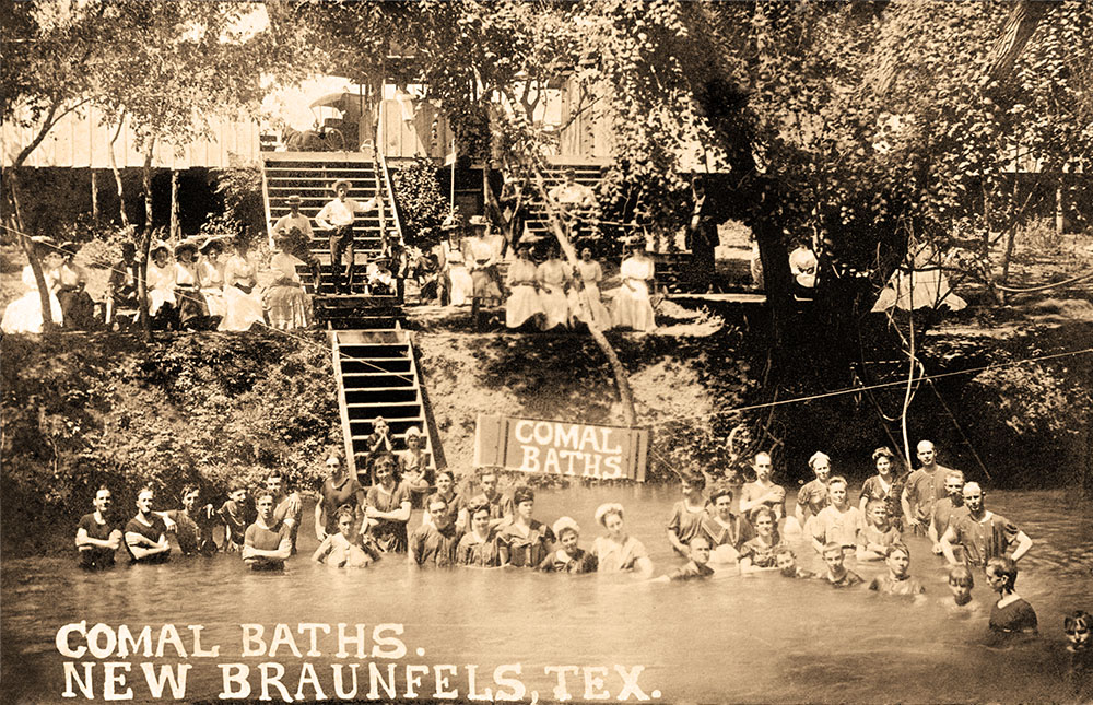
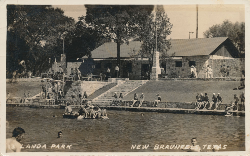
The city of New Braunfels opened the Comal Baths in 1900, where children and adults learned how to swim. Today, the city still conducts thousands of swimming lessons each year. |
|
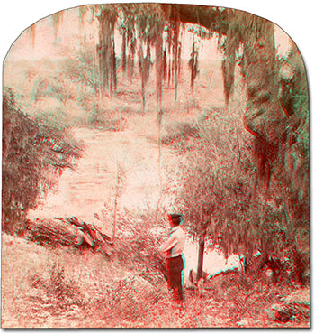 |
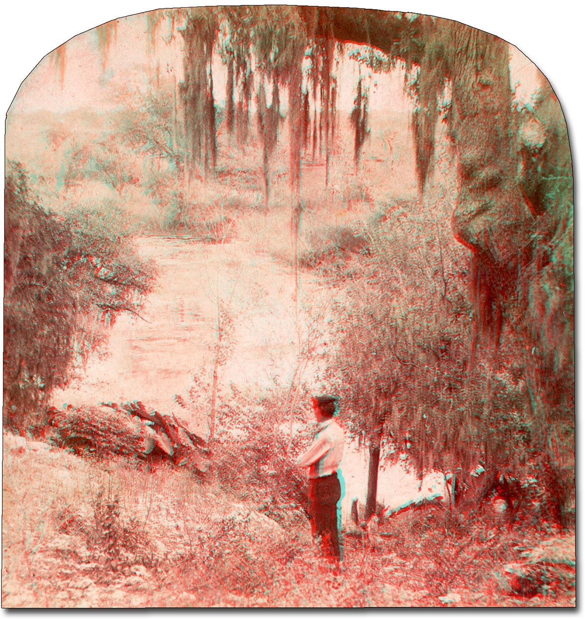
Get out your 3D glasses to view this vintage stereoview published in 1900 by the Keystone View Company. Click to enlarge, it's just like being there. |
|
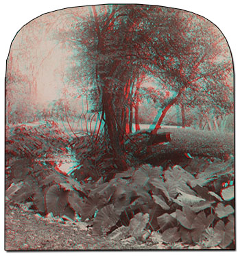 |
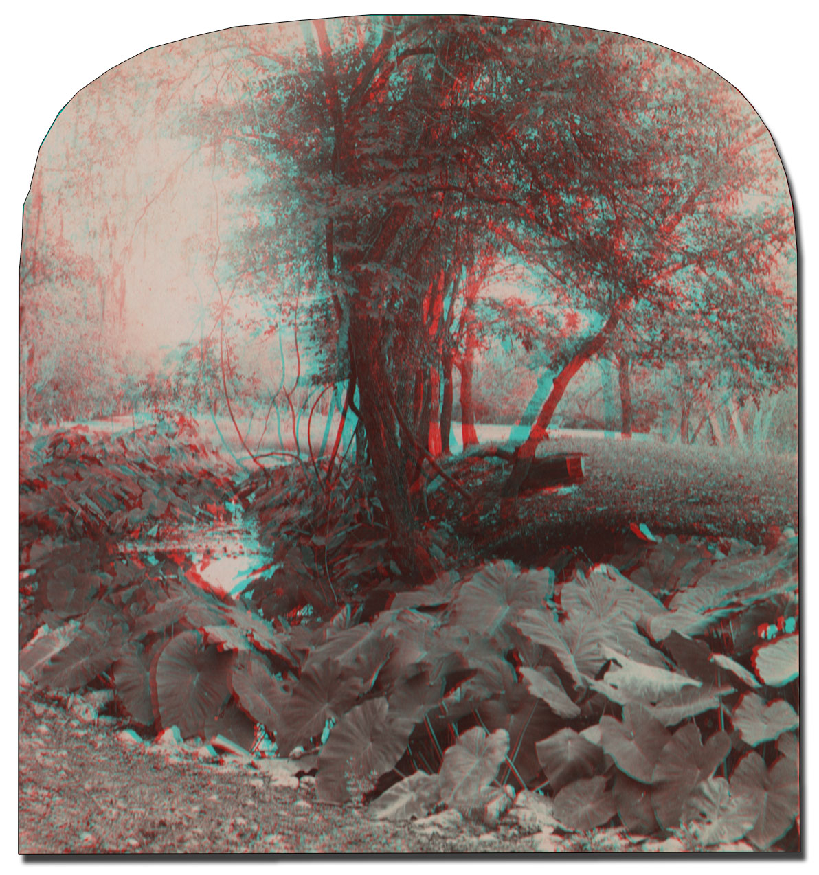
3D glasses also required for this one. The back says:
"Must I carry a revolver in Texas for protection; must I, really must I?" earnestly asked the conscientious tourist. "Stranger," replied the Texas; "you might not need a revolver in Texas at all; and then you might need it awful bad, and need it awful quick." But those rough frontier days are gone. Order and security, wealth and luxury, culture and bounty have taken their place. The largest state in the Union is bent on making its excellence equal to its vastness. The future home of twenty-five millions of people is being set in order and adorned. Landa's Park, beautiful by nature, will be made more inspiring by art. It is at New Braunfels, a city founded by Prince Braunfels in 1845, at the confluence of the Comal and Guadalupe rivers, 50 miles southwest of Austin and 30 miles northeast of San Antonio. This prosperous and public-spiritited town is a type of many that are transforming the old Texas into a name of greatness and honor. |
|
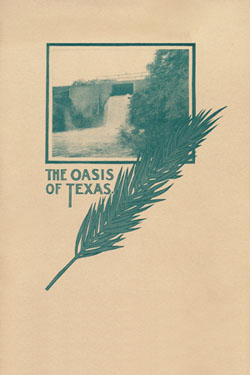 |
In 1904 the Landa Estate produced its second edition of The Oasis of Texas, a 30 page treatise on the area's history, its industries, and the park. After gushing about New Braunfels for 28 pages, Harry Landa finally concedes:
This scribe feels the poverty of his vocabulary, for one may bankrupt all the lexicons of all the languages and not flatter this heavenly spot. |
|
 |
An advertisement from the San Antonio Express-News, June 29, 1921. Nowadays the notion of radium in water tends to cause concern; the truth is that almost all water on Earth contains small amounts of naturally occurring radioactivity. |
By 1922, Landa Park was drawing over 100,000 visitors per year. In 1926, the park was sold along with much of the Landa estate to J. E. Jarratt of San Antonio. On Easter Sunday in 1931 the Park officially opened for its 37th year, but within a few years, as the Depression took hold, the owners were forced to close the Park and surround it with a barbed-wire fence. Local residents organized a petition drive to hold a bond election aimed at providing funds for a city purchase. In 1936 the city purchased 128 acres including the headwaters and adjoining springs, and two additional tracts totaling 72 acres were purchased later (Landa, 1945 and Haas, 1968).
|
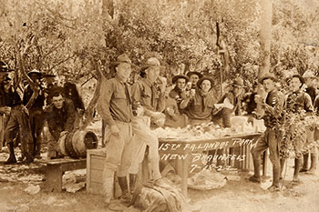 |
Soldiers of the 15th Field Artillery enjoying a keg of locally brewed Busto beer seem unfazed by the strictures of Prohibition. |
|
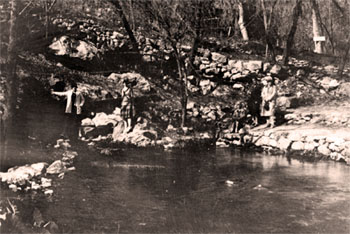 |
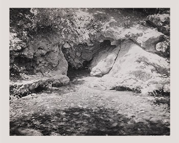
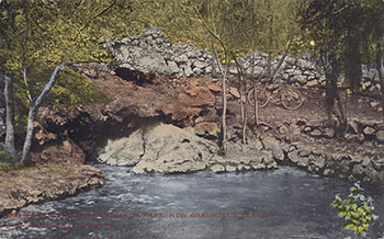
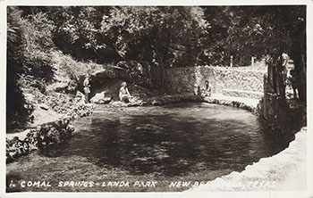
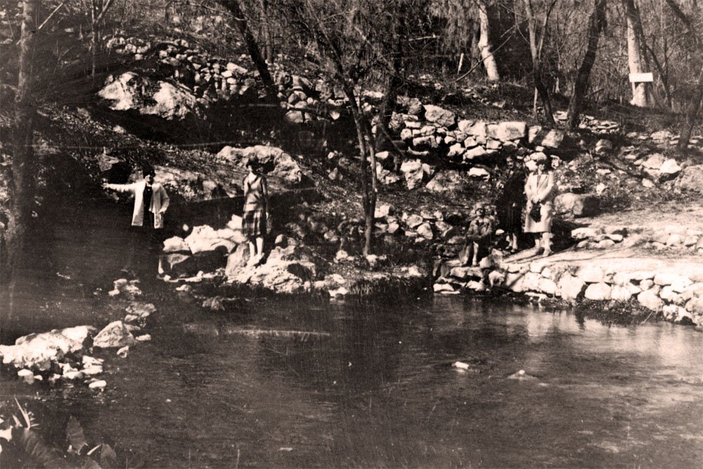
An early photographic view of the large spring west of Landa Park Drive. Another photograph from the same roll identifies the ladies as Mrs. Gough, Isabell Stark, Mrs. Frey, APJ, and Viora Frey. On the back, one of them wrote:
Section of Comal River. In one place it is 12 feet deep and the bottom is seen as clear as though there was no water.
|
With the purchase and consolidation of the headwaters properties by the city, and with the establishment of nearby resort parks like Camps Giesecke, Ulbricht's, and Warnecke (more on those farther down this page), New Braunfels grew into the epicenter of regional water recreation. When new interstate highways opened in the late 1950s, all the elements were in place for a regional synergy. Since San Antonio and the Alamo are only 30 miles away, families in station wagons from far and wide could spend a few days exploring the historic missions and battlegrounds of old San Antonio, and then spend a few days basking in the natural aquatic wonders of New Braunfels.
|
 |
Even today, it is difficult to overstate the importance of water recreation to the economy of New Braunfels. This tourist brochure from about 1942 featured, what else, water. |
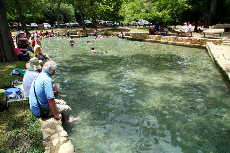
Today, Landa Park is still a mecca for local residents and tourists. Attractions include nature trails, paddle boats, a large spring-fed swimming pool, a miniature train, a golf course, and lots of sites for picnicking and celebrations. Swimming is no longer allowed in a large portion of Landa Lake because of the presence of the endangered species. Fountain darters can be easily observed at the paddle-boat landing. Landa Lake is very shallow and lined with gravel washed in by floods from upstream Blieders Creek. Many small springs issue forth through the gravel, their locations marked by bubbles and schools of fish that congregate around them. When habitat restoration efforts were undertaken in 2013 that involved removing this accumulated gravel and sediments, more than 450 springs were identified. The freshwater zone is very narrow here and the "bad water" line is less than a mile from Comal Springs.
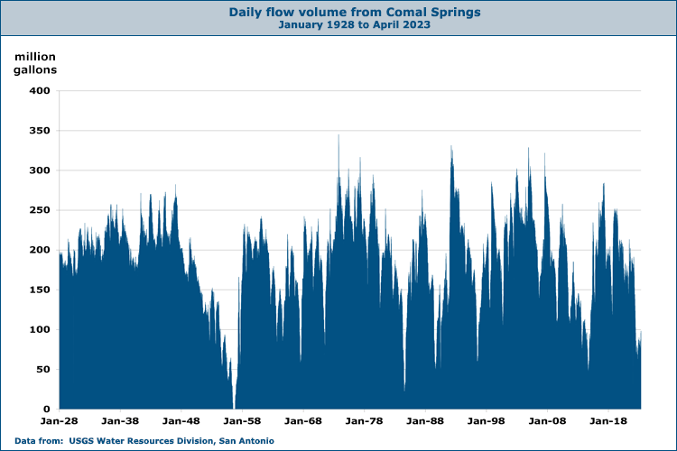
Flows at Comal Springs become intermittent when the level of the J-17 index well drops below 620 feet. Almost all flow at Comal ceases at an elevation of 618 feet. It is often said that Comal Springs went dry during the drought of record in the 1950s, but gage records reveal that was not really the case. The Springs were almost dry from June to November of 1956 and the river was reduced to isolated pools of water. The minimum springflow recorded during that period was 41 gallons per second. In any case, flows were not enough to support the Comal River population of the fountain darter - it was completely eliminated by the drought and was reintroduced using individuals from another population in San Marcos, where springflow was still sufficient to support the species. Models suggest that in a repeat of the 1950's drought, given current levels of pumping, Comal Springs would be dry for a number of years.
Only a small portion of total springflow comes from the largest springs shown in the graphic above. Special springflow measurements made by the U.S. Fish and Wildlife Service and the U.S. Geological Survey determined that most of the spring flows (about 78%) come from the many small springs and seeps under and around the shores of Landa Lake (McKinney and Sharp, 1995). Most of the water that becomes Comal springflow originates with recharge far to the west of the Springs and moves through major flow zones in Medina and Bexar counties on its way toward New Braunfels (see Flowpath Map). In five ground-water trace tests performed by Ogden, Quick, and Rothermel (1986) around Comal Springs, none of the dye appeared at any of the spring orifices. This supported earlier hypotheses that very little recent, locally derived recharge waters emerge from Comal Springs.
Data from dye-tracer studies also suggests there are some separate flowpaths that feed the individual spring orifices. Ogden, Quick, and Rothermel (1986) discussed their conversation with a scientist (Rettman) who injected dye into a well in Panther Creek about 500 feet from the nearest spring orifice. The dye emerged from one orifice but not another nearby. The trace was repeated and the results were the same. In March 2002 these results were duplicated by scientists from the Edwards Aquifer Authority, who injected green dye in the shallow well in Panther Creek. In less than three hours the dye started showing up in surprisingly strong concentrations in one spring, while no dye was seen in another spring only 10 feet away.
Official flow records for Comal Springs begin in 1928 and have been uninterrupted since then, giving Comal the longest period of record for any of the Edwards springs. The data is from USGS gage 08168710, which applies a calculation that attempts to separate flow that can be attributed to local stormwater runoff at gage 08169000 on the Comal River. Once runoff is removed, the rest is attributed to springflow. For the latest Comal springflows see the USGS Real-Time data page.
By the spring of 2013, New Braunfels had begun implementing a number of management and restoration efforts listed in the newly approved Habitat Conservation Plan to protect the endangered species in the Springs and the Comal River. An island was removed in the Comal River to increase fountain darter habitat, and other measures in the plan include flow management, restoring and maintaining native aquatic vegetation, managing public recreational use, and controlling harmful non-native species such as Asian gill parasites (see the New Braunfels section of the HCP). Over 75,000 snails were removed, along with 2,300 pounds of non-natives such as nutria and talapia, erosion control mats were installed, and more than 10,000 aquatic plants were planted. There were plans to consider a ban on certain types of non-native live bait and develop an education program for fishermen regarding what types of bait are appropriate in such a sensitive area.
By June of 2016 a second phase of improvement and restoration efforts had begun under the Habitat Conservation Plan to protect habitat for four endangered species Comal Springs. New retaining walls, re-contouring, and native plantings restored about 1,000 linear feet of steep and eroding bank alongside the first hole of the Landa Park Golf Course. This will minimize erosion from that slope and protect the instream habitat for fountain darters, the Comal Springs riffle beetle, the Comal Springs dryopid beetle, and a small crustacean known as Peck's cave amphipod. The project cost was $870,000.
In August of 2016 New Braunfels Utilities broke ground on Phase One of their project to transform the Klingemann wastewater station into a site to highlight the hydrological, environmental, and cultural history of the region and become a living demonstration of sustainable practices. Radio New Braunfels reported that landscape design of the property would include restoration of the Comal Springs headwaters and the transformation of more than 16 acres of asphalt into immersive native landscape. A new $23 million facility displays gardens, walking trails, outdoor classrooms, natural spring overlooks, wastewater treatment wetlands, and composting facilities.
In November of 2024 a proposal was floated to convert the old Dittlinger Flour Mill into a mixed-use development with a hotel, restaurant and retail space, housing, and a parking garage. Commissioners voted 6-0 in favor of rezoning the nine acre property so the project could move forward. Also in 2024, the New Braunfels City Council approved construction of a fence to limit public access to a section of the River below the Faust Street Bridge, which had always been a popular free swimming and gathering spot. The city staff cited an increase in crowds, trash, and safety concerns with people using the remains of an old textile mill as a diving platform. That has been going on at least since the first time I went there in the early 1970s and has always been dangerous!
|
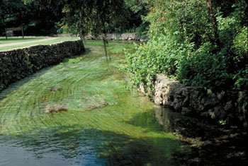 |
A view looking downstream from the large springs west of Landa Park Drive. This is called Spring Run 1. |
|
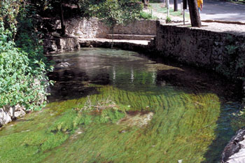 |
Looking upstream at Spring Run 1 toward the concrete steps and the large springs west of Landa Park drive. As you can see, water clarity is
exceptional. |
|
 |
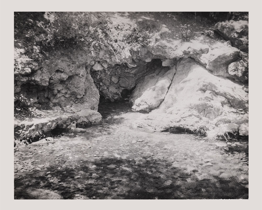
Mr. Paul Foerster took this photo of the large spring at Spring Run 1 when it was dry in the summer of 1956.
Mr. Foerster is Professor Emeritus of Mathematics at Alamo Heights School and taught there for 50 years. It is a virtual certainty that you used a math textbook in school written by Mr. Foerster. He wrote them for all the major publishers, and was still active doing so in 2019.
None of us in the water business had ever before seen a photo of Comal Springs dry in 1956, until Mr. Foerster brought it to my attention that he had one. He graciously allowed its use here.
Photo © Copyright 1956 by Paul Foerster. Used by permission. |
|
 |
A view of Spring Run 1 from the bluff just above the large springs. |
|
 |
The stone next to the large spring opening has traces of a thick shiny coating that archaeologists tell us is mostly animal fat built up over thousands of years of use in food preparation. |
|
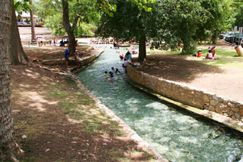 |
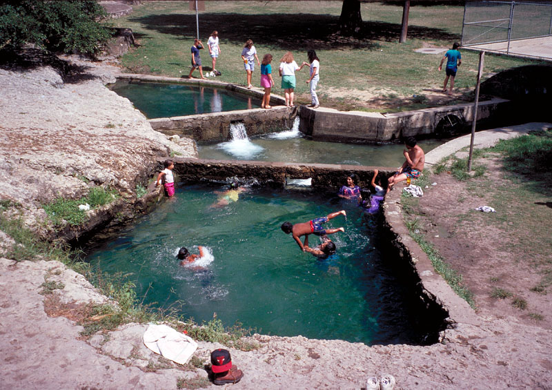
Most of Landa Lake is off-limits for swimming and wading because endangered species are present. Wading is allowed in this spring-fed channel that feeds the swimming hole in the photo below. |
|
 |
New Braunfels residents and tourists flock to this swimming hole on hot summer days. |
|
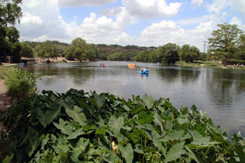 |
For $3 per person, you get 30 minutes of paddle boat time, but they are not real strict about it if you show up back at the dock a little late. It's a great way to see the Lake and also get some exercise! |
|
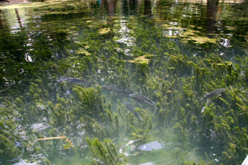 |
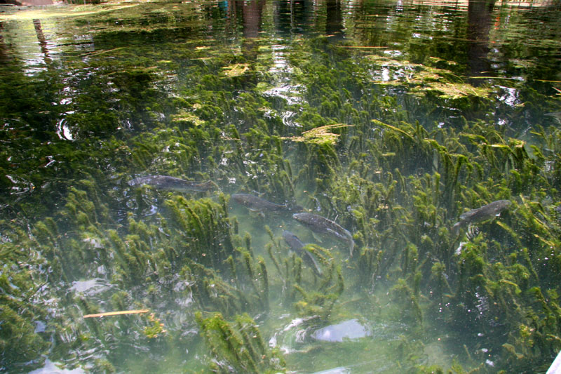
A school of tilapia in Landa Lake. Endangered fountain darters are also present. Removing non-native species like tilapia and suckermouth catfish is an important element of the Habitat Conservation Plan to protect endangered species, and twice a year a spearfishing tournment is held that helps to keep their populations under control. |
|
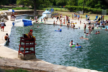 |
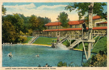
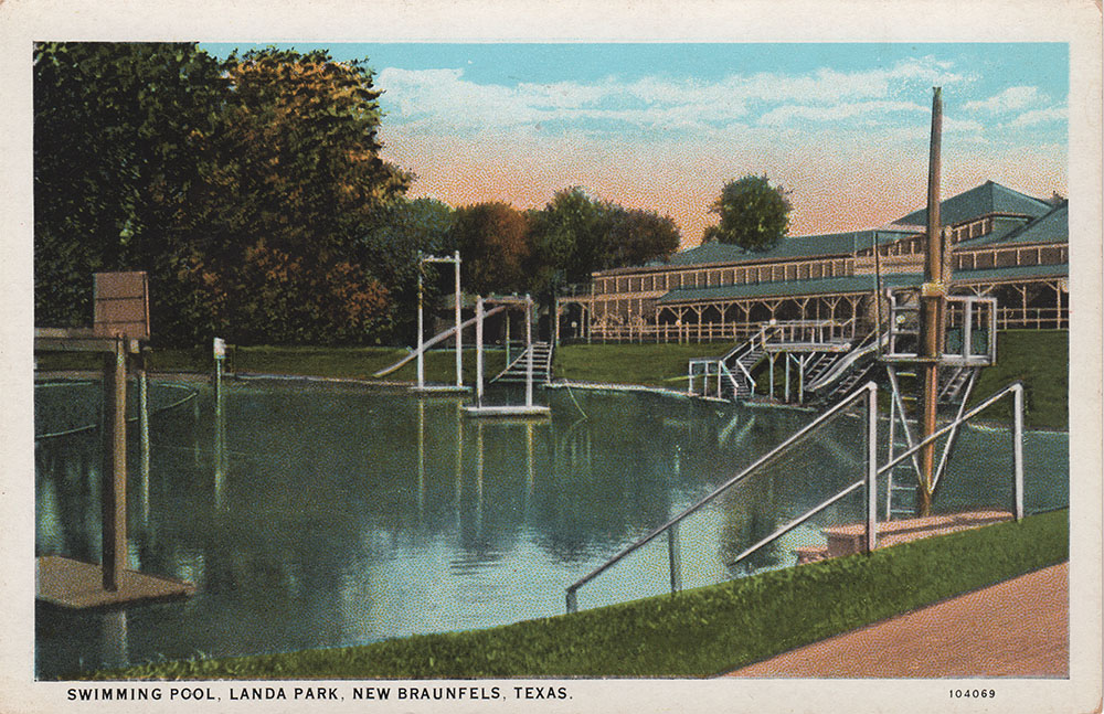
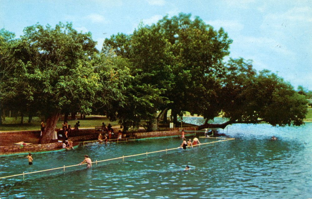
Another attraction in Landa Park is this large spring-fed swimming pool, complete with bathouses and lifeguard protection.
|
|
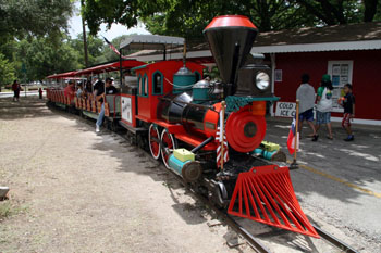 |
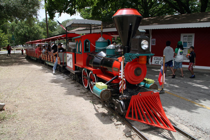
Taking a ride on the miniature train is a good way to get a feel for the layout of the Park. |
|
 |
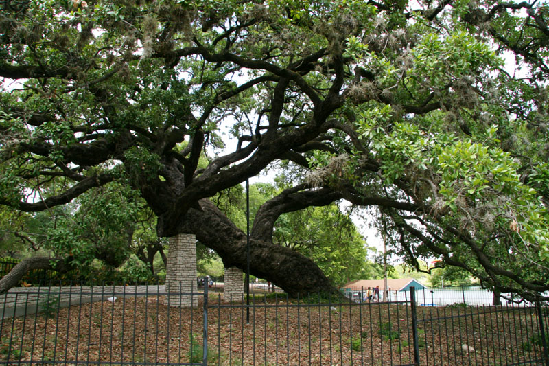
This tree in Landa Park is called the Founder's Oak. Legend has it that founders of New Braunfels held their first council meeting under the tree in 1845. Core samples taken in 1985 concluded that it sprouted in the year 1700. |
|
 |
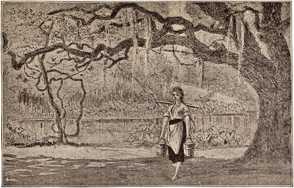
This image appeared in the Magazine of American History Illustrated in October 1888. Author Lee C. Harby wrote:
The first meeting of the council was held under a large oak in the lovely park of the Comal Springs. The tree was then crowned with verdure, and the gushing, sparkling water sang its song to the luxuriant caladiums which grew along its margin. Here the German girls came to fill their buckets, which they carried suspended from each end of a yoke which lay across the neck. These they still use, and very picturesque and un-American do the girls look in their straight skirts and short bodices. |
|
 |
Part of it says:
Visited in
1764 by French explorer St. Denis. Later a stop on El
Camino Real. In 1845, the area was settled by German
immigrants under Prince Carl Solms-Braunfels and called
Las Fontanas. 1300 surrounding acres were purchased for
$1,111. |
|
 |
Part of it says:
Good features at this site included five springs, fertile fields, timber, meadows and the nearby river. Two friars ran the small mission, with a citizen guard, so as to avoid friction. Four Spanish families and 47 Indians (27 of them baptized) comprised the inhabitants of this mission as of January 1757. |
|
 |
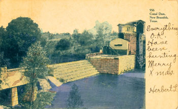
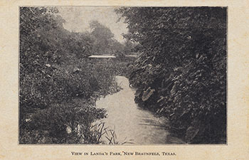
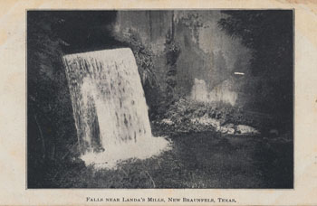
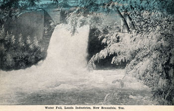
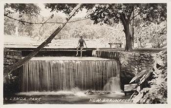
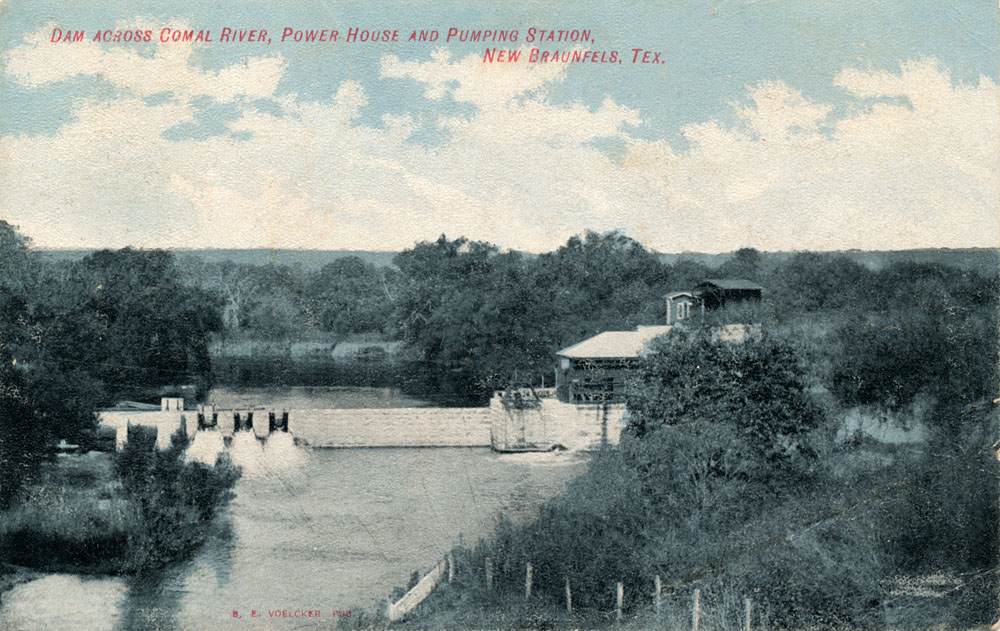
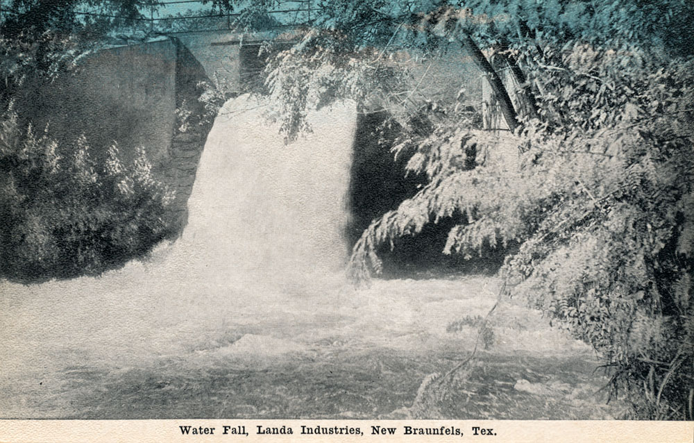
The earliest postcard I have found of the Comal River. Mailed in 1900. This is Clemens Dam, just downstream from the Springs, which later became known as Stinky Falls. Published by B. E. Voelcker
This postcard was technically illegal, because it has a "divided back", with one side for the address and the other side for writing your note. Divided back postcards were not made legal in the U.S. until 1907, but apparently some manufacturers simply ignored this requirement. |
|
 |
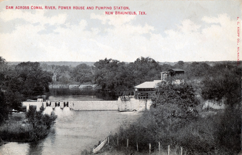
Postcard manufacturers of the day would often share images. This card appears to use the same photo as above, but it was published by E. C. Kropp Co. in Milwaukee. Like the card above, it has a divided back and was illegal. |
|
 |
A 1906 view of Clemens Dam. This card was completely legal - the back says "Nothing but address on this side." Note how the manufacturer has left a small space on the front side for the note. |
|
 |
Another legal card, with plenty of space on the front side for the note. |
|
 |
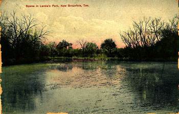
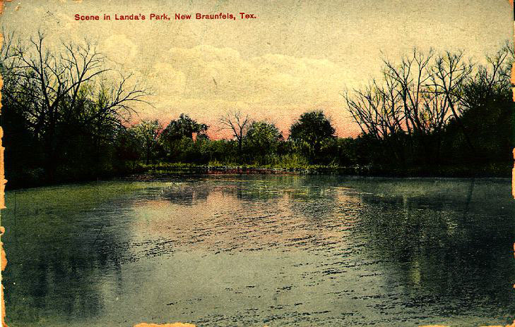
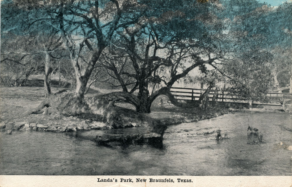
The earliest postcard I have found of Landa Park - not mailed but has a penciled date of June 2, 1906. |
|
 |
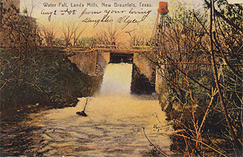
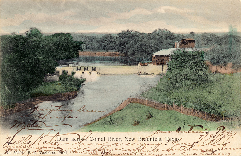
A nicely colored view of Clemens Dam mailed in 1907. Made in Germany by B. E. Voelcker. |
|
 |
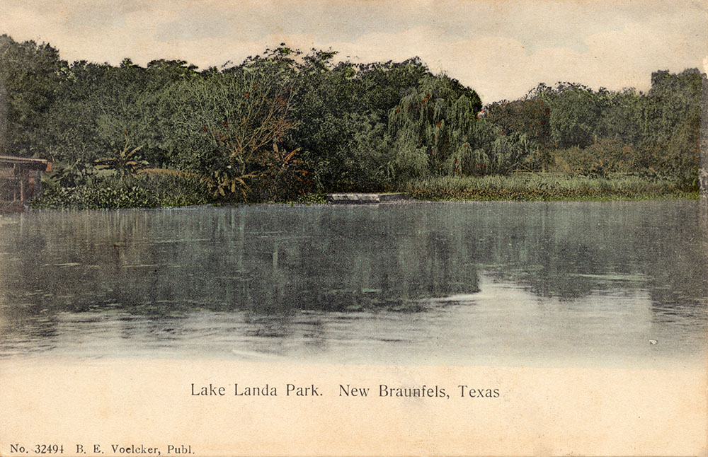
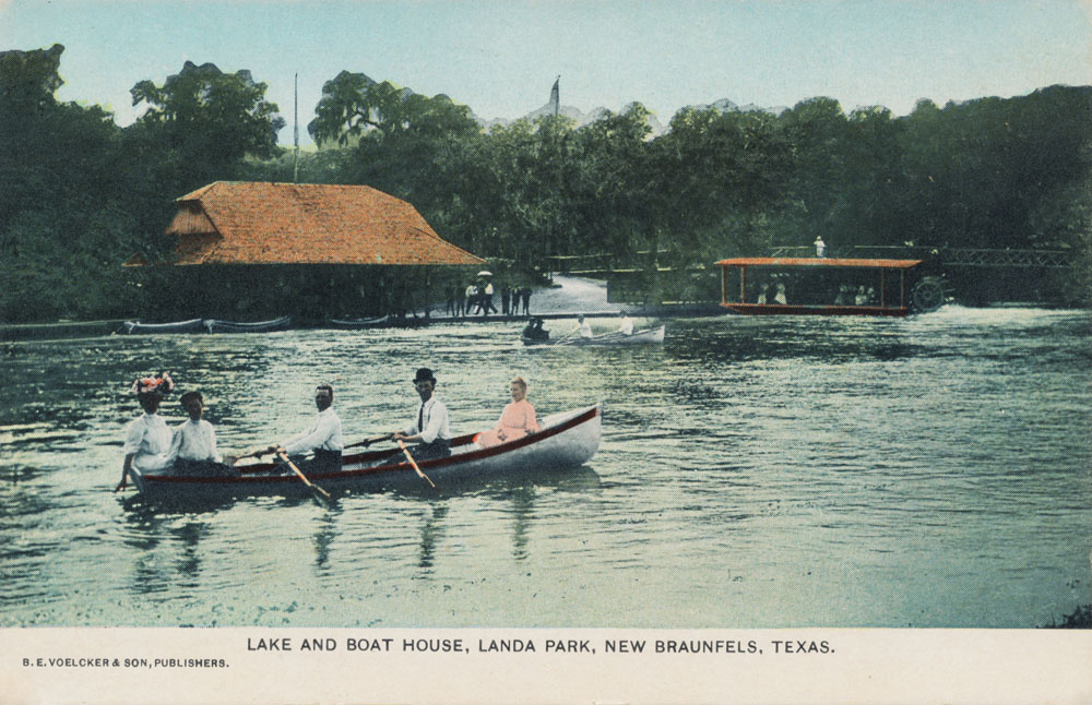
A view of Lake Landa Park, postmarked September 9, 1907. Made in Germany by B. E. Voelcker. |
|
 |
In August of 1907 Miss Maynort wrote to Miss Elma Bright:
You left too soon. Am still having a good time. See where I am. |
|
 |
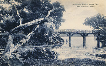
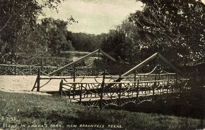
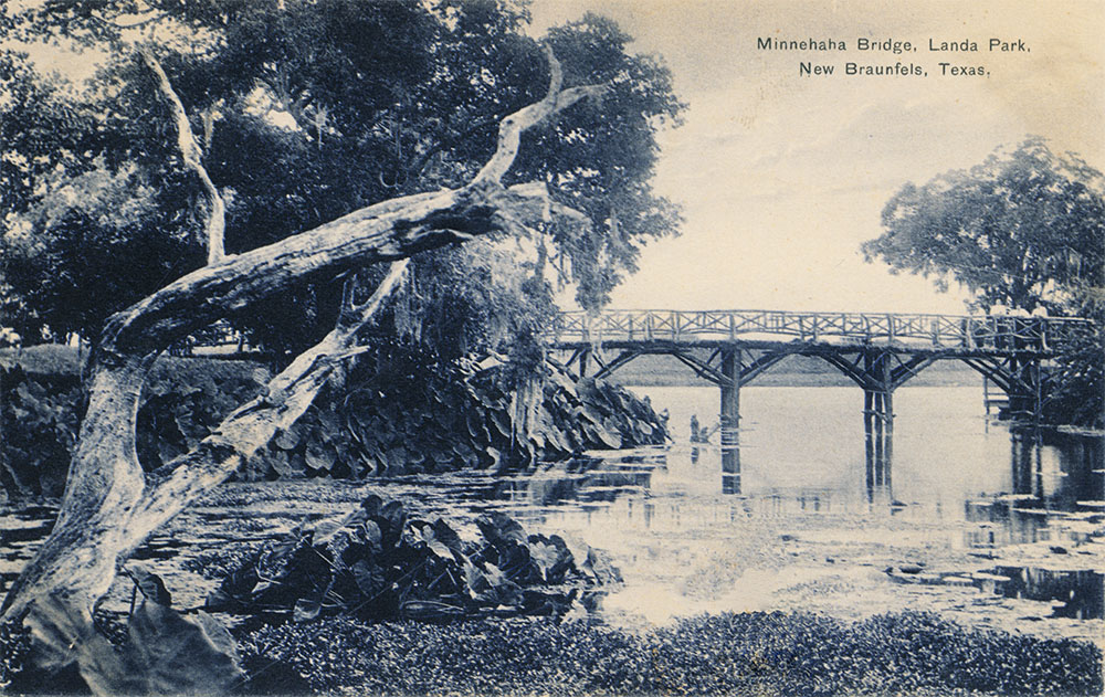
Mailed on August 10, 1907 to Miss Stella Masters in Swanville, Indiana. On the back, an apparent suitor lamented that she had gone far away and wrote:
I am afraid we will not get to cross this bridge. |
|
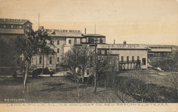 |
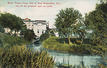
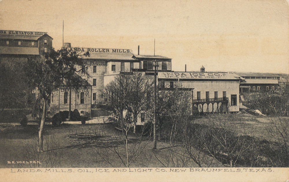
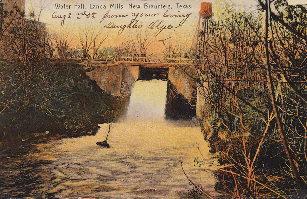
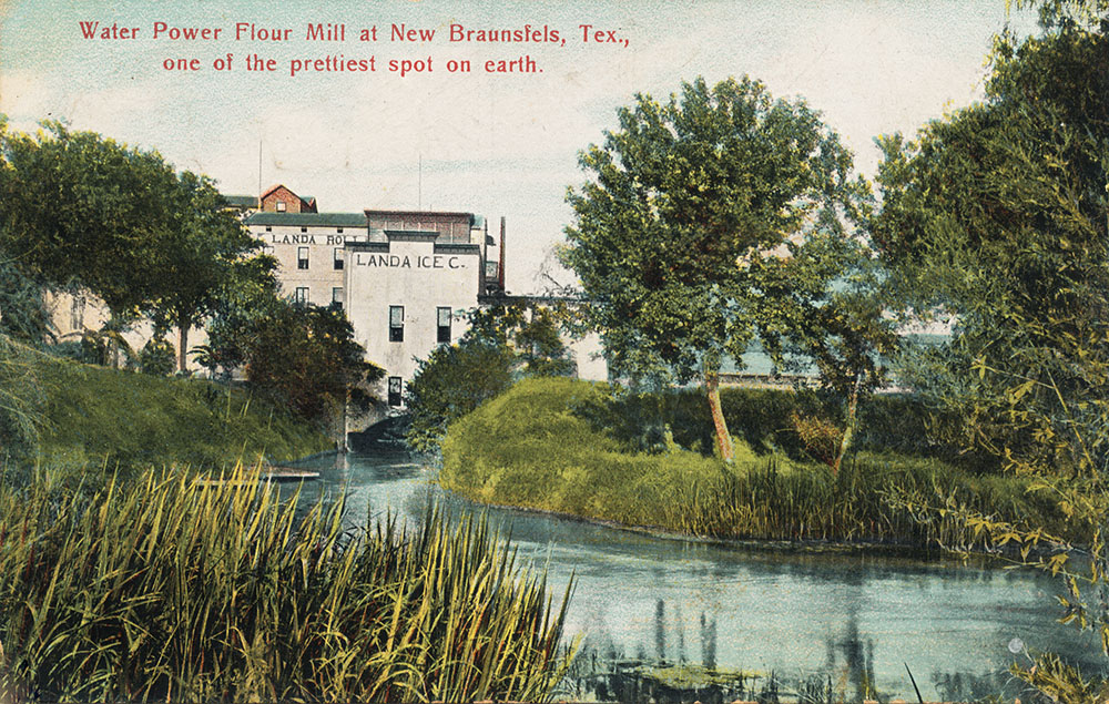
In the early 20th century a variety of mills and factories were using Spring water for power and in their processes. At Landa Mills, products included oil, ice, and light. |
|
 |
Produced by I. A. Hoffman in New Braunfels and mailed Dec. 28, 1907. |
|
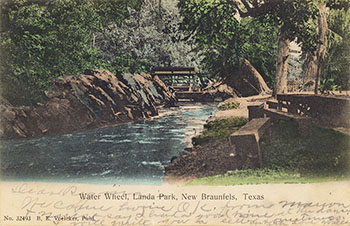 |
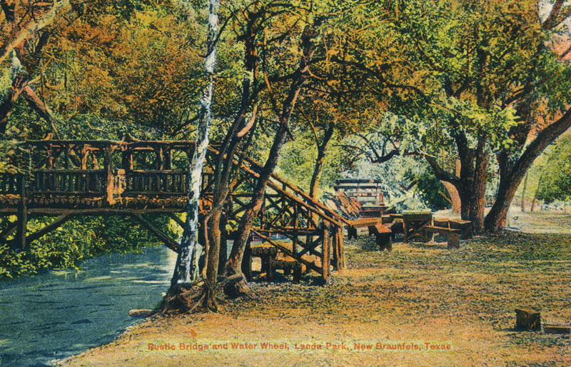
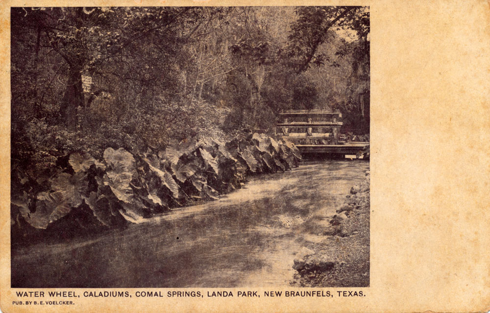
A nice view of the water wheel in Landa Park, mailed in August of 1907. |
|
 |
Postmarked Jan. 25, 1908. In those days postcards were like the text message of today, and it was expensive to send a lot of them. Ella Wise wrote to Miss Pauline Pepper:
Thank you very much for your postal. You don't know how much pleasure it gave me. But I am sorry to say that I cannot correspond with all for I am not able to. So I hope you are satisfied with this postal because that is all I can send you and no more. |
|
 |
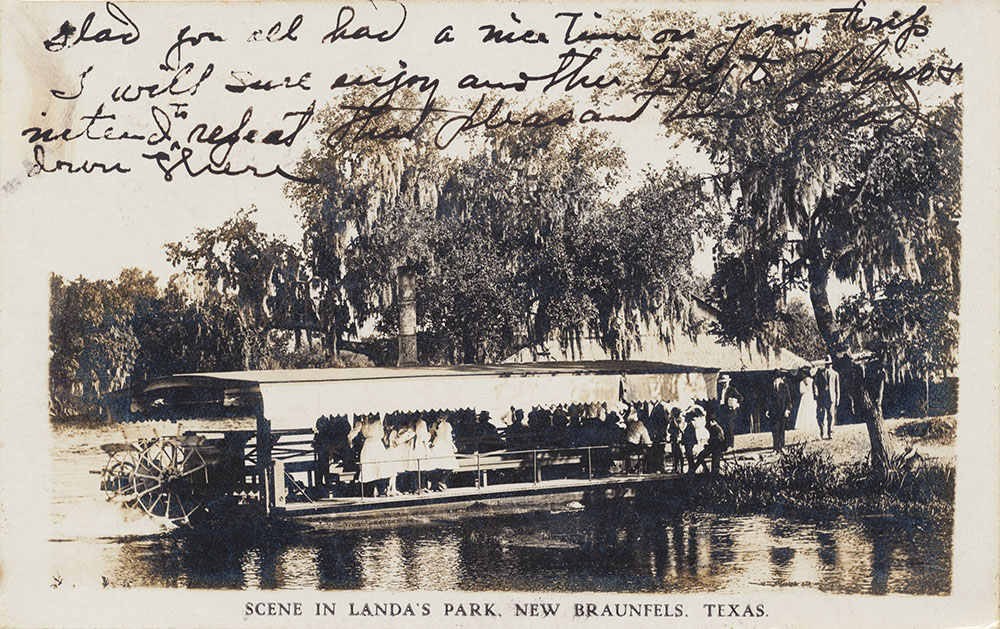
An early view of the steamboat in Landa Park, mailed in August of 1908. |
|
 |
Printed in Germany by B. E. Voelcker and postmarked August 1, 1908. |
|
 |
Postmarked Dec. 7, 1908. |
|
 |
From the first series of cards produced by famous postcard producer Curt Teich. He always numbered his cards with a unique identifier, but in the beginning did not record production dates. From the copyrights on other images card collectors have deduced that Teich cards numbered in this range were produced between 1900 and 1908. |
|
 |
Another card from the first series produced by Curt Teich, this one showing the swimming pool sometime between 1900 and 1908. |
|
 |
A Real Photo card published by B. E. Voelcker and Son, made in Germany. Postmarked from New Braunfels on May 16, 1909. |
|
 |
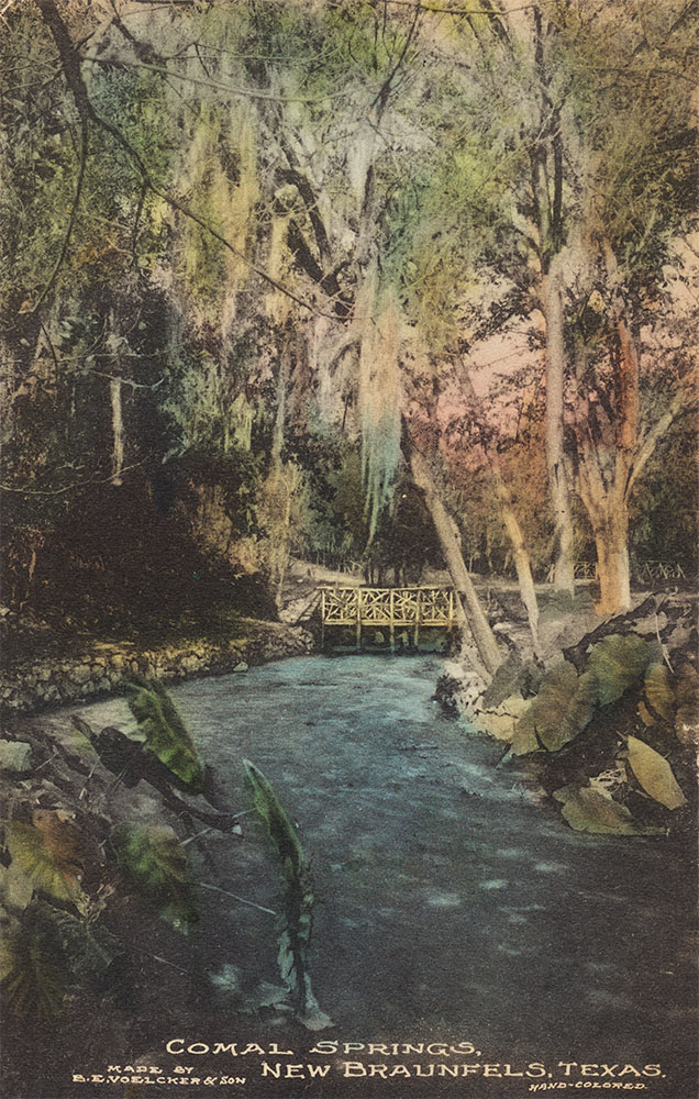
About 1909 B. E. Voelcker and Son produced a series of hand-colored Real Photo cards of Comal Springs and Landa Park. This one is postmarked from New Braunfels on April 14, 1909. There are a number of additional examples from this series among the cards below. |
|
 |
A variety of industries used water power from the Springs, including grist, flour, and sawmills, cotton and woolen factories, a paper mill, an ice plant, and a brewery. |
|
 |
A water wheel in one of the upper spring runs. Miss Lucille Stappes father wrote to her:
How are you getting along. I am in the park writing this. - Papa |
|
 |
Not mailed or dated, but from the stamp box on the back the postcard dealer believed it was produced circa 1910. |
|
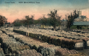 |
Cotton yard adjacent to the spring-water powered factory, 1910. |
|
 |
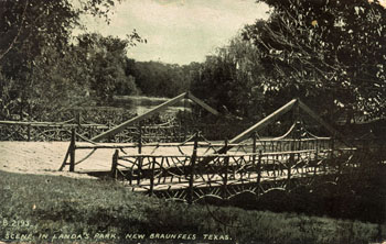
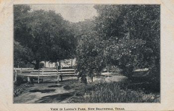
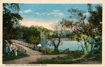
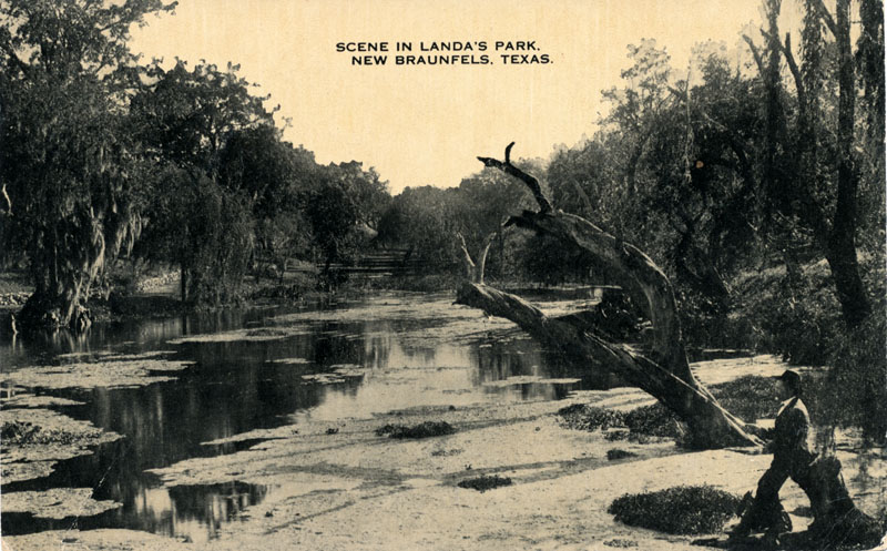
Postcard
mailed in 1911 shows a scene in Landa Park. |
|
 |
A vey rare early hand-colored view of Comal Springs, produced by B. E. Voelcker & Son. Mail from New Braunfels on June 18, 1911. Mrs. Louise Davis had news for relatives:
Dear Aunt Carrie - No doubt this will be a surpirse to all of you. I was quietly married last Wednesday and we are spending a few days in this pretty town. |
|
 |
A sepia tone version of the card above by the Albertype Company. This card is unusual because the back is an advertisement for Albertype's services in producing sepia tone cards. One thousand cards cost $7.50. |
|
 |
Another hand-colored card by B. E. Voelcker & Son, not mailed or dated but produced about the same time as the dated card above. |
|
 |
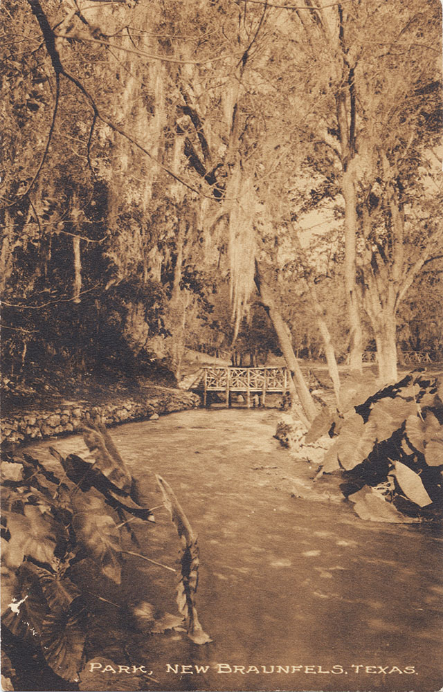
An early 20th century view of the large spring next to Landa Park Drive before the concrete steps were built. Not mailed or dated, but produced between about 1907 and 1915. |
|
 |
Another early 20th century view. On the back, Leonard wrote:
We made our hike all right and have sure got a nice place to stay. I think we will be here for a week or so but still send my mail to my old address. I'll get it alright. |
|
 |
Produced by Bradford and Company, St. Joseph, Michigan. |
|
 |
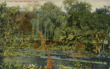
A view of Landa Lake circa 1915. Produced by B. E. Voelcker & Son in their typical hand-colorized style. |
|
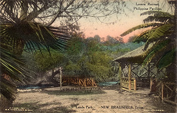 |
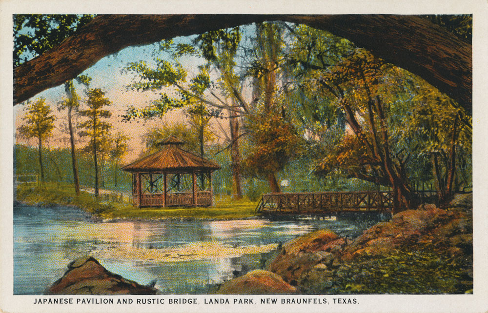
The gazebo was built in 1898 and was called the Philippine Pavilon. An article on the Sophienberg Museum website says the story is this gazebo was fashioned in the Oriental style so popular in the late 1800s when the United States was involved in the Spanish-American War, in which the first battles occurred in the Philippines (sophienberg.com, 2007). |
|
 |
Not mailed or dated, but appears to be circa 1910 - 1920. |
|
 |
An unusual sepia tone card with a hand-tinted blue sky. Also unusual because it was produced in New Braunfels; most cards of the day were produced in Germany or in printing houses back east. |
|
 |
Another version of the card above, also produced in New Braunfels by B. E. Voelcker & Son. |
|
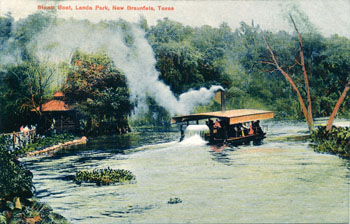 |
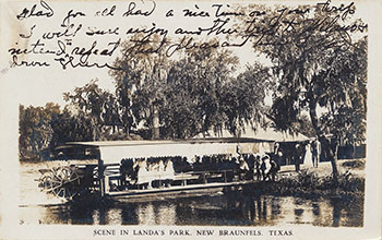
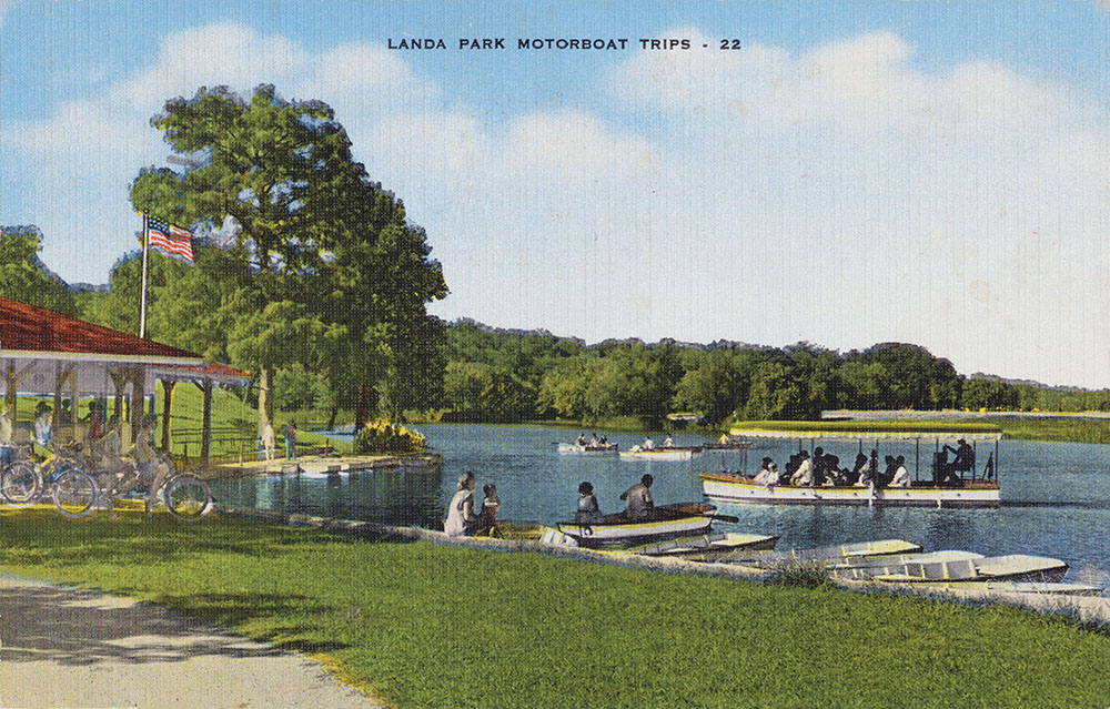
Not many people remember that steam boats used to ply the waters of Landa Lake. The card was not mailed or dated, but the style dates it as probably being produced between 1910 and 1915. |
|
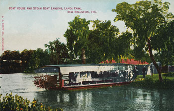 |
A view of a Landa Lake steam boat parked at its dock. |
|
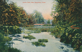 |
A view of the Lake circa 1910 - 1915. |
|
 |
Another view of the Lake in the postcard style that suggests a production date between 1910 and 1915. |
|
 |
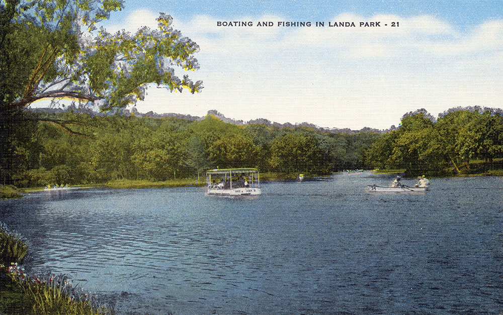
The back says:
Boating and fishing on Lake in Landa Park, in the heart of New Braunfels, Texas, where Nature did its masterpiece of beauty. |
|
 |
A view of the swimming pool from the time when black and white striped bathing suits were in style! |
|
 |
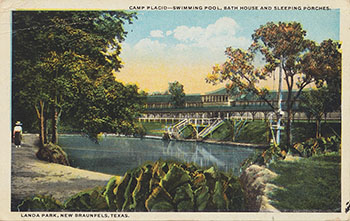
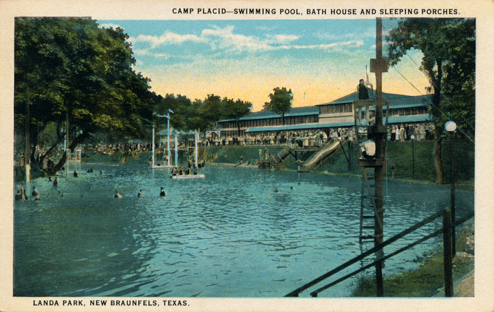
This area of Landa Park was known as "Camp Placid" around this time. A view of the swimming pool, bath house, and sleeping porches. |
|
 |
Mailed on August 16, 1916 to Mrs. Louis Hazelton in Chicago. Eunice wrote:
Dear Aunt Lou. Arrived here in good health and all's well. Expect to stay a week. Albert is feeling well. Regards to all and my Muriel. With love, Eunice. |
|
 |
Mailed in August of 1918. |
|
 |
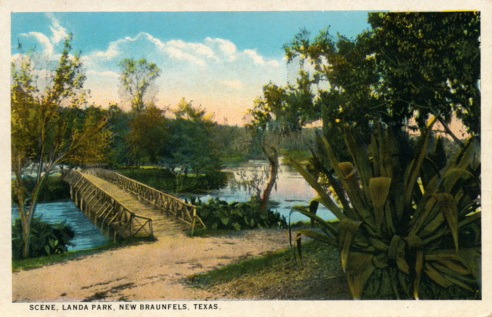
A similar scene to the one above, but the tree next to the bridge appears to have suffered some storm or ice damage, so this one was probably produced slightly later. The cactus also appears larger. |
|
 |
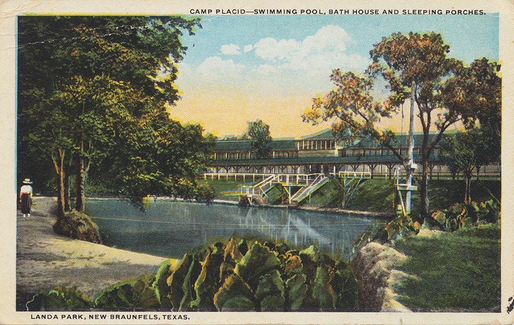
A view of the Camp Placid swimming pool, bath house, and sleeping porches. The Curt Teich production number indicates it was produced in 1919.
|
|
 |
The Curt Teich production number indicates this card was produced in approximately 1920. |
|
 |
Another Curt Teich card produced in approximately 1920 showing oneof the main spring runs. |
|
 |
A Curt Teich card with a production number that places the scene in 1924. The Philippine Pavilion is identified here as the Japanese Pavilion.
|
|
 |
Another Curt Teich card with a 1924 production number. |
|
 |
Apparently Curt Teich imaged New Braunfels heavily in 1924; this one also has a production number from that year. |
|
 |
Yet another Curt Teich card with a 1924 production number. |
|
 |
Not mailed or dated, but is from the "White Border Period" of postcards that lasted from 1915 to 1930. Probably produced mid 1920s. |
|
 |
A handwritten date on the back is "July 4, 1927." Perhaps a memento of someone's holiday visit to Landa Park. |
|
 |
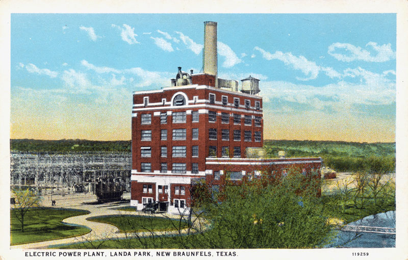
Hydroelectric power was generated using springflows as early as 1890. This power plant in Landa Park was built in the 1920s and operated until 1972. It sat vacant and decrepit for many years, until 2004, when a project began to re-develop the site into loft apartments. |
|
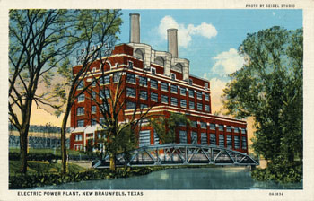 |
Another view after an expansion that doubled the plant's size. |
|
 |
A view of the northwest end of the Lake. Never mailed. Produced by the same manufacturer and about the same time as the card above. The gazebo pictured is still there. |
|
 |
Not mailed or dated, but dated to roughly 1935 as it straddles the "White Border" period of postcards and the "Linen Card Era" that began about 1930. It appears highly yellowed but really is not - the border is printed with the reddish tinge. |
|
 |
A Real Photo card mailed in October of 1939. |
|
 |
A Real Photo view of the Springs, mailed in August of 1940. |
|
 |
On August 17, 1941 Sally wrote J.R. and Claire:
I am having a good time on my vacation. There are lots of pretty parks, pools, and mountain drives and we have a big rock cottage up on a mountain - it overlooks the Comal Springs and Guadalupe River. Daddy is coming today. Love, Sally. |
|
 |
From the same Seidel Studio production run as the card below, which was mailed in 1942, so I am dating it to approximately that time. |
|
 |
By 1945 there was a highly colorized version of this scene, an example is several cards below.
On the back of this one, Roberta wrote:
Dear Polly - Had an all day picnic in this beautiful park. |
|
 |
On the back of the card, Frances wrote to Miss Lucille Brown of Borger, Texas:
Hi Pal -
Surely bet you'd like this cool place - lots of fishing, swimming, boating. Better come on down. I came on Friday - will return Sunday. Be good. Love, Frances. |
|
 |
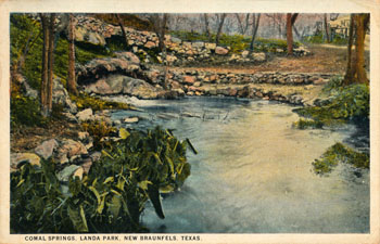
This postcard mailed on July 4, 1945 shows the
rock walls and steps that still surround the largest of the Comal Springs have
remained basically unchanged for over 60 years. |
|
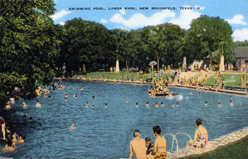 |
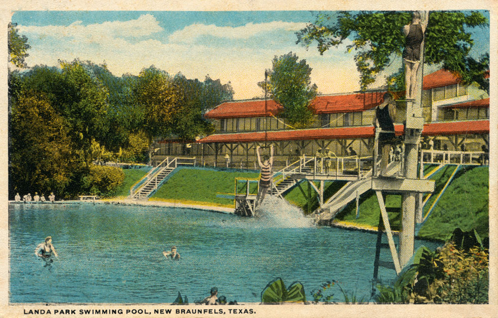
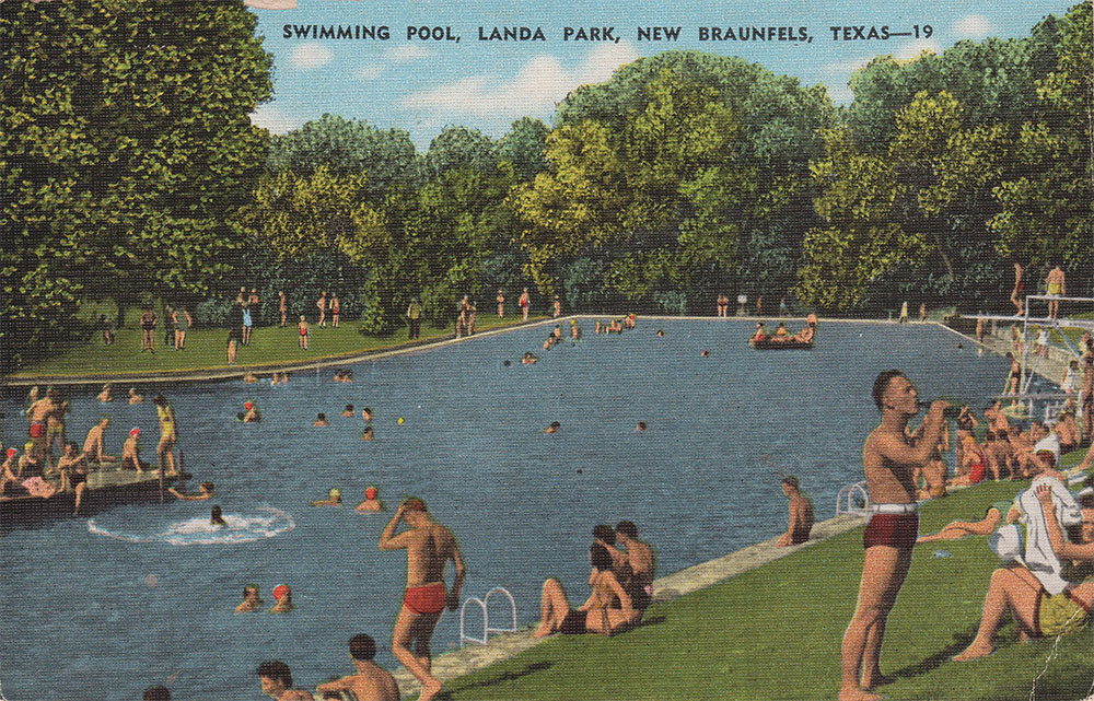
Mailed in August of 1945, the back caption says:
This is the largest swimming pool in the South. Five million gallons of water flow through it daily; modern bath house accommodates 500 bathers. Landa Park is famed as the beauty spot of Texas. |
|
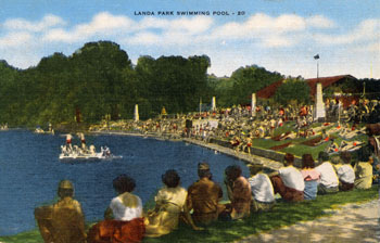 |
A view of the swimming pool circa late 1940s. The back caption says:
Landa Park Swimming Pool, where thousands swim weekly. 70 degrees year round temperature. Millions of gallons of Spring Water continuously flow through this pool. |
|
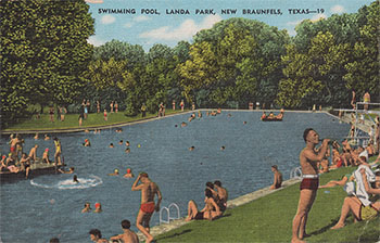 |
Another view of the swimming pool circa late 1940s. The back caption says:
This is the largest swimming pool in the South. Five million gallons of water flow through it daily; modern bath house accommodating 500 bathers. Landa Park is famed as the beauty spot of Texas. |
|
 |
The drought of record in the 1950s appears to have seriously impacted postcard production in those years. This is the only one of Landa Park I have seen, postmarked April 11, 1955. The springs were almost dry from June to November of 1956. |
|
 |
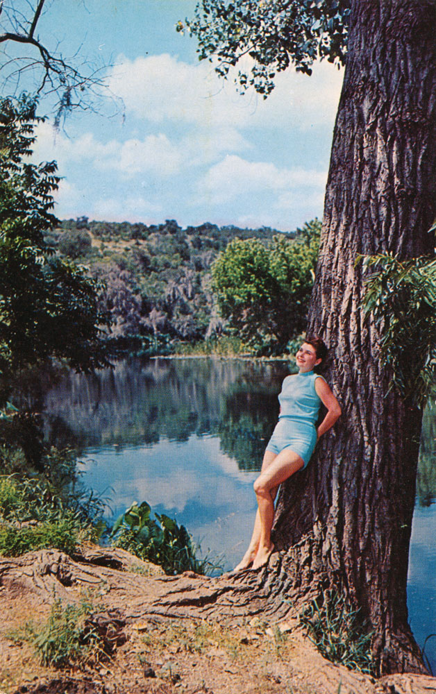
This is Evelyn Lois Peterson, who had been a model, actress, and Copa girl in New York before returning to New Braunfels to marry a local physician. She was featured in Life magazine twice. Her experience in modeling and publications probably explains why she was asked by local publisher Seidel Studio to appear in the card. The photographer was Joe Faust.
Very seldom is it possible to attach a name and a story to any of the people depicted in these vintage cards, so it was great to receive this information on Ms. Peterson from her granddaughter.
The postcard was mailed on July 20, 1962. |
|
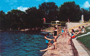 |
A view of the Landa Park swimming pool that appears to be circa 1960s |
|
 |
A view of the main spring from Seidel Studios in New Braunfels. Appears to be circa 1960s. |
|
 |
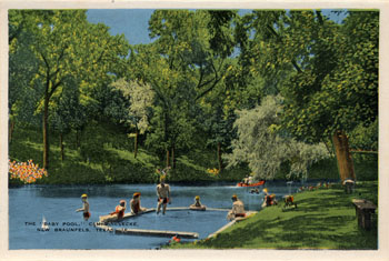
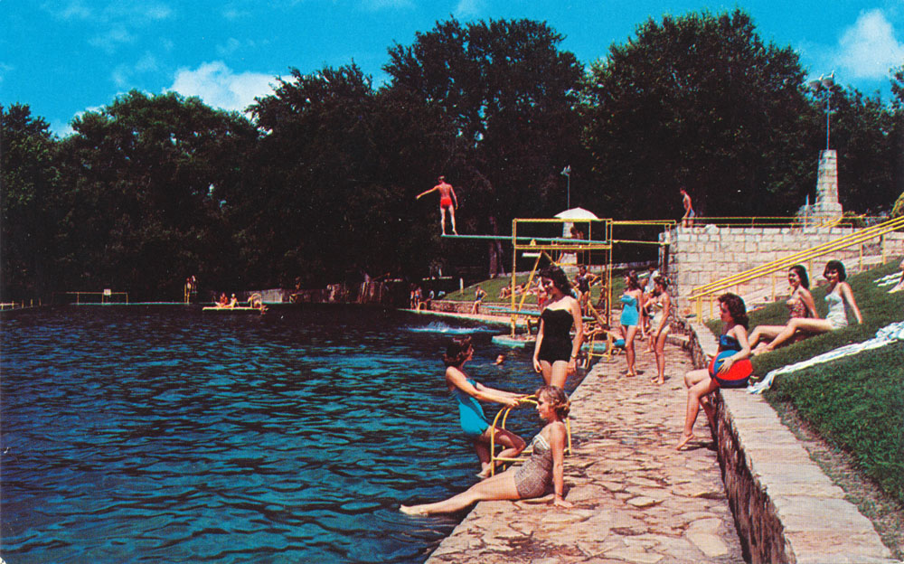
A section of Landa Lake used to be sectioned off as a children's pool. |
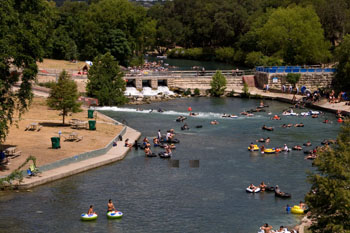
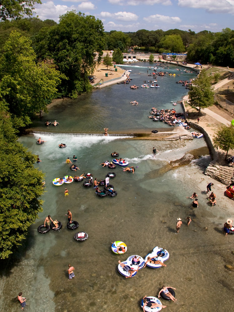
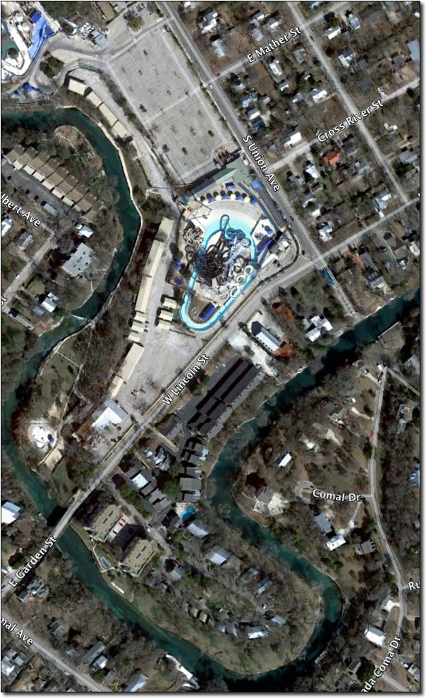
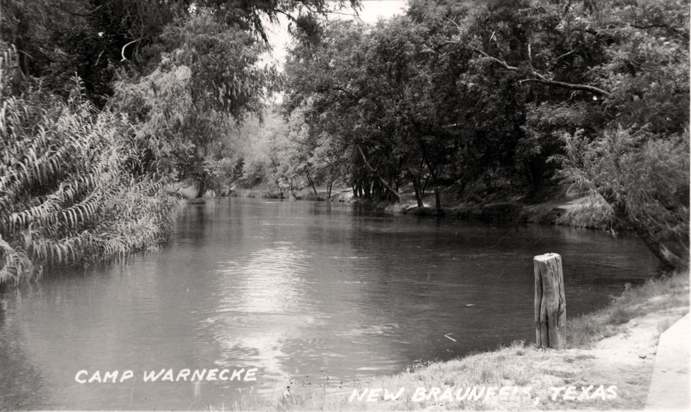
Though it winds for only two short miles through New Braunfels before confluencing with the Guadalupe River, the Comal River's importance as a recreational destination is long and legendary. In the mid 20th century, Stinky Falls, Camp Warnecke, Camp Ulbricht, Camp Giesecke, and Camp Placid were all popular sites. In 1979, the Schlitterbahn Waterpark first opened on the site where Camp Warnecke was, and today it is one of the country's premiere water parks. In 2024 the federal government designated the Comal River to be a National Water Trail.
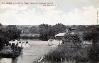
Stinky Falls was located at Clemens Dam, the site of an earlier dam and mill built by John F. Torrey in 1850. Mr. Torrey operated a grist mill, a cotton factory, and a wool factory, and he rebuilt his facilities several times after partial destruction by floods until all were finally washed away. In 1882 banker William Clemens acquired the property and built a new cut limestone dam to supply water under contract to the city of New Braunfels, but it soon became idle when the city built its own waterworks operation next to Landa Park. In 1907 a well was drilled nearby for the purpose of acquiring pure artesian water, but it produced only hot and smelly sulfur water. The well was left flowing, and the site became a popular swimming spot for kids long before anyone invented water parks. It became known as "Stinky Falls" (Sophienberg, 2006).
|
 |
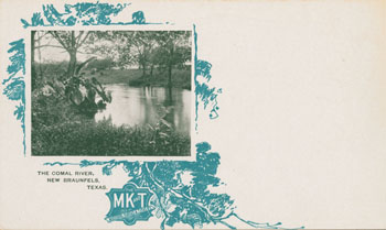
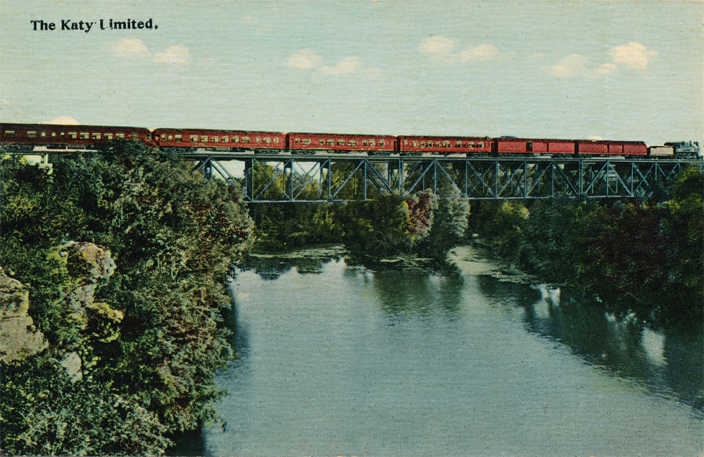
The M. K. & T. train known as The Katy Limited over the Comal River in New Braunfels around 1915. The card incorrectly identifies it as the "Camel" River, which might explain why this card is rare. |
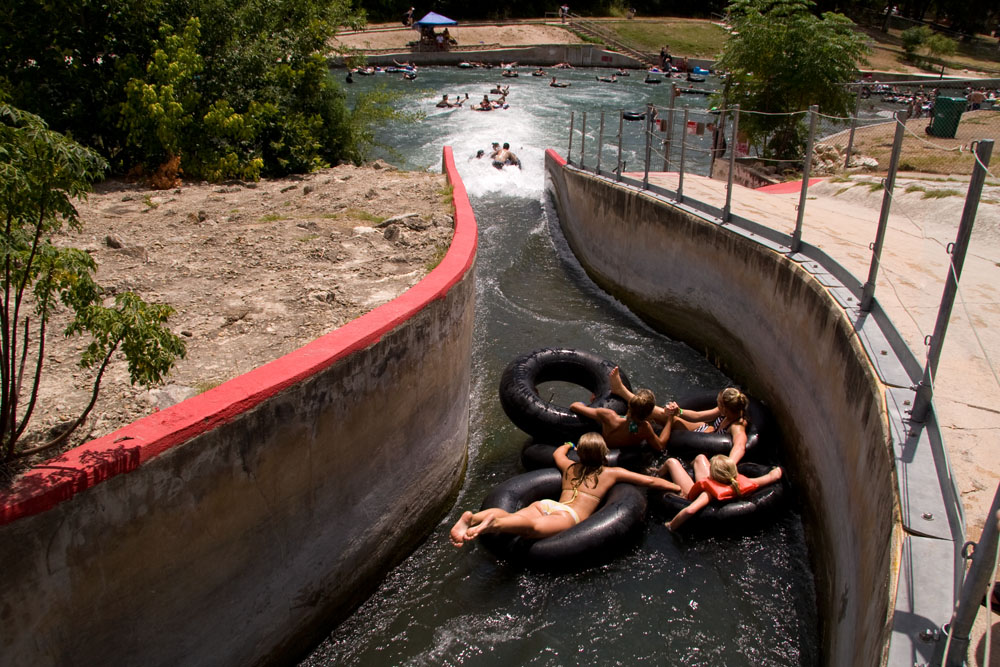
By the 1960s, Stinky Falls was drawing mostly unsupervised teenagers and hippies from all over the state. Though popular, the site was entirely unsafe. In the early 1970s I witnessed a lot of dangerous diving and risky swimming through the dam's outlet. The name "Stinky Falls" could just as easily have referred to all the weed. In 1976, the city built the New Braunfels Tube Chute at the site and capped the well. It is still an extremely popular summertime cooling-off spot.
By 2011, crowds on the Comal River had begun to grow so large that one could barely get a tube in the water. That summer, police concerned about public safety were forced to turn some visitors away, and city officials began looking at ways to control the number of people getting on the River. One of these might be an admission fee, but opponents insist that since the river is public property, it shouldn’t cost anything to get wet.
Another controversy erupted in the summer of 2011 over a container ban passed by the city of New Braunfels. On August 22, the city banned disposable food and beverage containers on the Comal River and a small portion of the Guadalupe River that passes through the city. Opponents promised a lawsuit and a petition drive to overturn the measure. The issue was placed on the November 8 ballot and voters approved the ban by 58%. It remained to be seen whether the ban would stick, however, because a 1993 state law prohibits cities from banning disposable containers. A lawsuit was filed by a group of local business owners and residents in state district court. In February of 2012, that suit was dropped and another was filed in Austin, also naming two state officials as defendants, Land Commissioner Jerry Patterson and TCEQ Executive Director Mark Vickery. Attorney Jim Ewbank said that as Land Commissioner, Patterson was responsible for state owned waterways, and Vickery is charged with managing municipal solid waste.
Over the Memorial Day weekend in 2012, a noticeable reduction in the amount of trash in the Comal River was attributed to the new ban on disposable containers, but not everyone was pleased. Commercial river outfitters who rent inner tubes claimed that trash was down simply because crowds were smaller. They noticed that rentals were down, even though weather and tubing conditons were excellent. Apparently some tubers simply went to stretches of the Guadalupe River outside the New Braunfels city limits, where beer cans were not banned.
In January of 2014, state District Judge Don Burgess ruled the New Braunfels can ban is unconstitutional and unenforceable. Jim Ewbank, lawyer for the water recreation interests that sued the city, said "We hope that, now that the court has spoken, declaring these ordinances unconstitutional, we can sit down with the city and try to work out a solution that addresses everybody's goals and purposes." New Braunfels said it would appeal the ruling. The first major holiday after the ruling was Memorial Day in May of 2014, and tubers hit the river with cans in hand. The city was providing free mesh bags through the tube outfitters for people to collect their trash in, and everything seemed under control. Anybody who finds themsef in Texas is at least part Texan, and Texans know you don't trash the river by "sinking your empties." If any Texans witness such behavior, it is expected they will put a stop to it and send the offender back to New York.
In November of 2013, an ownership squabble developed over a scenic little spot in the Comal River called Spring Island. For many decades, the general public has been excluded from the one-acre island - the only persons allowed were those residing within the Comal County Water Recreational District No. 1 in the Landa Park Highlands and Landa Park Estates subdivisions. The District was created in 1937 for mosquito and trash control and is the state's only Water Recreational District. The legislation that established it said its purpose was to "protect the health of those residing in such district and keep such waters in good condition for the recreational purposes of swimmers and fishing therein and boating thereon by those entitled to do so." This was interpreted to mean the only "entitled" persons are those in subdivisions with deed provisions that grant them access. After a spate of trespassing complaints in 2013, the District was asked to produce a deed, which it couldn't. Board chairman Cecil Eager said "The district was given authority over the island by the Legislature. I believe it's owned by the residents of the subdivisions." Mike Reynolds, publisher of the Texas Citizen weekly newspaper said "They're basically squatting on public property and claiming it for themselves," and he offered to fund the defense of the first person arrested for trespassing. "We want to see this ownership claim test in court. It's not going to pass muster," he said.
Eventually, a title search revealed the Island was actually owned by the Lower Colorado River Authority, which acquired it in 1972. In 2015 the LCRA transferred title of the Island to the Colorado River Land Trust, a nonprofit created by the LCRA in 2013 to preserve the natural beauty and history of the Colorado River basin. The site is not in the Colorado River basin, it's in the Guadalupe River basin, but the LCRA Trust and the Water Recreational District have similar goals, so they began negotiations to sell the Island to the District. In April 2016 the Trust sold to the District 9.46 acres of river property between Houston and Landa Streets, including Spring Island and other small islands, for $300,000. The District assessed a special one-time charge to each of the 311 residential property owners in the district to fund the purchase.
So the title issue was solved, and the District defended its practice of restricting public access to the land even when it didn't own the land. Property owners have deeds which give them rights to build structures, swim, fish, and enjoy the place, and the District's lawyer Leonard Dougal said "We've always believed those were exclusive rights, otherwise there would be no need to include them in the deed. Because they were exclusive rights, the district that manages the property had grounds to exclude people from the property."
In May of 2017, a state appeals court overturned the 2014 decision by Judge Don Burgess in favor of river businesses on New Braunfels' "can ban" and the city was considering how to resume enforcement of the ordinance. The Third Court of Appeals ruled the plaintiffs in the case had no legal standing challenge the ban in the first place and therefore Judge Burgess did not have subject-matter jurisdiction over the case. Although the plaintiffs had evidence they'd lost business, the court found no harm occurred to a vested property right, because the ordinance does not prohibit the businesses from selling disposable containers. In October of 2017 the Texas Supreme Court refused to bar the city from enforcing the ban, but also requested a full briefing, so the issue was not quite settled yet. New Braunfels announced that it would resume enforcement of the ban on November 1 and erected signs informing tubers. Parties to the lawsuit were required to file briefs by late November, and the Court would then decide if it would hear the whole case. In October of 2018, the Court declined to review the case, and the issue was finally settled. The can ban stood.
|
 |
In the old days, before the sidewalks were built, there was a lot of risky diving from the raised platform on the right. The New Braunfels Tube Chute is seen entering the River on the left. |
|
 |
If you don't have the $50 bucks to get into Schlitterbahn, the city-owned New Braunfels tube chute is almost as good and lots cheaper. |
|
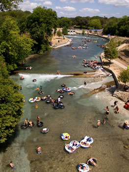 |
Just below Clemens Dam, the Comal River teems with people on a hot summer morning in 2009. |
|
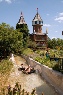 |
The Schlitterbahn Waterpark, on the site where Camp Warnecke was located, is consistently ranked as the best water park in America. |
|
 |
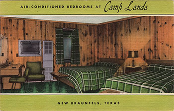
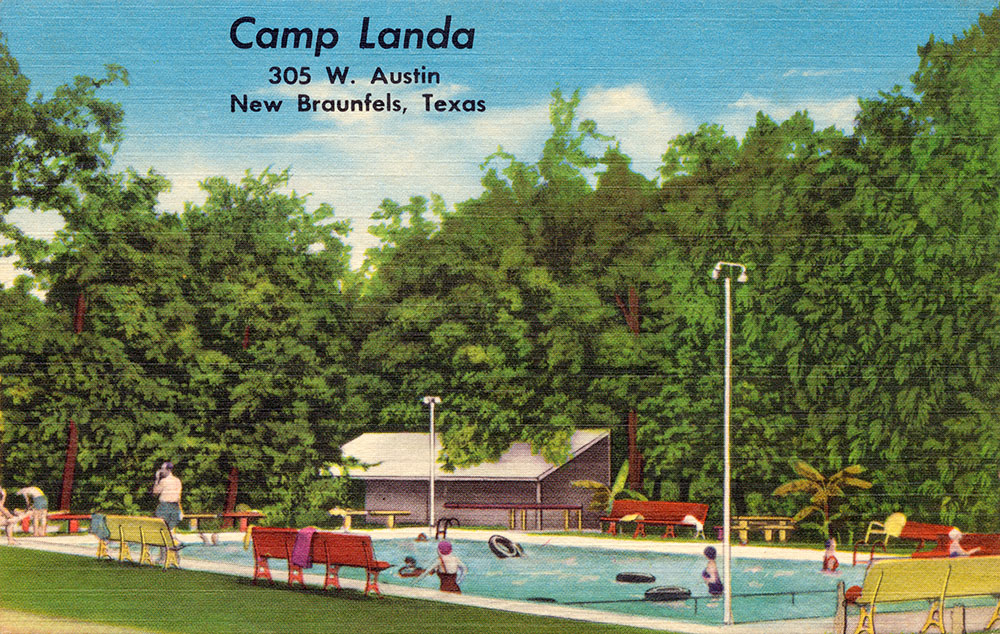
Not mailed or dated, but from the linen post card era that lasted from about 1930 to 1945. At this address today is The Resort at Schlitterbahn, adjacent to the park itself and offering a wide variety of accommodations from hotel rooms to vacation homes and condos. The caption on the back of the card says:
This spring fed pool, plus Camp Landa's new modern, one and two bedroom cottages, and our recreational facilities make Camp Landa an ideal place for YOUR family vacation. |
|
 |
A few of you probably remember what your summer cottage bedroom looked like. The back caption says:
New motel accommodations, quiet surroundings, vented heat, air conditioning, swimming pool. Also units with kitchens. |
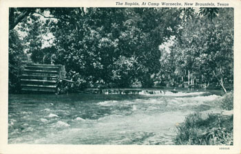
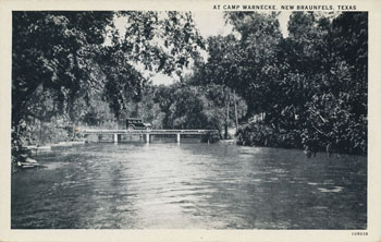
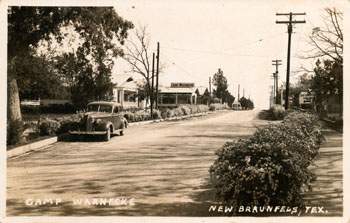
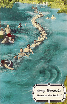
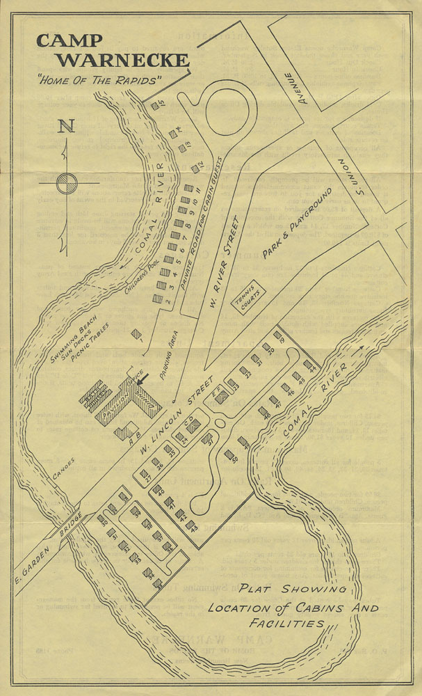
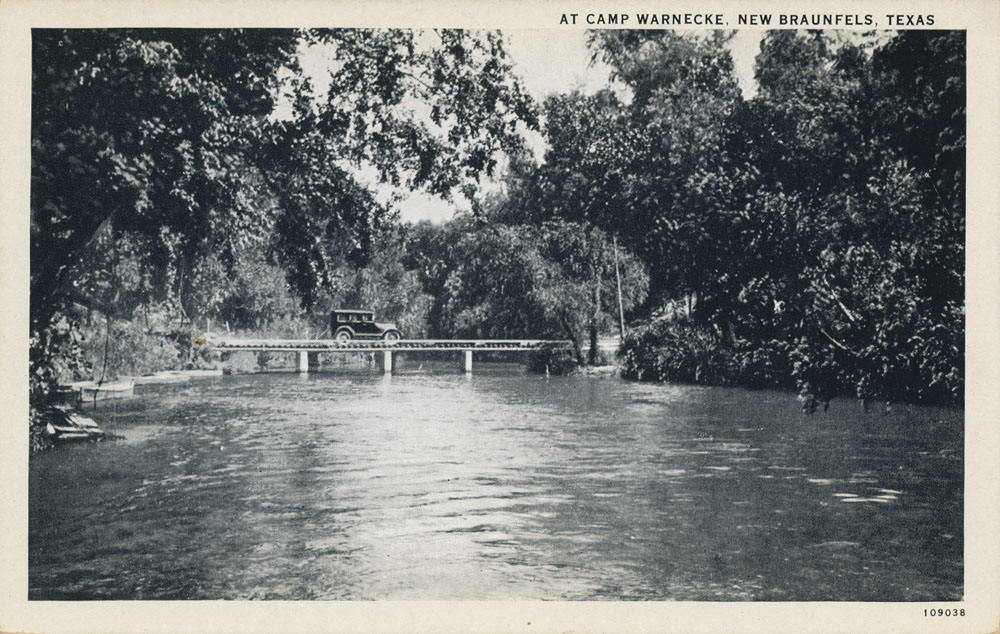
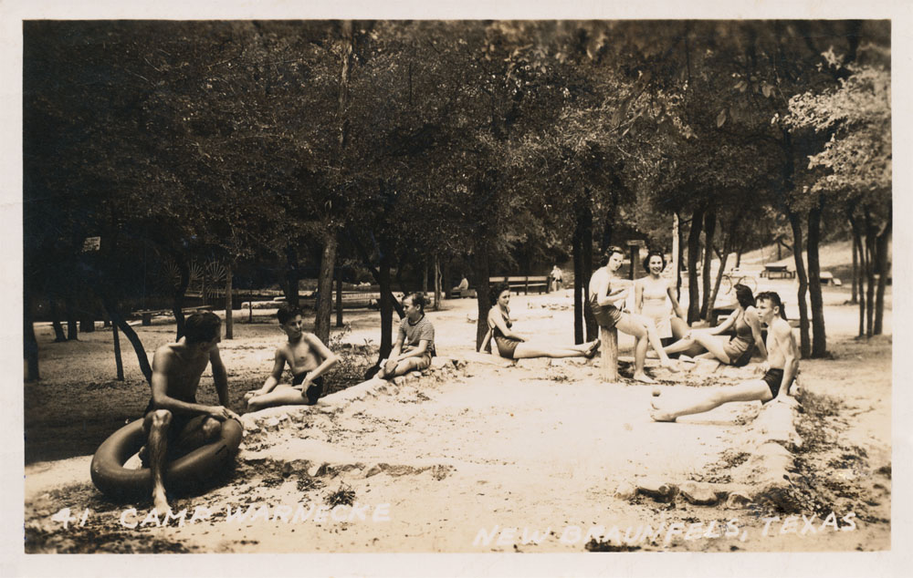
Just below Stinky Falls and Clemens Dam, Camp Warnecke was one of the top family summer resort areas in South Texas for most of the 20th century.
Camp Warnecke was created by A&M professor F. E. Giesecke, who purchased a 60 acre site in 1910 for the purpose of establishing a summer school for students. A generator attached to a waterwheel provided electricity the first year, however, the contraption was unreliable because the paddles of the wheel were warped on one side, causing an irregular turn and sudden dimming and flaring of the lights. The second year the electricity was provided by Harry Landa.
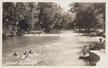
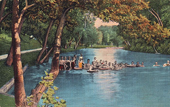
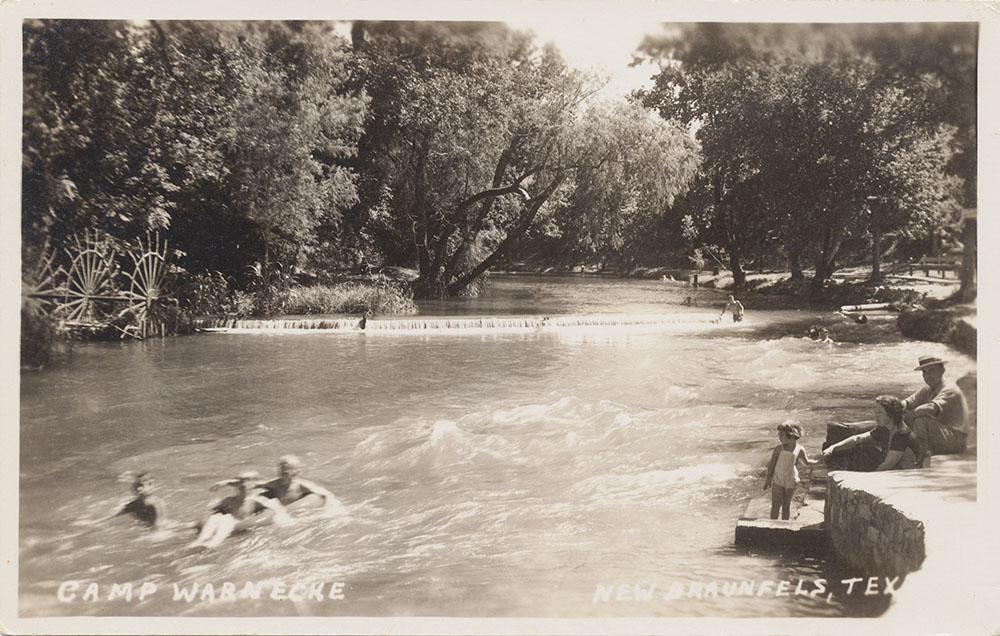
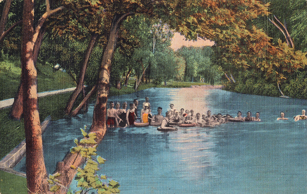
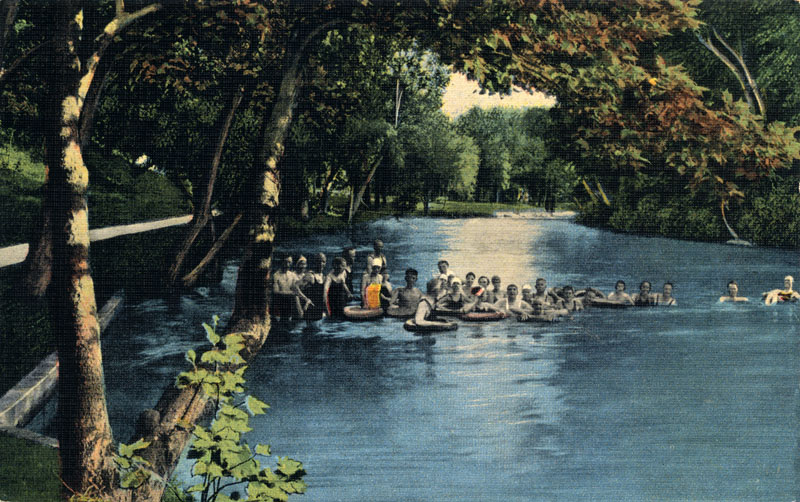
By the 1940s, Camp Warnecke was a large and popular attraction. Long trains of swimmers hooked tubes together by locking feet under the armpits of the one in front of them, forming a train to “shoot the rapids”. Another favorite pastime was “catching the ledges”, which involved diving into the rapids and hanging on to the limestone rocks. If you were “shooting the rapids”, the trick was to avoid being tumped over by young local boys catching the ledges. After tumping you over, they would help you get back into your tube. (Sophienberg, 2006).
Enlarge the image below to figure out where the cabin you had as a kid would be today on the Schlitterbahn site.
|
 |
This card and the one below are the earliest I have found of Camp Warnecke. Produced by Curt Teich of Chicago, the production numbers on the bottom right indicate both were produced in 1926. |
|
 |
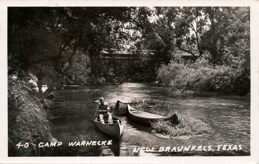
A group of Camp Warnecke canoes are seen tied to the bank at left. |
|
 |
Canoes on the Comal River at Camp Warnecke. Not lithographed but an actual photo, produced by the Seidel Studio in New Braunfels and mailed in October of 1940. |
|
 |
Another photographic card by the Seidel Studio in New Braunfels from about 1940. |
|
 |
A view of one of the cabins about 1940. |
|
 |
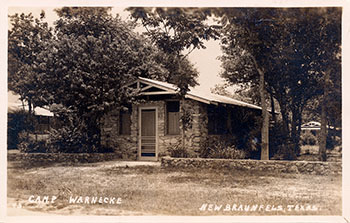
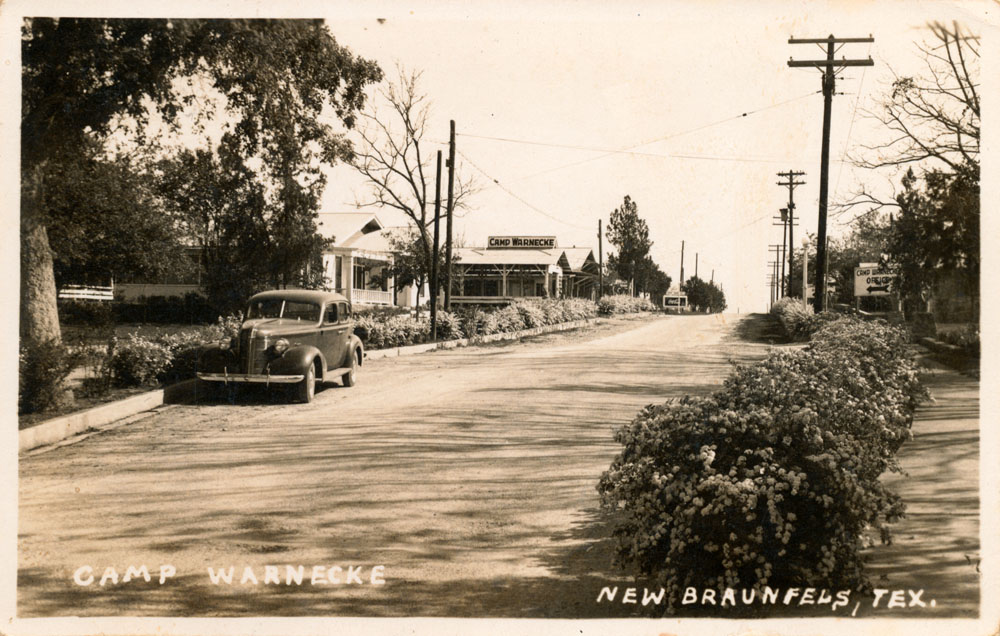
A view of the entrance to Camp Warnecke in the 1940s. |
|
 |
A Real Photo card mailed in 1941. |
|
 |
Mailed from New Braunfels in September of 1943. The back says:
New Braunfels camp of distinction, where swimming, boating, and fishing is the byword on the Crystal Clear Comal. |
|
 |
Mailed in July of 1944. Marie wrote to the Mittag family in Eunice, Mexico:
Here we are at Camp Warnecke having fun. Sure wish you were here. Will try to see you this summer. Mom said she will drink a beer on Uncle Max. Love, Marie. |
|
 |
A group of tubers that look like they are preparing to form a train and shoot the rapids. Not mailed or dated, but the linen stock suggests it was produced in the 1940s. The caption on the back says:
Warnecke's Camp, New Braunfels camp of distinction, where swimming, boating and fishing is the byword on the Crystal Clear Comal. |
|
 |
This one includes an unusual water wheel whose function is unclear. |
|
 |
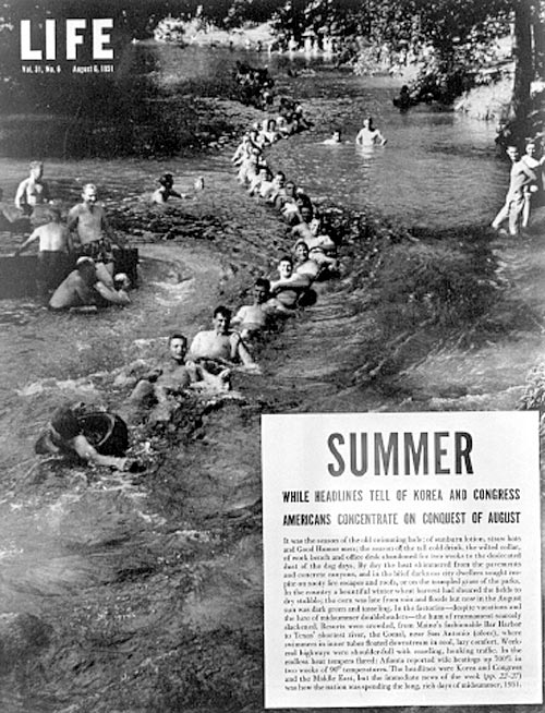
Camp Warnecke made it into Life magazine in 1951 as part of a photo essay on how Americans deal with the summer heat. |
|
 |
A 1950s era postcard from Camp Warnecke. The Camp had little cabins all along the shady banks of the Comal River. In 2009 Jim Walters recalled they were true cabins, with no refrigerator, just an icebox. In the 1950s, summertime stays at Camp Warnecke were a tradition for his family. He declared that:
Heaven is bound to have such a river, where you can just float along on a hot afternoon, without a care in the world, exerting no energy and feeling no stress. (Walters, 2009) |
|
 |
A "Bursheen" finished Color-Litho card, made only by the MWM Company of Aurora, Missouri:
Beautifully shaded acres on the crystal-clear Comal River. Both summer cottages and modern apartments at reasonable prices. Finest swimming in the State of Texas. |
|
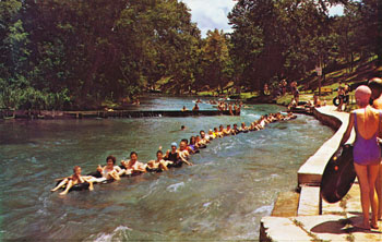 |
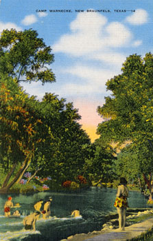
Shooting the rapids in a long train was a popular tradition until Camp Warnecke closed. |
|
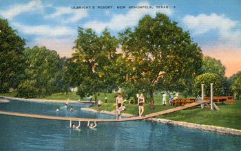 |
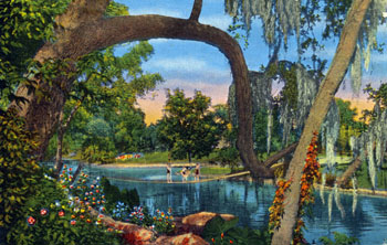
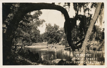
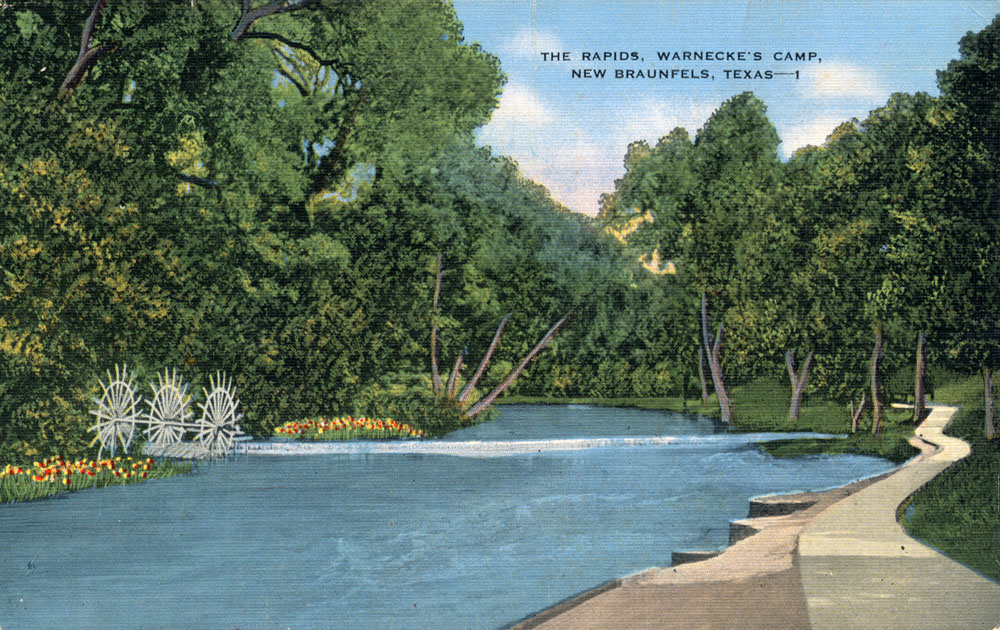
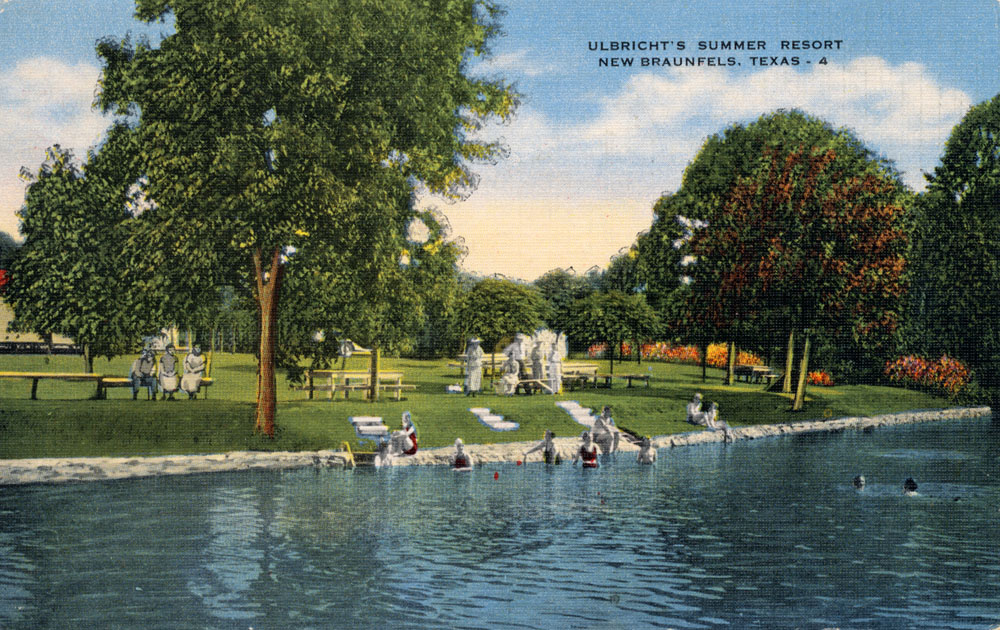
Other resorts on the Comal River included Ulbricht's and Giesecke's. This card was not mailed or dated, but the linen stock suggests it was produced between 1930 and 1944. |
|
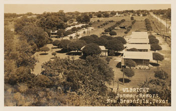 |
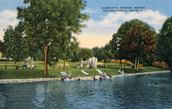
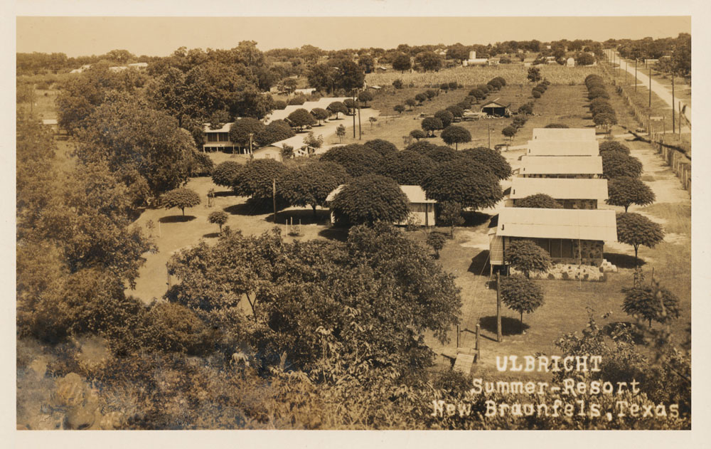
A Real Photo postcard showing an aerial view of Ulbricht's Summer Resort. It was produced by the EKKP company, a major national producer of Real Photo cards in the 1930s and 40s. This one was not mailed or dated, but the narrow white margin is characteristic of other EKKP cards produced in the mid 1930s. |
|
 |
A Phototone card by the Federal Printing Company of Chicago. Not mailed or dated, but the deckled edge was popular in the 1930s and 40s. |
|
 |
Mailed in August of 1945. The back caption says:
On the banks of the Comal River, within the city limits, are Camp Warnecke, Camp Ulbricht, and Camp Giesecke. Accommodations are modern here, where cooling gulf breezes fan the city, which is located just below the escarpment of the Edwards Plateau at the entrance to the scenic Southwest Texas "Hill Country." |
|
 |
The artistic license that lithographers took in creating colored postcards is evident by comparison with the card above. This Real Photo card mailed in 1947 apparently served as the base image for the highly colorized version above. |
|
 |
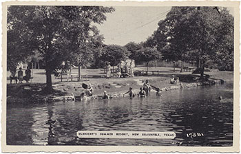
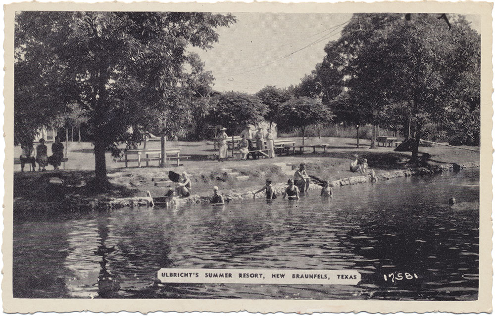
Another view of Ulbricht's Summer Resort, mailed in 1962. |
|
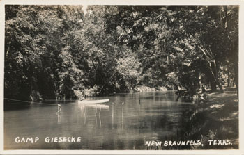 |
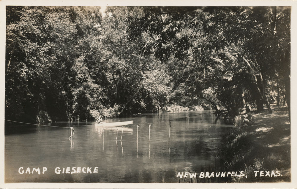
So far, the card at left and the one below are the only two images of Camp Giesecke that I have seen. |
|
 |
This card was included in a collection of 18 images that were featured in a postcard mailer marketed to tourists. Unlike other collections, they were not intended to be separated and mailed as individual cards - the entire booklet was mailed with all the accordion-folded images intact. |
|


